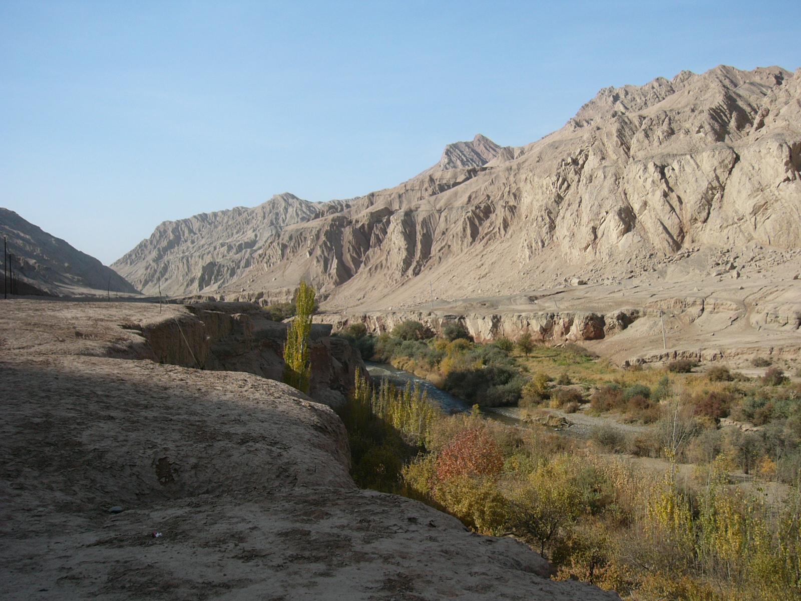
忙得古爾石窟はラムジン(連木沁)から少し奥に入った小さな渓谷の中にある。渓谷から出るとラムジンからシルキップに通じる道に出る。ここにシルキップ(色爾克普)仏像石刻がある。仏像石刻は道路脇にある。道路は高台を通り、中央の河岸段丘の下を河が流れる。これは仏像石刻から南側を見たところ。南下するとシルキップを経てリュクチュン(魯克沁)に通じる。
Card Information
Class
Image Card
Identifier (dcterms:identifier)
http://dsr.nii.ac.jp/photograph/iiif/turfan0695.tif/full/full/0/default.jpg
Spatial Coverage (dcterms:spatial)
色爾克普(シルキップ)仏像石
Place Card
Is Part Of (dcterms:isPartOf)
http://dsr.nii.ac.jp/photograph/manifest/turfan0695
number (bibo:number)
http://dsr.nii.ac.jp/photograph/iiif/canvas/turfan0695
Source (dcterms:source)
ja
連木沁(ラムジン)から色爾克普(シルキップ)への道
en
Main route from Lamjin to Sirkip
Image
Map
- Stein Place Name - Innermost Asia / Kara-Khoja
- Not Collated
- Hedin Place Name - Central Asia Atlas
- Collated
- German Expeditions Place Name - Idikutschari
- Not Collated (with Image Cards)
- Huang Wenbi Place Name - Archaeological Report in Turfan / Archaeological Report in Tarim Basin
- Collated (with Image Cards)
- DSR Place Name - Silk Road in Photographs
- Ruin Card
Linked Cards
Filter by property
| Title | Alternate label | Class |
|---|---|---|
| Canvas Indexer search result | Curation Card |
Graph of Related Cards
Ruin Card
Image Card
Image Matching Card
Place Card
Place Matching Card
Reference Card
Curation Card