National Institute of Informatics - Digital Silk Road Project
| |||||||||
|
| Scientific Results of a Journey in Central Asia, 1899-1902 : vol.1 |
 |
| Ak-satma, October 10. | |
| Dugha-dschaji, October 11. |
FROM KURUK-ASTI TO THE CONFLUENCE OF THE KODAJ-DARJA. 49
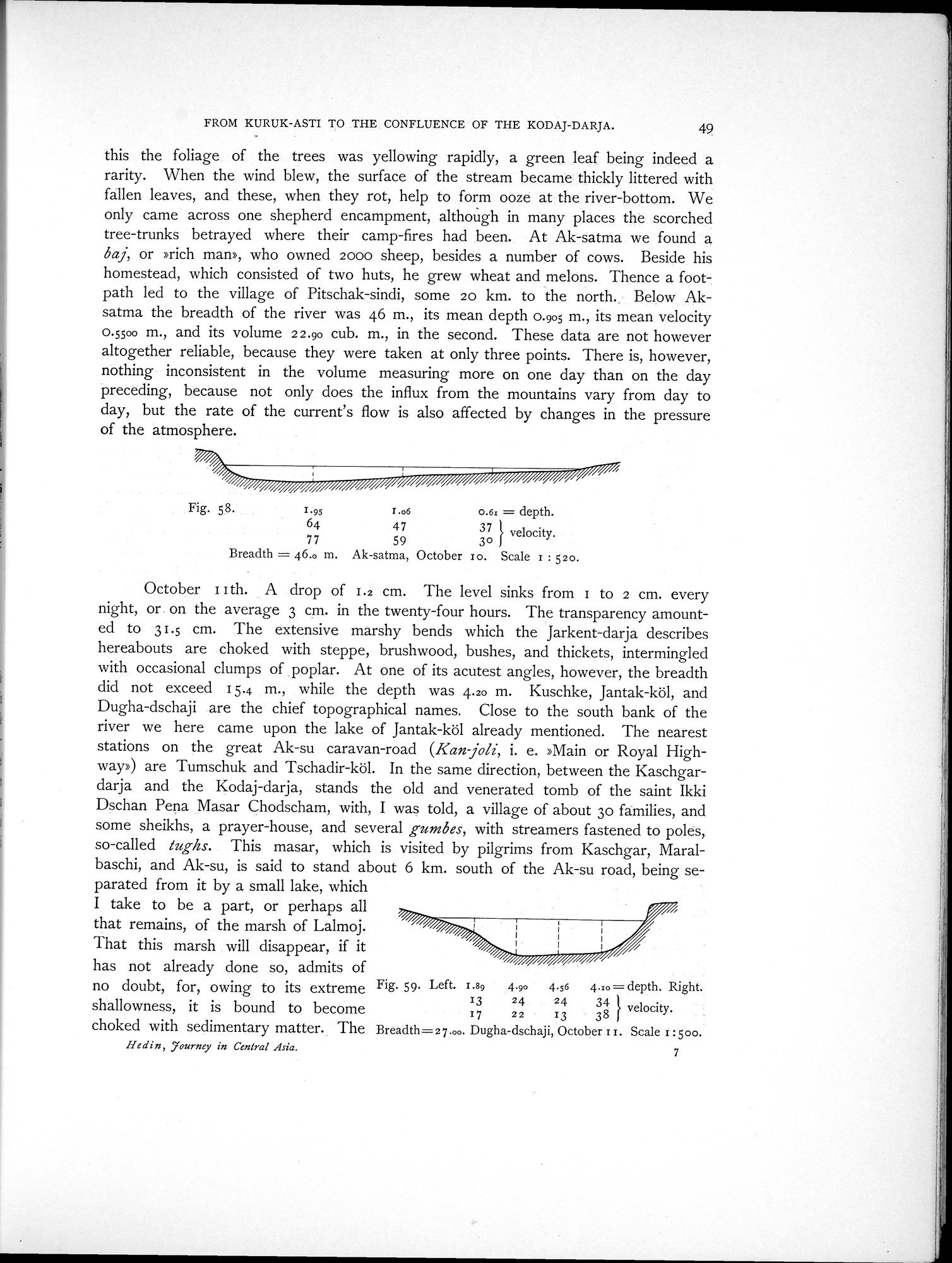
this the foliage of the trees was yellowing rapidly, a green leaf being indeed a rarity. When the wind blew, the surface of the stream became thickly littered with fallen leaves, and these, when they rot, help to form ooze at the river-bottom. We only came across one shepherd encampment, although in many places the scorched tree-trunks betrayed where their camp-fires had been. At Ak-satma we found a baj, or »rich man», who owned 2000 sheep, besides a number of cows. Beside his homestead, which consisted of two huts, he grew wheat and melons. Thence a footpath led to the village of Pitschak-sindi, some 20 km. to the north. Below Aksatma the breadth of the river was 46 m., its mean depth 0.905 m., its mean velocity 0.5500 m., and its volume 22.90 cub. m., in the second. These data are not however altogether reliable, because they were taken at only three points. There is, however, nothing inconsistent in the volume measuring more on one day than on the day preceding, because not only does the influx from the mountains vary from day to day, but the rate of the current's flow is also affected by changes in the pressure of the atmosphere.
Fig. 58. 1.95 r.o6 0.6: = depth.
64 47 37 } velocity.
77 59 3o
Breadth = 46.o m. Ak-satma, October to. Scale 1 : 52o.
October I I th. A drop of 1.2 cm. The level sinks from 1 to 2 cm. every night, or on the average 3 cm. in the twenty-four hours. The transparency amounted to 31.5 cm. The extensive marshy bends which the Jarkent-darja describes hereabouts are choked with steppe, brushwood, bushes, and thickets, intermingled with occasional clumps of poplar. At one of its acutest angles, however, the breadth did not exceed 15.4 m., while the depth was 4.20 m. Kuschke, Jantak-köl, and Dugha-dschaji are the chief topographical names. Close to the south bank of the river we here came upon the lake of Jantak-köl already mentioned. The nearest stations on the great Ak-su caravan-road (Kan joli, i. e. »Main or Royal Highway») are Tumschuk and Tschadir-köl. In the same direction, between the Kaschgardarja and the Kodaj-darja, stands the old and venerated tomb of the saint Ikki Dschan Pena Masar Chodscham, with, I was told, a village of about 3o families, and some sheikhs, a prayer-house, and several gumbes, with streamers fastened to poles, so-called tughs. This masar, which is visited by pilgrims from Kaschgar, Maralbaschi, and Ak-su, is said to stand about 6 km. south of the Ak-su road, being separated from it by a small lake, which
I take to be a part, or perhaps all that remains, of the marsh of Lalmoj.
That this marsh will disappear, if it
has not already done so, admits of
no doubt, for, owing to its extreme Fig. 59. Left. r .89 4.90 4.56 4.:o = depth. Right.
shallowness, it is bound to become 17 22 13 38 } velocity.
choked with sedimentary matter. The Breadth=27.00. Dugha-dschaji, October r r. Scale 1:500.
He din , ,journey in Central Asia. 7
|
Copyright (C) 2003-2019 National Institute of Informatics and The Toyo Bunko. All Rights Reserved.