National Institute of Informatics - Digital Silk Road Project
| |||||||||
|
| Scientific Results of a Journey in Central Asia, 1899-1902 : vol.1 |
 |
| Islik, October 15. | |
| Kujluschning-baschi, October 16. |
FROM KURUK-ASTI TO THE CONFLUENCE OF THE KODAJ-DARJA. 53
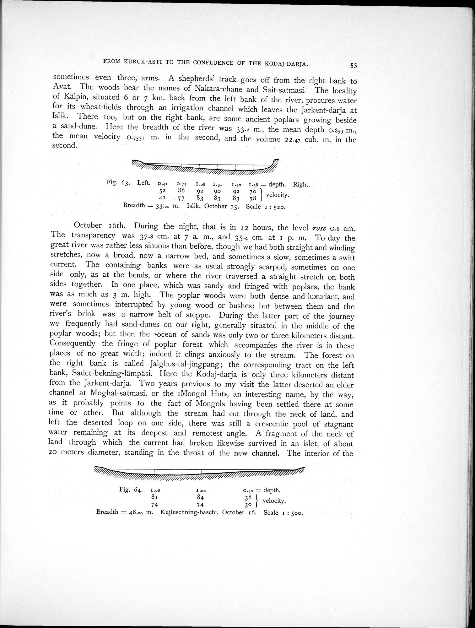
sometimes even three, arms. A shepherds' track goes off from the right bank to Avat. The woods bear the names of Nakara-chane and Sait-satmasi. The locality of Kälpin, situated 6 or 7 km. back from the left bank of the river, procures water for its wheat-fields through an irrigation channel which leaves the Jarkent-darja at Islik. There too, but on the right bank, are some ancient poplars growing beside a sand-dune. Here the breadth of the river was 33.2 m., the mean depth 0.899 m., the mean velocity 0.7531 m. in the second, and the volume 2 2.47 cub. m. in the second.
Fig. 63. Left. o.4x o.,x I.os I.3x 1.40 I.3s =depth. Right.
52 86 92 90 92 7o velocity.
41 77 83 83 83 78
Breadth = 33.20 m. Islik, October 15. Scale i : 52o.
October 16th. During the night, that is in I2 hours, the level rose 0.6 cm. The transparency was 37.8 cm. at 7 a. m., and 35.4 cm. at I p. m. To-day the great river was rather less sinuous than before, though we had both straight and winding stretches, now a broad, now a narrow bed, and sometimes a slow, sometimes a swift current. The containing banks were as usual strongly scarped, sometimes on one side only, as at the bends, or where the river traversed a straight stretch on both sides together. In one place, which was sandy and fringed with poplars, the bank was as much as 3 m. high. The poplar woods were both dense and luxuriant, and were sometimes interrupted by young wood or bushes; but between them and the river's brink was a narrow belt of steppe. During the latter part of the journey we frequently had sand-dunes on our right, generally situated in the middle of the poplar woods; but then the »ocean of sand» was only two or three kilometers distant. Consequently the fringe of poplar forest which accompanies the river is in these places of no great width ; indeed it clings anxiously to the stream. The forest on the right bank is called Jalghus-tal-jingpang; the corresponding tract on the left bank, Sadet-bekning-lämpäsi. Here the Kodaj-darja is only three kilometers distant from the Jarkent-darja. Two years previous to my visit the latter deserted an older channel at Moghal-satmasi, or the »Mongol Hut», an interesting name, by the way, as it probably points to the fact of Mongols having been settled there at some time or other. But although the stream had cut through the neck of land, and left the deserted loop on one side, there was still a crescentic pool of stagnant water remaining at its deepest and remotest angle. A fragment of the neck of land through which the current had broken likewise survived in an islet, of about 20 meters diameter, standing in the throat of the new channel. The interior of the
38 } velocity.
74 74 3o
Breadth = 48.00 m. Kujluschning-baschi, October 16. Scale x : boo.
Fig. 64. I.os I.00 0.4o = depth.
81 84
|
Copyright (C) 2003-2019 National Institute of Informatics and The Toyo Bunko. All Rights Reserved.