National Institute of Informatics - Digital Silk Road Project
| |||||||||
|
| Scientific Results of a Journey in Central Asia, 1899-1902 : vol.1 |
 |
| Atschi-dung, October 18. |
58
THE TARIM RIVER.
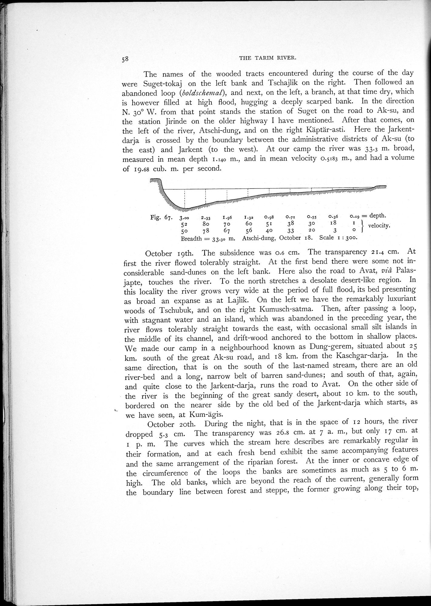
The names of the wooded tracts encountered during the course of the day were Suget-tokaj on the left bank and Tschajlik on the right. Then followed an abandoned loop (boldschernal.), and next, on the left, a branch, at that time dry, which is however filled at high flood, hugging a deeply scarped bank. In the direction N. 30° W. from that point stands the station of Suget on the road to Ak-su, and the station Jirinde on the older highway I have mentioned. After that comes, on the left of the river, Atschi-dung, and on the right Käptär-asti. Here the Jarkentdarja is crossed by the boundary between the administrative districts of Ak-su (to the east) and Jarkent (to the west). At our camp the river was 33.3 m. broad, measured in mean depth 1.140 m., and in mean velocity 0.5183 m., and had a volume of 19.68 cub. m. per second.
i velocity.
56 4o 33 20 3 0 1
Breadth = 33.3o m. Atschi-dung, October 18. Scale 1 : 300.
October 19th. The subsidence was 0.6 cm. The transparency 21.4 cm. At first the river flowed tolerably straight. At the first bend there were some not inconsiderable sand-dunes on the left bank. Here also the road to Avat, vi â Palasjapte, touches the river. To the north stretches a desolate desert-like region. In this locality the river grows very wide at the period of full flood, its bed presenting as broad an expanse as at Lajlik. On the left we have the remarkably luxuriant woods of Tschubuk, and on the right Kumusch-satma. Then, after passing a loop, with stagnant water and an island, which was abandoned in the preceding year, the river flows tolerably straight towards the east, with occasional small silt islands in the middle of its channel, and drift-wood anchored to the bottom in shallow places. We made our camp in a neighbourhood known as Dung-gerem, situated about 2 5 km. south of the great Ak-su road, and 18 km. from the Kaschgar-darja. In the same direction, that is on the south of the last-named stream, there are an old river-bed and a long, narrow belt of barren sand-dunes; and south of that, again, and quite close to the Jarkent-darja, runs the road to Avat. On the other side of the river is the beginning of the great sandy desert, about 1 o km. to the south, bordered on the nearer side by the old bed of the Jarkent-darja which starts, as we have seen, at Kum-ägis.
October loth. During the night, that is in the space of 12 hours, the river dropped 5.3 cm. The transparency was 26.8 cm. at 7 a. m., but only 17 cm. at I p. m. The curves which the stream here describes are remarkably regular in their formation, and at each fresh bend exhibit the same accompanying features and the same arrangement of the riparian forest. At the inner or concave edge of the circumference of the loops the banks are sometimes as much as 5 to 6 m. high. The old banks, which are beyond the reach of the current, generally form the boundary line between forest and steppe, the former growing along their top,
Fig. 67. 3.00 2.33 I.96 1.32 0.98 O.y: 0.55 0.36 0.:9 = depth.
52 8o 70
6o 51 38 30 18
|
Copyright (C) 2003-2019 National Institute of Informatics and The Toyo Bunko. All Rights Reserved.