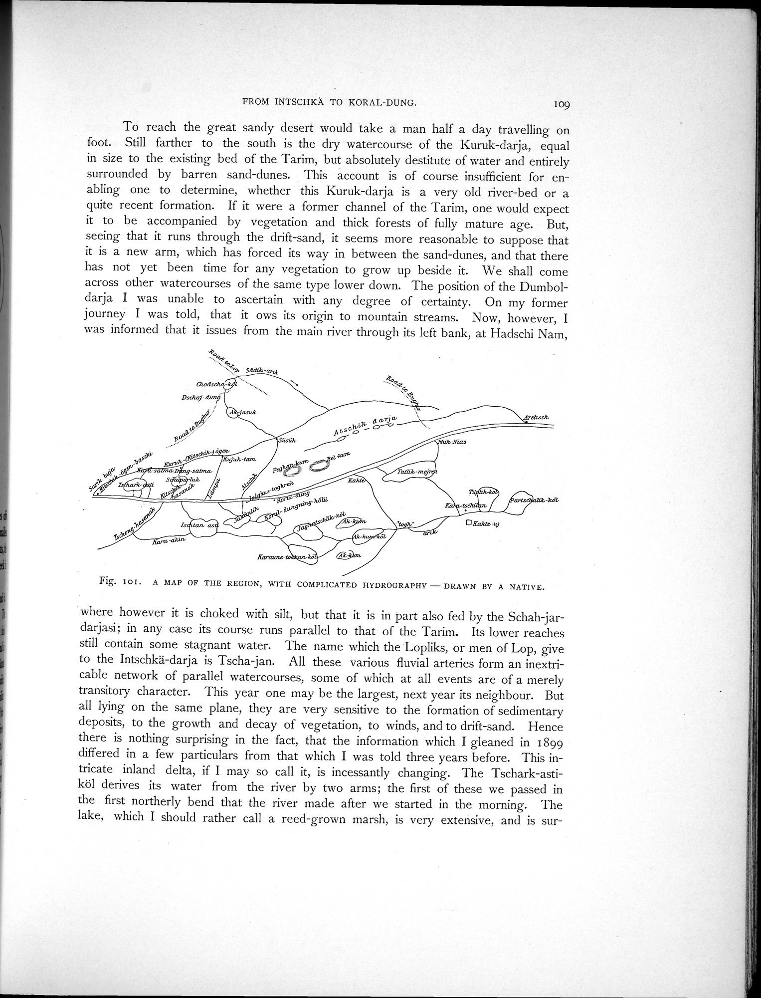
To reach the great sandy desert would take a man half a day travelling on foot. Still farther to the south is the dry watercourse of the Kuruk-darja, equal in size to the existing bed of the Tarim, but absolutely destitute of water and entirely surrounded by barren sand-dunes. This account is of course insufficient for enabling one to determine, whether this Kuruk-darja is a very old river-bed or a quite recent formation. If it were a former channel of the "I'arim, one would expect it to be accompanied by vegetation and thick forests of fully mature age. But, seeing that it runs through the drift-sand, it seems more reasonable to suppose that it is a new arm, which has forced its way in between the sand-dunes, and that there has not yet been time for any vegetation to grow up beside it. We shall come across other watercourses of the same type lower down. The position of the Dumboldarja I was unable to ascertain with any degree of certainty. On my former journey I was told, that it ows its origin to mountain streams. Now, however, I was informed that it issues from the main river through its left bank, at Hadschi Nam,
Fig. 10I. A MAP OF THE REGION, WITH COMPLICATED HYDROGRAPHY - DRAWN BY A NATIVE.
where however it is choked with silt, but that it is in part also fed by the Schah-jardarjasi; in any case its course runs parallel to that of the Tarim. Its lower reaches still contain some stagnant water. The name which the Lopliks, or men of Lop, give to the Intschkä-darja is Tscha-jan. All these various fluvial arteries form an inextricable network of parallel watercourses, some of which at all events are of a merely transitory character. This year one may be the largest, next year its neighbour. But all lying on the same plane, they are very sensitive to the formation of sedimentary deposits, to the growth and decay of vegetation, to winds, and to drift-sand. Hence there is nothing surprising in the fact, that the information which I gleaned in 1899 differed in a few particulars from that which I was told three years before. This intricate inland delta, if I may so call it, is incessantly changing. The Tschark-astiköl derives its water from the river by two arms; the first of these we passed in the first northerly bend that the river made after we started in the morning. The lake, which I should rather call a reed-grown marsh, is very extensive, and is sur-