National Institute of Informatics - Digital Silk Road Project
| |||||||||
|
| Scientific Results of a Journey in Central Asia, 1899-1902 : vol.1 |
 |
| Siva, Nov. 28. | |
| THE SAME SECTION AT HIGH WATER. |
FROM THE TOKUS-KUM TO KARAUL. 141
sej-su, though in other districts known as atschik-su. Behind the two big massive dunes lies another lake, Jäjir-köl, which is only supplied through its canal at the season of high flood. The map would seem to suggest that it is the dunes of these two lakes that compel the river to alter its course. But this is not so; the contact between them is purely fortuitous, for when dunes come in the river's way, it simply sweeps them aside.
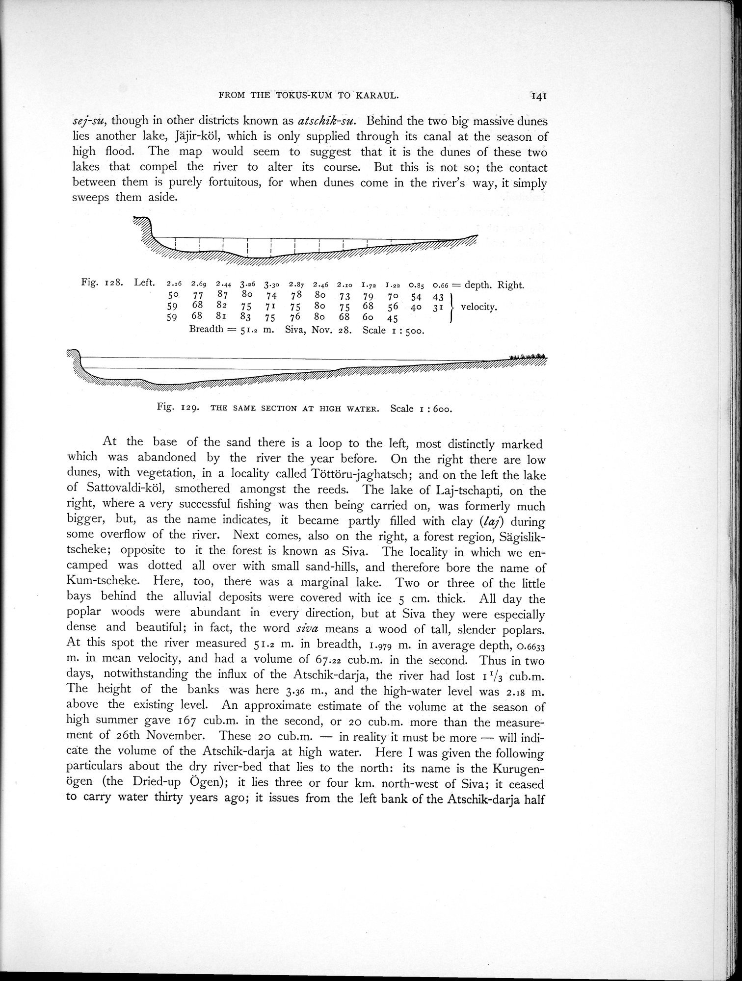
Fig. 128. Left. 2.:6 2.6g 2.44 3.z6 3.3o 2.87 2.46 2.10 I.73 1.22 0.85 0.66 = depth. Right.
5o 77 87 8o 74 78 8o 73 79 7o 54 43
59 68 82 75 71 75 8o 75 68 56 4o 31 velocity.
59 68 81 83 75 76 8o 68 6o 45
Breadth = 51.2 m. Siva, Nov. 28. Scale I : 500.
Fig. 129. THE SAME SECTION AT HIGH WATER. Scale I : boo.
At the base of the sand there is a loop to the left, most distinctly marked which was abandoned by the river the year before. On the right there are low dunes, with vegetation, in a locality called Töttöru-jaghatsch; and on the left the lake of Sattovaldi-köl, smothered amongst the reeds. The lake of Laj-tschapti, on the right, where a very successful fishing was then being carried on, was formerly much bigger, but, as the name indicates, it became partly filled with clay (laj) during some overflow of the river. Next comes, also on the right, a forest region, Sägisliktscheke ; opposite to it the forest is known as Siva. The locality in which we encamped was dotted all over with small sand-hills, and therefore bore the name of Kum-tscheke. Here, too, there was a marginal lake. Two or three of the little bays behind the alluvial deposits were covered with ice 5 cm. thick. All day the poplar woods were abundant in every direction, but at Siva they were especially dense and beautiful; in fact, the word siva means a wood of tall, slender poplars. At this spot the river measured 51.2 m. in breadth, 1.979 m. in average depth, 0.6633 m. in mean velocity, and had a volume of 67.22 cub.m. in the second. Thus in two days, notwithstanding the influx of the Atschik-darja, the river had lost 1'/3 cub.m. The height of the banks was here 3.36 m., and the high-water level was 2.18 m. above the existing level. An approximate estimate of the volume at the season of high summer gave 167 cub.m. in the second, or zo cub.m. more than the measurement of 26th November. These 20 cub.m. — in reality it must be more — will indicate the volume of the Atschik-darja at high water. Here I was given the following particulars about the dry river-bed that lies to the north: its name is the Kurugenögen (the Dried-up Ögen); it lies three or four km. north-west of Siva; it ceased to carry water thirty years ago; it issues from the left bank of the Atschik-darja half
|
Copyright (C) 2003-2019 National Institute of Informatics and The Toyo Bunko. All Rights Reserved.