National Institute of Informatics - Digital Silk Road Project
| |||||||||
|
| Scientific Results of a Journey in Central Asia, 1899-1902 : vol.1 |
 |
| Formation of Ugen-darja |
156 THE TARIM RIVER.
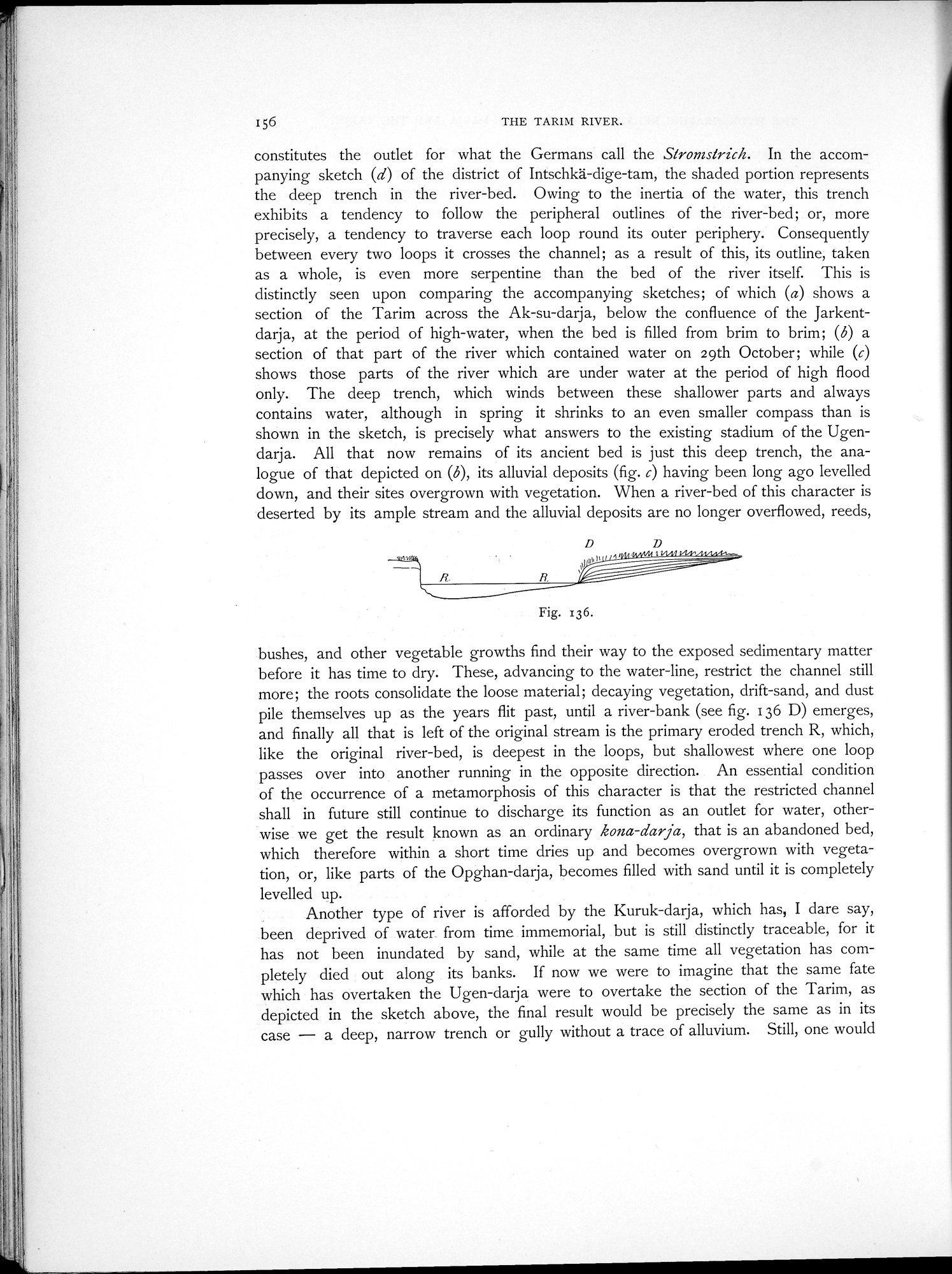
constitutes the outlet for what the Germans call the Stromstrich. In the accompanying sketch (d) of the district of Intschkä-dige-tam, the shaded portion represents the deep trench in the river-bed. Owing to the inertia of the water, this trench exhibits a tendency to follow the peripheral outlines of the river-bed; or, more precisely, a tendency to traverse each loop round its outer periphery. Consequently between every two loops it crosses the channel; as a result of this, its outline, taken as a whole, is even more serpentine than the bed of the river itself. This is distinctly seen upon comparing the accompanying sketches; of which (a) shows a section of the Tarim across the Ak-su-darja, below the confluence of the Jarkentdarja, at the period of high-water, when the bed is filled from brim to brim; (6) a section of that part of the river which contained water on 29th October; while (c) shows those parts of the river which are under water at the period of high flood only. The deep trench, which winds between these shallower parts and always contains water, although in spring it shrinks to an even smaller compass than is shown in the sketch, is precisely what answers to the existing stadium of the Ugendarja. All that now remains of its ancient bed is just this deep trench, the analogue of that depicted on (6), its alluvial deposits (fig. c) having been long ago levelled down, and their sites overgrown with vegetation. When a river-bed of this character is deserted by its ample stream and the alluvial deposits are no longer overflowed, reeds,
bushes, and other vegetable growths find their way to the exposed sedimentary matter before it has time to dry. These, advancing to the water-line, restrict the channel still more; the roots consolidate the loose material; decaying vegetation, drift-sand, and dust pile themselves up as the years flit past, until a river-bank (see fig. 136 D) emerges, and finally all that is left of the original stream is the primary eroded trench R, which, like the original river-bed, is deepest in the loops, but shallowest where one loop passes over into another running in the opposite direction. An essential condition of the occurrence of a metamorphosis of this character is that the restricted channel shall in future still continue to discharge its function as an outlet for water, otherwise we get the result known as an ordinary kona-darja, that is an abandoned bed, which therefore within a short time dries up and becomes overgrown with vegetation, or, like parts of the Opghan-darja, becomes filled with sand until it is completely levelled up.
Another type of river is afforded by the Kuruk-darja, which has, I dare say, been deprived of water from time immemorial, but is still distinctly traceable, for it has not been inundated by sand, while at the same time all vegetation has completely died out along its banks. If now we were to imagine that the same fate which has overtaken the Ugen-darja were to overtake the section of the Tarim, as depicted in the sketch above, the final result would be precisely the same as in its case — a deep, narrow trench or gully without a trace of alluvium. Still, one would
Fig. x36.
|
Copyright (C) 2003-2019 National Institute of Informatics and The Toyo Bunko. All Rights Reserved.