National Institute of Informatics - Digital Silk Road Project
| |||||||||
|
| Scientific Results of a Journey in Central Asia, 1899-1902 : vol.1 |
 |
| PROFILE AT IGHIS-DUNG. THE DOTTED LINE SHOWS THE ANCIENT POSITION OF THE SAND-ACCUMULATION. |
1 70 THE TARIM RIVER.
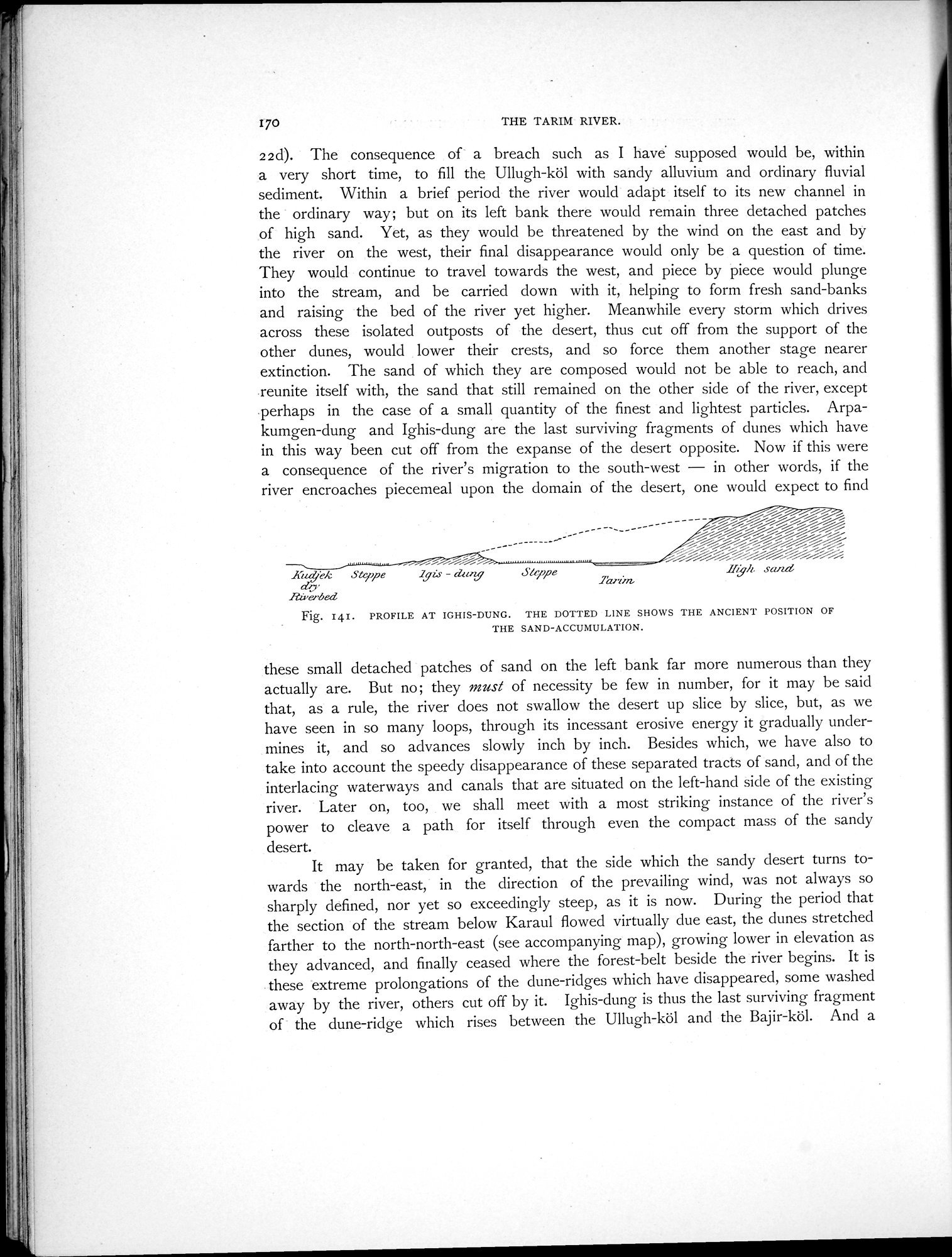
22d). The consequence of- a breach such as I have supposed would be, within a very short time, to fill the Ullugh-köl with sandy alluvium and ordinary fluvial sediment. Within a brief period the river would adapt itself to its new channel in the ordinary way; but on its left bank there would remain three detached patches of high sand. Yet, as they would be threatened by the wind on the east and by the river on the west, their final disappearance would only be a question of time. They would continue to travel towards the west, and piece by piece would plunge into the stream, and be carried down with it, helping to form fresh sand-banks and raising the bed of the river yet higher. Meanwhile every storm which drives across these isolated outposts of the desert, thus cut off from the support of the other dunes, would lower their crests, and so force them another stage nearer extinction. The sand of which they are composed would not be able to reach, and .reunite itself with, the sand that still remained on the other side of the river, except perhaps in the case of a small quantity of the finest and lightest particles. Arpakumgen-dung and Ighis-dung are the last surviving fragments of dunes which have in this way been cut off from the expanse of the desert opposite. Now if this were a consequence of the river's migration to the south-west — in other words, if the river encroaches piecemeal upon the domain of the desert, one would expect to find
---- ~// j—/ ~//////%~jj/---------- ---
- ~~~ %%%i%i%%%%i
Xt4ek Steppe Igzs - clang Steppe Il 'h sandcej'
dy lanira
Riverbed
Fig. 141. PROFILE AT IGHIS-DUNG. THE DOTTED LINE SHOWS THE ANCIENT POSITION OF
THE SAND-ACCUMULATION.
these small detached patches of sand on the left bank far more numerous than they actually are. But no; they must of necessity be few in number, for it may be said that, as a rule, the river does not swallow the desert up slice by slice, but, as we have seen in so many loops, through its incessant erosive energy it gradually undermines it, and so advances slowly inch by inch. Besides which, we have also to take into account the speedy disappearance of these separated tracts of sand, and of the interlacing waterways and canals that are situated on the left-hand side of the existing river. Later on, too, we shall meet with a most striking instance of the river's power to cleave a path for itself through even the compact mass of the sandy desert.
It may be taken for granted, that the side which the sandy desert turns towards the north-east, in the direction of the prevailing wind, was not always so sharply defined, nor yet so exceedingly steep, as it is now. During the period that the section of the stream below Karaul flowed virtually due east, the dunes stretched farther to the north-north-east (see accompanying map), growing lower in elevation as they advanced, and finally ceased where the forest-belt beside the river begins. It is these extreme prolongations of the dune-ridges which have disappeared, some washed away by the river, others cut off by it. Ighis-dung is thus the last surviving fragment of the dune-ridge which rises between the Ullugh-köl and the Bajir-köl. And a
|
Copyright (C) 2003-2019 National Institute of Informatics and The Toyo Bunko. All Rights Reserved.