National Institute of Informatics - Digital Silk Road Project
| |||||||||
|
| Scientific Results of a Journey in Central Asia, 1899-1902 : vol.1 |
 |
| Sand on the River-bank |
THE STRUGGLE BETWEEN THE RIVER AND THE SAND. 171
glance at my maps of the extension of the sandy desert will sufficiently prove, that this actually was the case, and that theory _ is here adequately covered by fact. The circumstance which carries the strongest conviction is that the steeper faces of the dunes are turned towards the river and towards the direction of the prevailing wind. Had the river been constant in its bed for, say, a couple of centuries, we should have had on its right bank a broad belt of steppe and forest, and the edge of the sand would have been some distance further back, while the slopes up to the culminating crests of the accumulations of sand would have been long and gradual. Moreover the flat zone between the river-bank and the beginning of the desert would have grown wider year by year. Instead of these features, however, we find the stream winding backwards and forwards through a very serpentine course, and advancing quite close to the margin of the sand, in places actually encroaching upon it. It would thus hardly be possible to have a clearer and more unmistakable proof of the fact that the river does move towards the south-west at a faster rate than the dunes do. It puts one in mind of a column of infantry cut down file by file by a troop of pursuing cavalry. Both forces are indeed advancing in one and the same direction, but the pursued does not succeed in getting out of the way, and is consequently destroyed. The power of the flowing water is inconceivably great
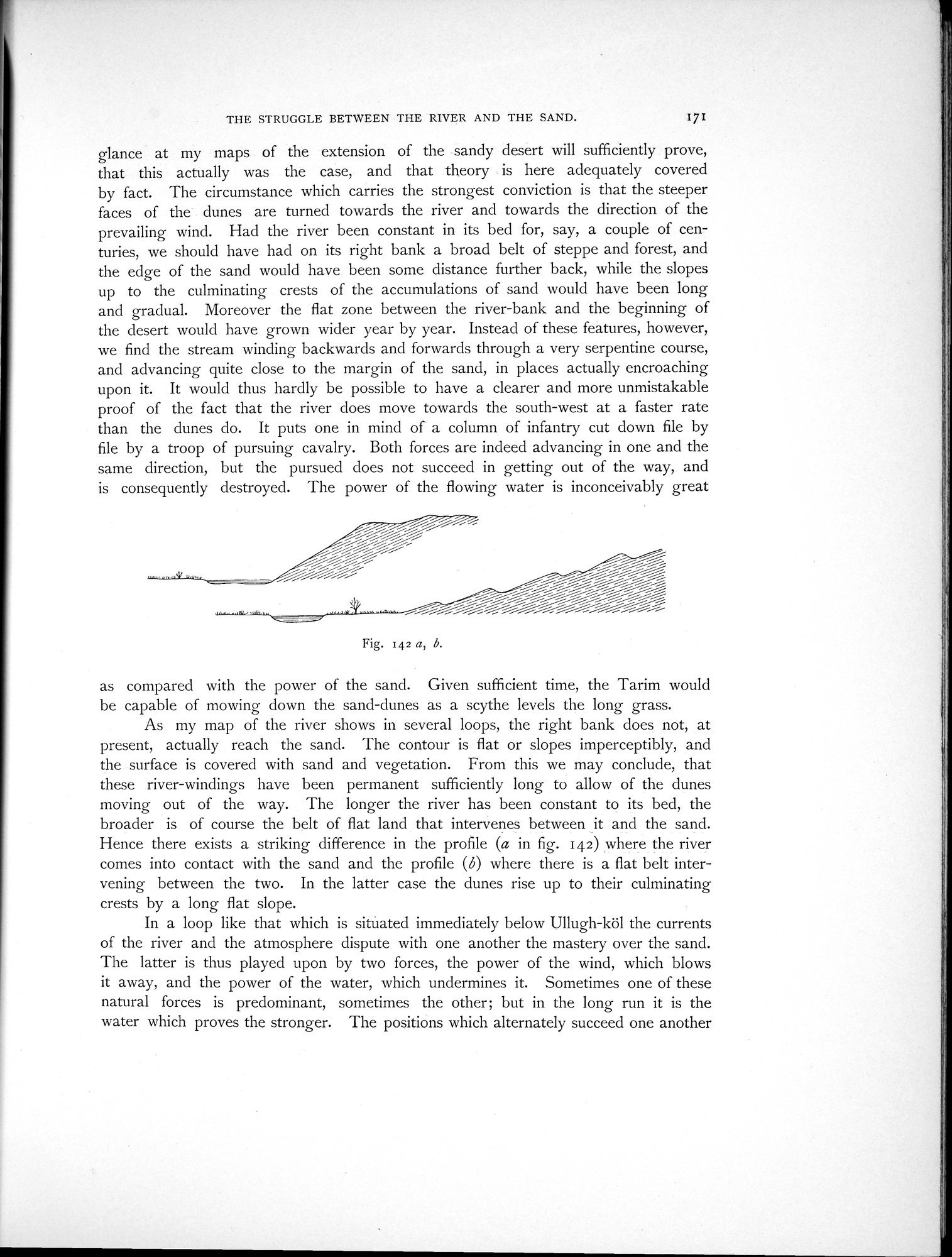
Fig. 142 a, b.
as compared with the power of the sand. Given sufficient time, the Tarim would be capable of mowing down the sand-dunes as a scythe levels the long grass.
As my map of the river shows in several loops, the right bank does not, at present, actually reach the sand. The contour is flat or slopes imperceptibly, and the surface is covered with sand and vegetation. From this we may conclude, that these river-windings have been permanent sufficiently long to allow of the dunes moving out of the way. The longer the river has been constant to its bed, the broader is of course the belt of flat land that intervenes between it and the sand. Hence there exists a striking difference in the profile (a in fig. 142) where the river comes into contact with the sand and the profile (b) where there is a flat belt intervening between the two. In the latter case the dunes rise up to their culminating crests by a long flat slope.
In a loop like that which is sitùated immediately below Ullugh-köl the currents of the river and the atmosphere dispute with one another the mastery over the sand. The latter is thus played upon by two forces, the power of the wind, which blows it away, and the power of the water, which undermines it. Sometimes one of these natural forces is predominant, sometimes the other; but in the long run it is the water which proves the stronger. The positions which alternately succeed one another
|
Copyright (C) 2003-2019 National Institute of Informatics and The Toyo Bunko. All Rights Reserved.