National Institute of Informatics - Digital Silk Road Project
| |||||||||
|
| Scientific Results of a Journey in Central Asia, 1899-1902 : vol.1 |
 |
| A loop |
BOLDSCHEMALS, THEIR FORMATION. 197
Fig. x62.
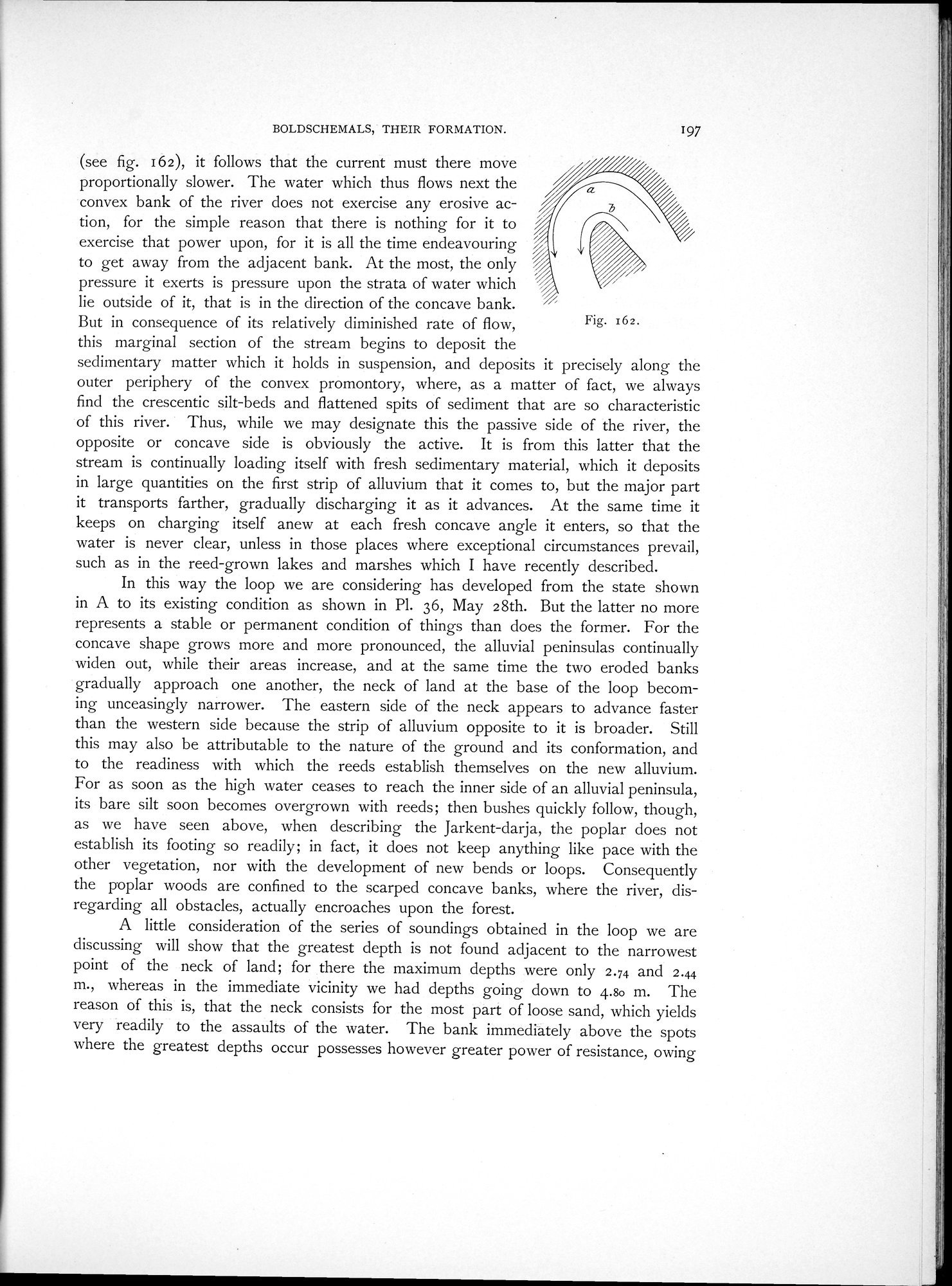
(see fig. 162), it follows that the current must there move proportionally slower. The water which thus flows next the convex bank of the river does not exercise any erosive action, for the simple reason that there is nothing for it to exercise that power upon, for it is all the time endeavouring to get away from the adjacent bank. At the most, the only pressure it exerts is pressure upon the strata of water which lie outside of it, that is in the direction of the concave bank. But in consequence of its relatively diminished rate of flow, this marginal section of the stream begins to deposit the
sedimentary matter which it holds in suspension, and deposits it precisely along the outer periphery of the convex promontory, where, as a matter of fact, we always find the crescentic silt-beds and flattened spits of sediment that are so characteristic of this river. Thus, while we may designate this the passive side of the river, the opposite or concave side is obviously the active. It is from this latter that the stream is continually loading itself with fresh sedimentary material, which it deposits in large quantities on the first strip of alluvium that it comes to, but the major part it transports farther, gradually discharging it as it advances. At the same time it keeps on charging itself anew at each fresh concave angle it enters, so that the water is never clear, unless in those places where exceptional circumstances prevail, such as in the reed-grown lakes and marshes which I have recently described.
In this way the loop we are considering has developed from the state shown in A to its existing condition as shown in Pl. 36, May 28th. But the latter no more represents a stable or permanent condition of things than does the former. For the concave shape grows more and more pronounced, the alluvial peninsulas continually widen out, while their areas increase, and at the same time the two eroded banks gradually approach one another, the neck of land at the base of the loop becoming unceasingly narrower. The eastern side of the neck appears to advance faster than the western side because the strip of alluvium opposite to it is broader. Still this may also be attributable to the nature of the ground and its conformation, and to the readiness with which the reeds establish themselves on the new alluvium. For as soon as the high water ceases to reach the inner side of an alluvial peninsula, its bare silt soon becomes overgrown with reeds; then bushes quickly follow, though, as we have seen above, when describing the Jarkent-darja, the poplar does not establish its footing so readily; in fact, it does not keep anything like pace with the other vegetation, nor with the development of new bends or loops. Consequently the poplar woods are confined to the scarped concave banks, where the river, disregarding all obstacles, actually encroaches upon the forest.
A little consideration of the series of soundings obtained in the loop we are discussing will show that the greatest depth is not found adjacent to the narrowest point of the neck of land; for there the maximum depths were only 2.74 and 2.44 m., whereas in the immediate vicinity we had depths going down to 4.so m. The reason of this is, that the neck consists for the most part of loose sand, which yields very readily to the assaults of the water. The bank immediately above the spots where the greatest depths occur possesses however greater power of resistance, owing
|
Copyright (C) 2003-2019 National Institute of Informatics and The Toyo Bunko. All Rights Reserved.