National Institute of Informatics - Digital Silk Road Project
| |||||||||
|
| Scientific Results of a Journey in Central Asia, 1899-1902 : vol.1 |
 |
| Theoretical sectoin of underground. |
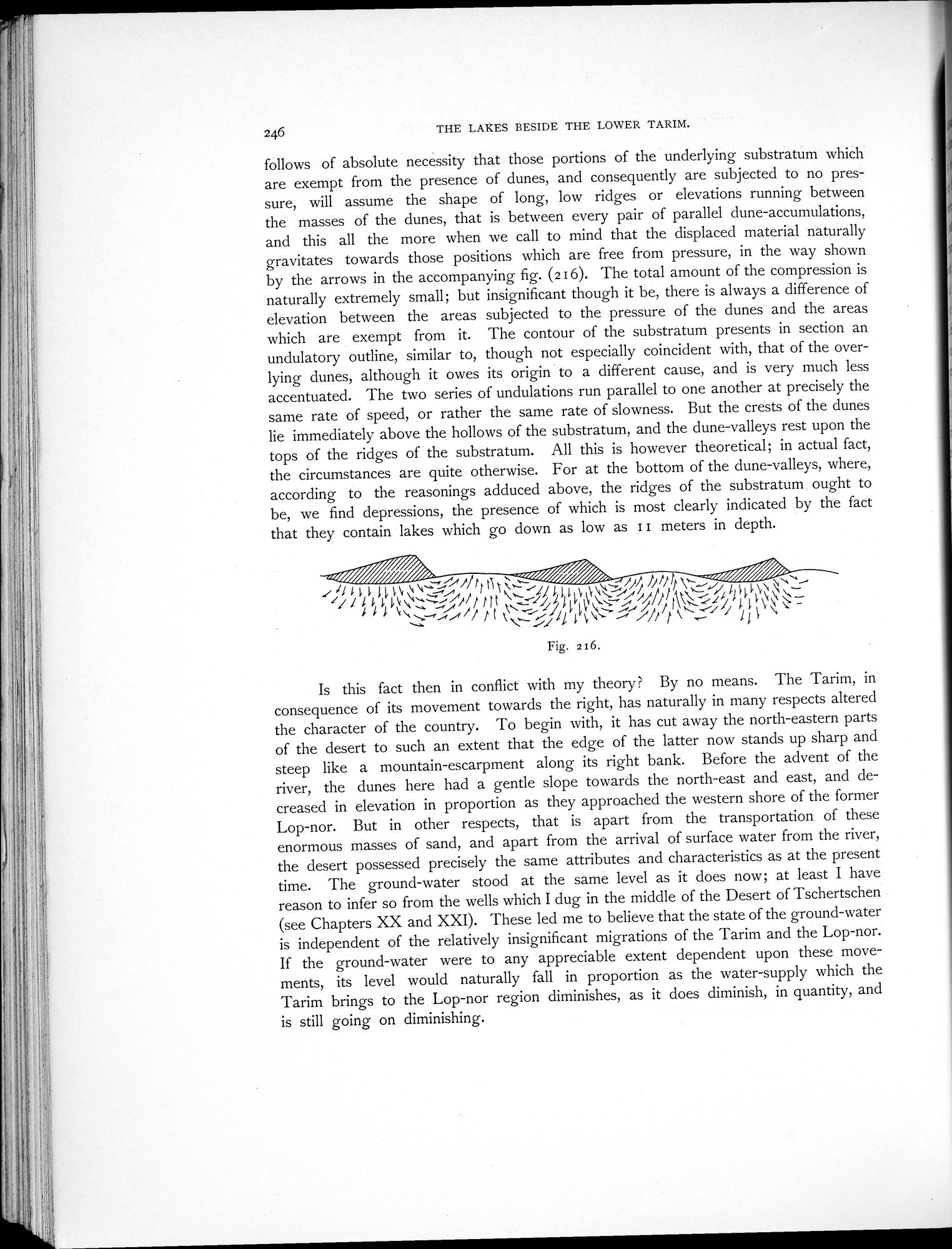
246 THE LAKES BESIDE THE LOWER TARIM.
follows of absolute necessity that those portions of the underlying substratum which are exempt from the presence of dunes, and consequently are subjected to no pressure, will assume the shape of long, low ridges or elevations running between the masses of the dunes, that is between every pair of parallel dune-accumulations, and this all the more when we call to mind that the displaced material naturally gravitates towards those positions which are free from pressure, in the way shown by the arrows in the accompanying fig. (216). The total amount of the compression is naturally extremely small; but insignificant though it be, there is always a difference of elevation between the areas subjected to the pressure of the dunes and the areas which are exempt from it. The contour of the substratum presents in section an undulatory outline, similar to, though not especially coincident with, that of the overlying dunes, although it owes its origin to a different cause, and is very much less accentuated. The two series of undulations run parallel to one another at precisely the same rate of speed, or rather the same rate of slowness. But the crests of the dunes lie immediately above the hollows of the substratum, and the dune-valleys rest upon the tops of the ridges of the substratum. All this is however theoretical; in actual fact, the circumstances are quite otherwise. For at the bottom of the dune-valleys, where, according to the reasonings adduced above, the ridges of the substratum ought to be, we find depressions, the presence of which is most clearly indicated by the fact that they contain lakes which go down as low as II meters in depth.
~~~~/////////////////~i. •.i~///~~~ /i.
~~1d661~1~~ÿ`,.,~, ~~~ ~lldll ti~~`'~—~.~~` r~~`~✓6L 6~~\~~`
~d1~~~4~~4
1~ ~`._~// VO' l// P r— 11 1 `~
Fig. 216.
Is this fact then in conflict with my theory? By no means. The Tarim, in consequence of its movement towards the right, has naturally in many respects altered the character of the country. To begin with, it has cut away the north-eastern parts of the desert to such an extent that the edge of the latter now stands up sharp and steep like a mountain-escarpment along its right bank. Before the advent of the river, the dunes here had a gentle slope towards the north-east and east, and decreased in elevation in proportion as they approached the western shore of the former Lop-nor. But in other respects, that is apart from the transportation of these enormous masses of sand, and apart from the arrival of surface water from the river, the desert possessed precisely the same attributes and characteristics as at the present time. The ground-water stood at the same level as it does now; at least I have reason to infer so from the wells which I dug in the middle of the Desert of Tschertschen (see Chapters XX and XXI). These led me to believe that the state of the ground-water is independent of the relatively insignificant migrations of the Tarim and the Lop-nor. If the ground-water were to any appreciable extent dependent upon these movements, its level would naturally fall in proportion as the water-supply which the Tarim brings to the Lop-nor region diminishes, as it does diminish, in quantity, and is still going on diminishing.
|
Copyright (C) 2003-2019 National Institute of Informatics and The Toyo Bunko. All Rights Reserved.