National Institute of Informatics - Digital Silk Road Project
| |||||||||
|
| Scientific Results of a Journey in Central Asia, 1899-1902 : vol.1 |
 |
| Formation of a bajir. | |
| Disappearing lake. | |
| Disappearing lake. |
250 THE LAKES BESIDE THE LOWER TARIM.
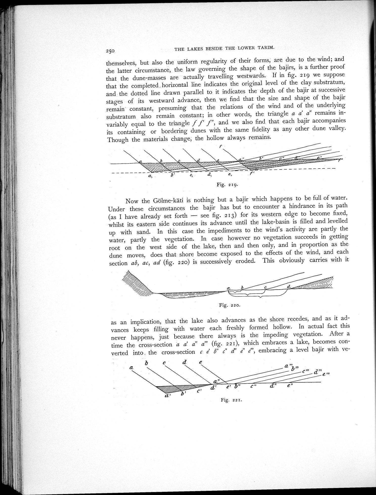
themselves, but also the uniform regularity of their forms, are due to the wind; and the latter circumstance, the law governing the shape of the bajirs, is a further proof that the dune-masses are actually travelling westwards. If in fig. 219 we suppose that the completed, horizontal line indicates the original level of the clay substratum, and the dotted line drawn parallel to it indicates the depth of the bajir at successive stages of its westward advance, then we find that the size and shape of the bajir remain constant, presuming that the relations of the wind and of the underlying substratum also remain constant; in other words, the triangle a a' a" remains invariably equal to the triangle f f' f", and we also find that each bajir accompanies its containing or bordering dunes with the same fidelity as any other dune valley. Though the materials change, the hollow always remains.
î
~•i bi,f/ ~Î//iu.~-' ~ //U~i.._ i~~ /iii.. /ii....•
~i%~~y~y~y~ /' ///i riwrii~Ï/%%%/~ ii .iiiii/~/////
~ii /~Y~~~M~ ~ ,_
2, D' C, lL e,
Fig. 219.
Now the Gölme-käti is nothing but a bajir which happens to be full of water. Under these circumstances the bajir has but to encounter a hindrance in its path (as I have already set forth — see fig. 213) for its western edge to become fixed, whilst its eastern side continues its advance until the lake-basin is filled and levelled up with sand. In this case the impediments to the wind's activity are partly the water, partly the vegetation. In case however no vegetation succeeds in getting root on the west side of the lake, then and then only, and in proportion as the dune moves, does that shore become exposed to the effects of the wind, and each section ab, ac, ad (fig. 2 20) is successively eroded. This obviously carries with it
as an implication, that the lake also advances as the shore recedes, and as it advances keeps filling with water each freshly formed hollow. In actual fact this never happens, just because there always is the impeding vegetation. After a time the cross-section a a' a" a"' (fig. 221), which embraces a lake, becomes converted into . the cross-section c e' b" c" d" e" e ", embracing a level bajir with ve-
b c d
1»
c'/°
e l"
Fig. 220.
11
e"
Fig. 22 I.
|
Copyright (C) 2003-2019 National Institute of Informatics and The Toyo Bunko. All Rights Reserved.