National Institute of Informatics - Digital Silk Road Project
| |||||||||
|
| Scientific Results of a Journey in Central Asia, 1899-1902 : vol.1 |
 |
| Emin Achun-uktusu and Gölme-käti. |
RELATIONS BETWEEN MARGINAL LAKES AND DUNES. 251
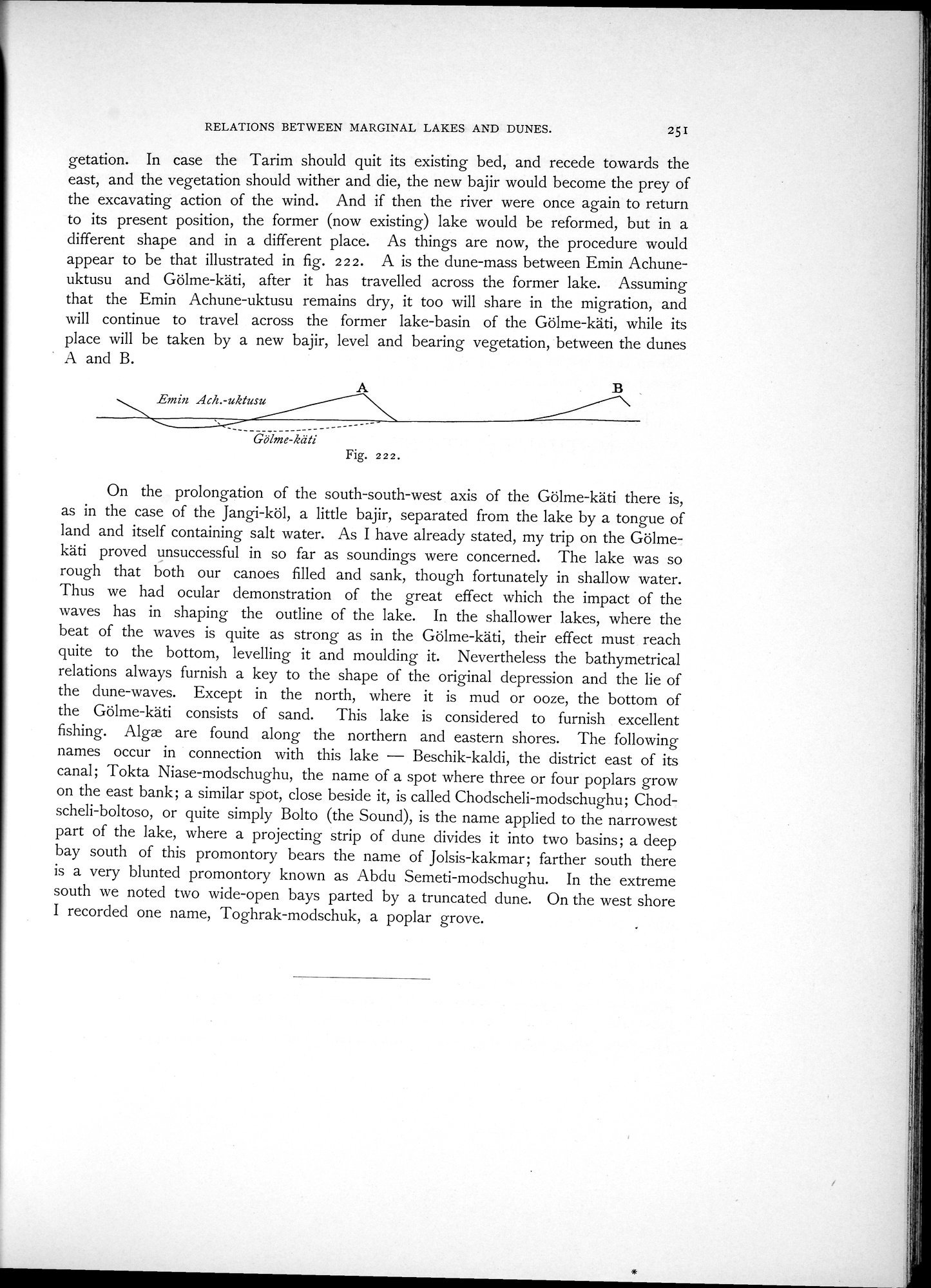
getation. In case the Tarim should quit its existing bed, and recede towards the east, and the vegetation should wither and die, the new bajir would become the prey of the excavating action of the wind. And if then the river were once again to return to its present position, the former (now existing) lake would be reformed, but in a different shape and in a different place. As things are now, the procedure would appear to be that illustrated in fig. 2 2 2. A is the dune-mass between Emin Achuneuktusu and Gölme-käti, after it has travelled across the former lake. Assuming that the Emin Achune-uktusu remains dry, it too will share in the migration, and will continue to travel across the former lake-basin of the Gölme-käti, while its place will be taken by a new bajir, level and bearing vegetation, between the dunes A and B.
Gölme-käti
Fig. 222.
On the prolongation of the south-south-west axis of the Gölme-käti there is, as in the case of the Jangi-köl, a little bajir, separated from the lake by a tongue of land and itself containing salt water. As I have already stated, my trip on the Gölmekäti proved unsuccessful in so far as soundings were concerned. The lake was so rough that both our canoes filled and sank, though fortunately in shallow water. Thus we had ocular demonstration of the great effect which the impact of the waves has in shaping the outline of the lake. In the shallower lakes, where the beat of the waves is quite as strong as in the Gölme-käti, their effect must reach quite to the bottom, levelling it and moulding it. Nevertheless the bathymetrical relations always furnish a key to the shape of the original depression and the lie of the dune-waves. Except in the north, where it is mud or ooze, the bottom of the Gölme-käti consists of sand. This lake is considered to furnish excellent fishing. Alga are found along the northern and eastern shores. The following names occur in connection with this lake — Beschik-kaldi, the district east of its canal; Tokta Niase-modschughu, the name of a spot where three or four poplars grow on the east bank; a similar spot, close beside it, is called Chodscheli-modschughu; Chodscheli-boltoso, or quite simply Bolto (the Sound), is the name applied to the narrowest part of the lake, where a projecting strip of dune divides it into two basins; a deep bay south of this promontory bears the name of Jolsis-kakmar; farther south there is a very blunted promontory known as Abdu Semeti-modschughu. In the extreme south we noted two wide-open bays parted by a truncated dune. On the west shore I recorded one name, Toghrak-modschuk, a poplar grove.
Emin Ach.-uktusu
|
Copyright (C) 2003-2019 National Institute of Informatics and The Toyo Bunko. All Rights Reserved.