National Institute of Informatics - Digital Silk Road Project
| |||||||||
|
| Scientific Results of a Journey in Central Asia, 1899-1902 : vol.1 |
 |
| Vertical section of dunes and lakes. | |
| Vertical section of a filled depression. |
THE TOGHRAKLIK-KÖL AND THE KARAUNELIK-KÖL. 267
the Toghraklik-köl is continually being freshened and renewed by the inflow from the river; but the water which finds its way into the depressions is only able to leave it through evaporation. The presence of the belt of black mud round the several pools, consisting as it does of extremely fine mud, suggests, that they lose but little by absorption; the process of sedimentary cementing is so far advanced that at some earlier period they would seem to have been in much closer connection with the Toghraklik-köl. While however the lake is surrounded with vegetation, amongst other forms with poplars, as indeed its name implies, the immediate vicinity of the depressions is perfectly barren. There cannot exist a doubt that in the future these basins will be entirely cut off from all connection with the lake, and will no longer be fed by any transmission of its water; they will then attain the same stadium as the bajir- of the Jangi-köl, which contains but one quite insignificant pool. They will gradually dry up one after the other, and their floors will then resemble the ordinary bajirs in the interior of the desert.
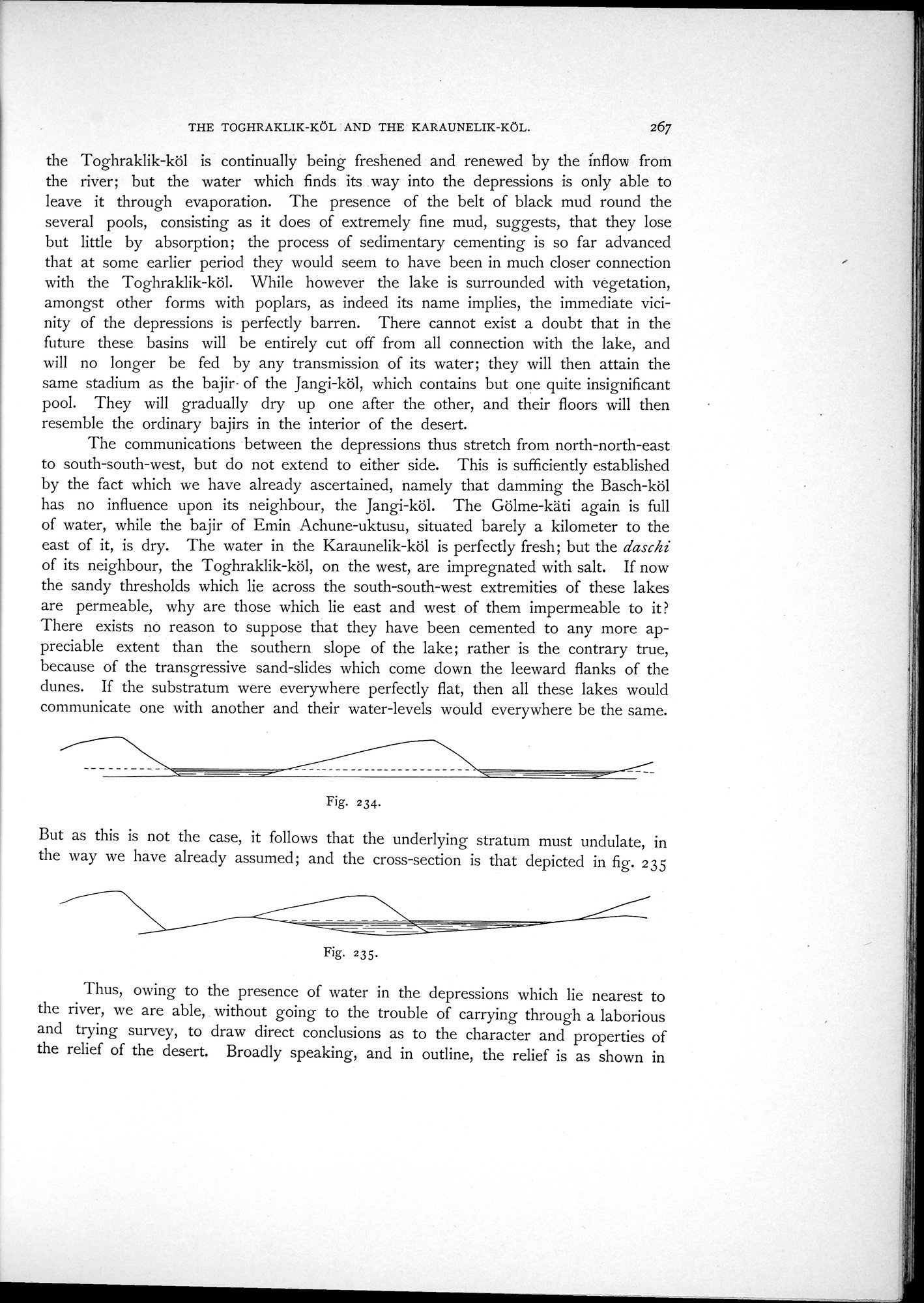
The communications between the depressions thus stretch from north-north-east to south-south-west, but do not extend to either side. This is sufficiently established by the fact which we have already ascertained, namely that damming the Basch-köl has no influence upon its neighbour, the Jangi-köl. The Gölme-käti again is full of water, while the bajir of Emin Achune-uktusu, situated barely a kilometer to the east of it, is dry. The water in the Karaunelik-köl is perfectly fresh; but the daschi of its neighbour, the Toghraklik-köl, on the west, are impregnated with salt. If now the sandy thresholds which lie across the south-south-west extremities of these lakes are permeable, why are those which lie east and west of them impermeable to it? There exists no reason to suppose that they have been cemented to any more appreciable extent than the southern slope of the lake; rather is the contrary true, because of the transgressive sand-slides which come down the leeward flanks of the dunes. If the substratum were everywhere perfectly flat, then all these lakes would communicate one with another and their water-levels would everywhere be the same.
Fig. 234.
But as this is not the case, it follows that the underlying stratum must undulate, in the way we have already assumed; and the cross-section is that depicted in fig. 235
Fig. 235.
Thus, owing to the presence of water in the depressions which lie nearest to the river, we are able, without going to the trouble of carrying through a laborious and trying survey, to draw direct conclusions as to the character and properties of the relief of the desert. Broadly speaking, and in outline, the relief is as shown in
|
Copyright (C) 2003-2019 National Institute of Informatics and The Toyo Bunko. All Rights Reserved.