National Institute of Informatics - Digital Silk Road Project
| |||||||||
|
| Scientific Results of a Journey in Central Asia, 1899-1902 : vol.1 |
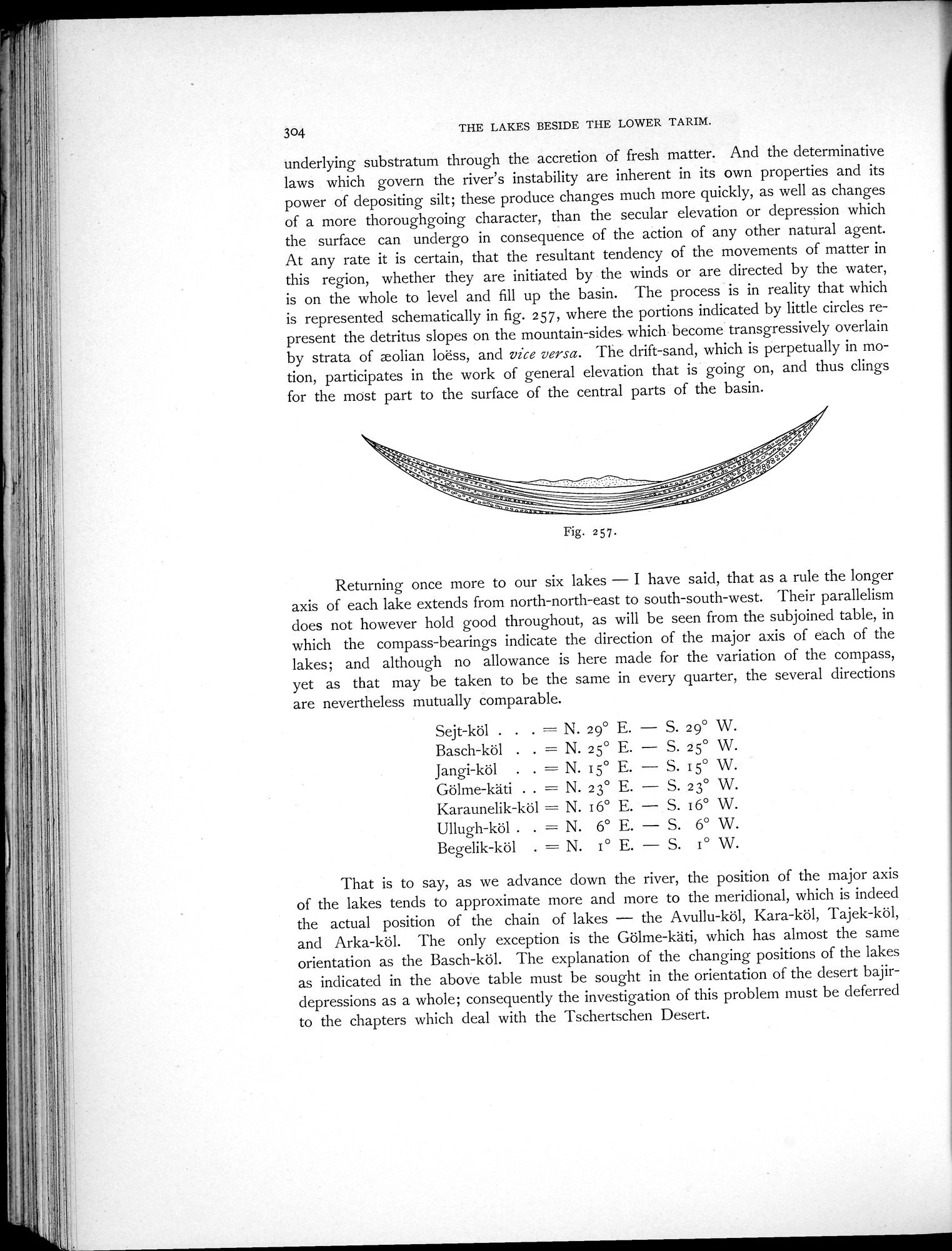 |
| Filling up of the same. |
304 THE LAKES BESIDE THE LOWER TARIM.
underlying substratum through the accretion of fresh matter. And the determinative laws which govern the river's instability are inherent in its own properties and its power of depositing silt; these produce changes much more quickly, as well as changes of a more thoroughgoing character, than the secular elevation or depression which the surface can undergo in consequence of the action of any other natural agent. At any rate it is certain, that the resultant tendency of the movements of matter in this region, whether they are initiated by the winds or are directed by the water, is on the whole to level and fill up the basin. The process is in reality that which is represented schematically in fig. 257, where the portions indicated by little circles represent the detritus slopes on the mountain-sides. which become transgressively overlain by strata of eolian loess, and vice versa. The drift-sand, which is perpetually in motion, participates in the work of general elevation that is going on, and thus clings for the most part to the surface of the central parts of the basin.
Returning once more to our six lakes — I have said, that as a rule the longer axis of each lake extends from north-north-east to south-south-west. Their parallelism does not however hold good throughout, as will be seen from the subjoined table, in which the compass-bearings indicate the direction of the major axis of each of the lakes; and although no allowance is here made for the variation of the compass, yet as that may be taken to be the same in every quarter, the several directions are nevertheless mutually comparable.
Sejt-köl . . . = N. 29° E. — S. 29° W. Basch-köl . . = N. 25° E. — S. 25° W Jangi-köl . . = N. 15° E. — S. 15° W. Gölme-käti . . = N. 23° E. — S. 23° W. Karaunelik-köl = N. 16° E. — S. 16° W. Ullugh-köl . . = N. 6° E. — S. 6° W. Begelik-köl . = N. I° E. — S. I° W.
That is to say, as we advance down the river, the position of the major axis of the lakes tends to approximate more and more to the meridional, which is indeed the actual position of the chain of lakes — the Avullu-köl, Kara-köl, Tajek-köl, and Arka-köl. The only exception is the Gölme-käti, which has almost the same orientation as the Basch-köl. The explanation of the changing positions of the lakes as indicated in the above table must be sought in the orientation of the desert bajirdepressions as a whole; consequently the investigation of this problem must be deferred to the chapters which deal with the Tschertschen Desert.
Fig. 257.
|
Copyright (C) 2003-2019 National Institute of Informatics and The Toyo Bunko. All Rights Reserved.