National Institute of Informatics - Digital Silk Road Project
| |||||||||
|
| Scientific Results of a Journey in Central Asia, 1899-1902 : vol.1 |
 |
| Vertical section of a bajir in the S. part of the desert. | |
| Tamarisk mounds. |
BAJIRS WITH KAMISCH — DESERT SNOWS. 347
The processes of thawing and regelation now produced upon the surface of the snow fresh crystallisations in the form of thin three-pointed flakes, resembling oak-leaves, about I cm. across, and pointing towards the south-east. Possibly the wind, which was then blowing from the north-east, may have had something to do with their formation_
Early on the 8th January the belt of kötäk came to an end, and we were again amongst the high sand, although every now and then we perceived a tree-mound, and a couple of living poplars or tamarisks amongst the dunes. The sand was once more arranged in the familiar characteristic bajir-formation. Although the depressions were of miniature size, they were fenced in on the east by the same steep dune-wall, at the foot of which dwarf tamarisks were sometimes growing without the usual mound underneath them. In several of these bajirs the ground
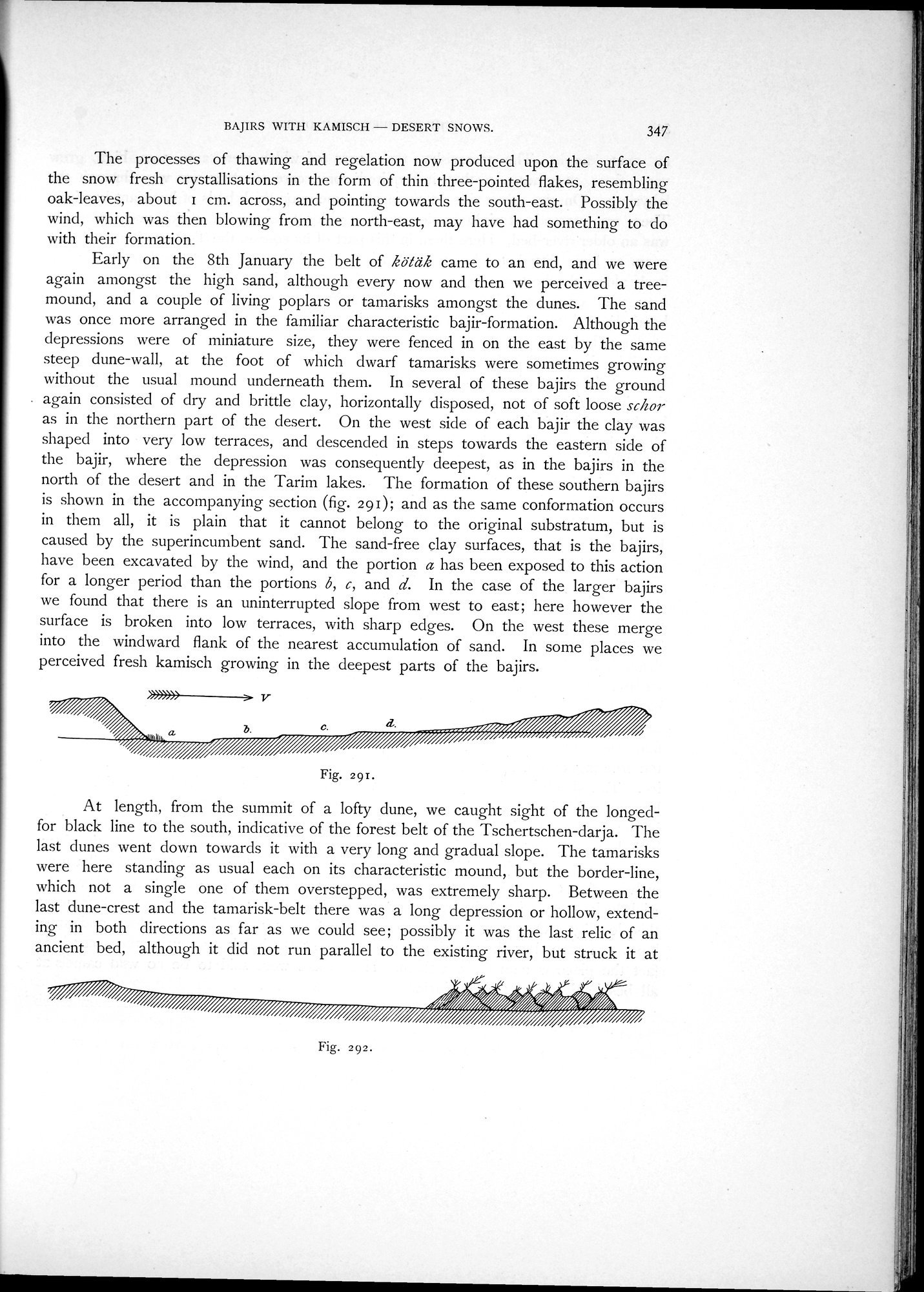
. again consisted of dry and brittle clay, horizontally disposed, not of soft loose schor as in the northern part of the desert. On the west side of each bajir the clay was shaped into very low terraces, and descended in steps towards the eastern side of the bajir, where the depression was consequently deepest, as in the bajirs in the north of the desert and in the Tarim lakes. The formation of these southern bajirs is shown in the accompanying section (fig. 291); and as the same conformation occurs in them all, it is plain that it cannot belong to the original substratum, but is caused by the superincumbent sand. The sand-free clay surfaces, that is the bajirs, have been excavated by the wind, and the portion a has been exposed to this action for a longer period than the portions 6, c, and d. In the case of the larger bajirs we found that there is an uninterrupted slope from west to east; here however the surface is broken into low terraces, with sharp edges. On the west these merge into the windward flank of the nearest accumulation of sand. In some places we perceived fresh kamisch growing in the deepest parts of the bajirs.
»>»»> > V
b.
Fig. 291.
At length, from the summit of a lofty dune, we caught sight of the longed-for black line to the south, indicative of the forest belt of the Tschertschen-darja. The last dunes went down towards it with a very long and gradual slope. The tamarisks were here standing as usual each on its characteristic mound, but the border-line, which not a single one of them overstepped, was extremely sharp. Between the last dune-crest and the tamarisk-belt there was a long depression or hollow, extending in both directions as far as we could see; possibly it was the last relic of an ancient bed, although it did not run parallel to the existing river, but struck it at
//~///%%~ 4/:
~~///o.
Fig. 292.
|
Copyright (C) 2003-2019 National Institute of Informatics and The Toyo Bunko. All Rights Reserved.