National Institute of Informatics - Digital Silk Road Project
| |||||||||
|
| Scientific Results of a Journey in Central Asia, 1899-1902 : vol.1 |
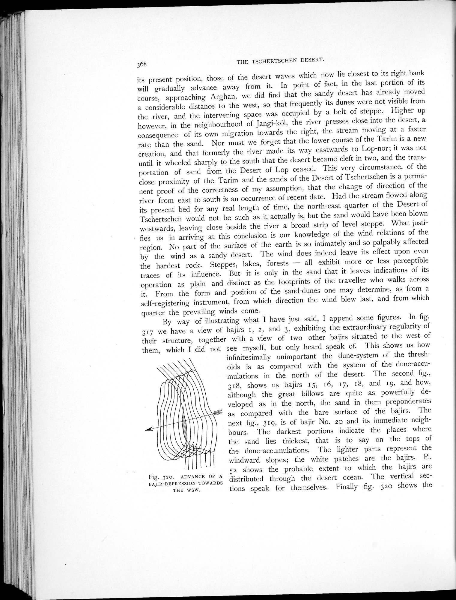 |
| ADVANCE OF A BAJIR-DEPRESSION TOWARDS THE WSW. |
368 THE TSCHERTSCHEN DESERT.
its present position, those of the desert waves which now lie closest to its right bank will gradually advance away from it. In point of fact, in the last portion of its course, approaching Arghan, we did find that the sandy desert has already moved a considerable distance to the west, so that frequently its dunes were not visible from the river, and the intervening space was occupied by a belt of steppe. Higher up however, in the neighbourhood of Jangi-köl, the river presses close into the desert, a consequence of its own migration towards the right, the stream moving at a faster rate than the sand. Nor must we forget that the lower course of the Tarim is a new creation, and that formerly the river made its way eastwards to Lop-nor; it was not until it wheeled sharply to the south that the desert became cleft in two, and the transportation of sand from the Desert of Lop ceased. This very circumstance, of the close proximity of the Tarim and the sands of the Desert of Tschertschen is a permanent proof of the correctness of my assumption, that the change of direction of the river from east to south is an occurrence of recent date. Had the stream flowed along its present bed for any real length of time, the north-east quarter of the Desert of Tschertschen would not be such as it actually is, but the sand would have been blown westwards, leaving close beside the river a broad strip of level steppe. What justi-
fies us in arriving at this conclusion is our knowledge of the wind relations of the region. No part of the surface of the earth is so intimately and so palpably affected by the wind as a sandy desert. The wind does indeed leave its effect upon even the hardest rock. Steppes, lakes, forests — all exhibit more or less perceptible traces of its influence. But it is only in the sand that it leaves indications of its operation as plain and distinct as the footprints of the traveller who walks across it. From the form and position of the sand-dunes one may determine, as from a self-registering instrument, from which direction the wind blew last, and from• which quarter the prevailing winds come.
By way of illustrating what I have just said, I append some figures. In fig. 317 we have a view of bajirs i, 2, and 3, exhibiting the extraordinary regularity of their structure, together with a view of two other bajirs situated to the west of them, which I did not see myself, but only heard speak of. This shows us how
infinitesimally unimportant the dune-system of the thresholds is as compared with the system of the dune-accumulations in the north of the desert. The second fig., 318, shows us bajirs 15, 16, 17, 18, and 19, and how, although the great billows are quite as powerfully developed as in the north, the sand in them preponderates as compared with the bare surface of the bajirs. The next fig., 319, is of bajir No. zo and its immediate neighbours. The darkest portions indicate the places where the sand lies thickest, that is to say on the tops of the dune-accumulations. The lighter parts represent the windward slopes; the white patches are the bajirs. Pl. 52 shows the probable extent to which the bajirs are
Fig. 320. ADVANCE A distributed TOWARDS gbuted throu h the desert ocean. The vertical sec-
THE WSW. tions speak for themselves. Finally fig. 32o shows the
|
Copyright (C) 2003-2019 National Institute of Informatics and The Toyo Bunko. All Rights Reserved.