National Institute of Informatics - Digital Silk Road Project
| |||||||||
|
| Scientific Results of a Journey in Central Asia, 1899-1902 : vol.1 |
 |
| ORDINARY TOPOGRAPHY OF THE LOWER TSCHERTSCHEN-DARJA. | |
| VERTICAL SECTION OF THE SAME. |
THE LOWER TSCHERTSCHEN-DARJA. 393
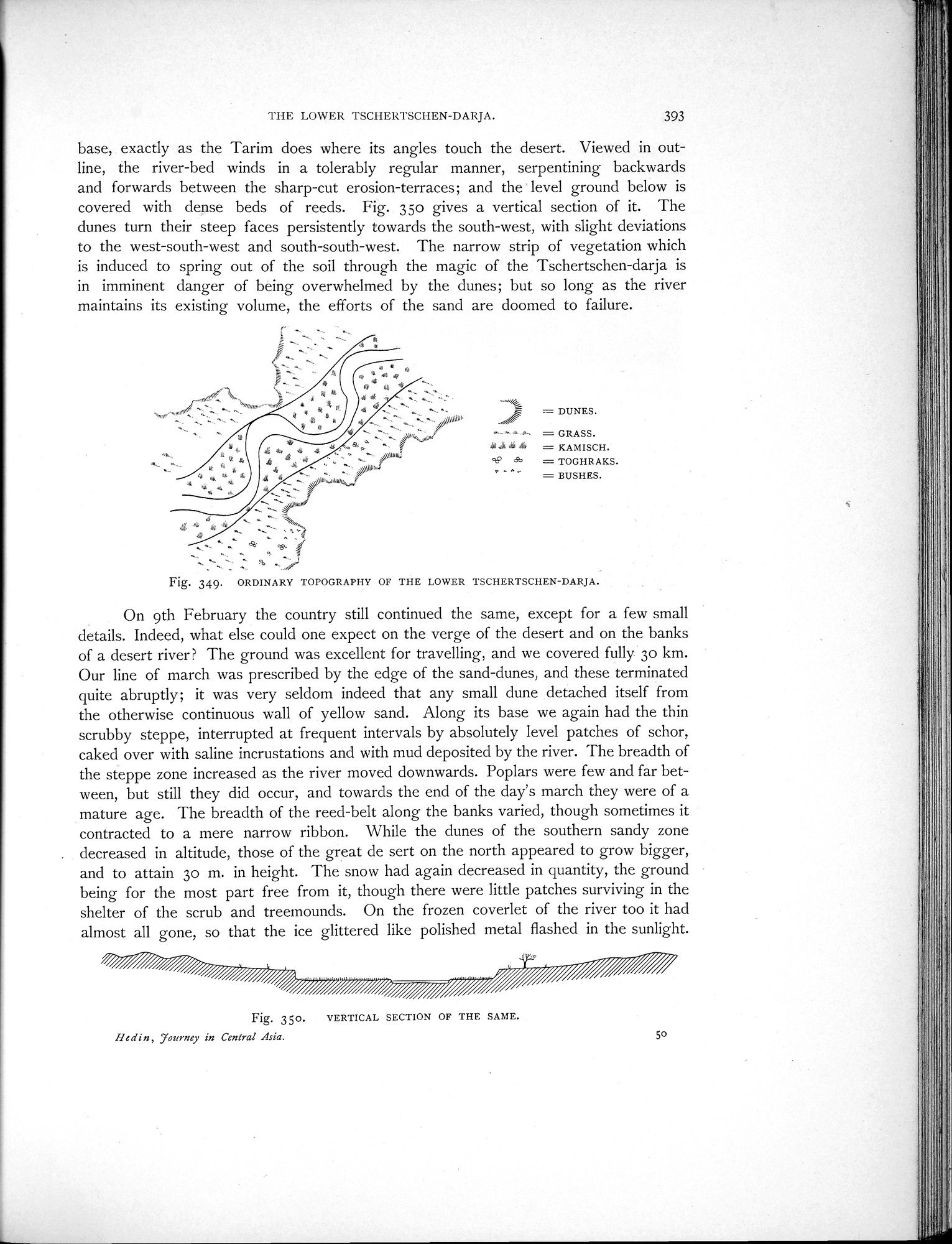
base, exactly as the Tarim does where its angles touch the desert. Viewed in outline, the river-bed winds in a tolerably regular manner, serpentining backwards and forwards between the sharp-cut erosion-terraces; and the level ground below is covered with dense beds of reeds. Fig. 35o gives a vertical section of it. The dunes turn their steep faces persistently towards the south-west, with slight deviations to the west-south-west and south-south-west. The narrow strip of vegetation which is induced to spring out of the soil through the magic of the Tschertschen-darja is in imminent danger of being overwhelmed by the dunes; but so long as the river maintains its existing volume, the efforts of the sand are doomed to failure.
= DUNES.
,• ^ = GRASS.
41i '6 = KAMISCH.
6b = TOGHRAKS. " - = BUSHES.
Fig. 349. ORDINARY TOPOGRAPHY OF THE LOWER TSCHERTSCHEN-DARJA.
On 9th February the country still continued the same, except for a few small details. Indeed, what else could one expect on the verge of the desert and on the banks of a desert river ? The ground was excellent for travelling, and we covered fully 3o km. Our line of march was prescribed by the edge of the sand-dunes, and these terminated quite abruptly; it was very seldom indeed that any small dune detached itself from the otherwise continuous wall of yellow sand. Along its base we again had the thin scrubby steppe, interrupted at frequent intervals by absolutely level patches of schor, caked over with saline incrustations and with mud deposited by the river. The breadth of the steppe zone increased as the river moved downwards. Poplars were few and far between, but still they did occur, and towards the end of the day's march they were of a mature age. The breadth of the reed-belt along the banks varied, though sometimes it contracted to a mere narrow ribbon. While the dunes of the southern sandy zone
. decreased in altitude, those of the great de sert on the north appeared to grow bigger, and to attain 3o m. in height. The snow had again decreased in quantity, the ground being for the most part free from it, though there were little patches surviving in the shelter of the scrub and treeinounds. On the frozen coverlet of the river too it had almost all gone, so that the ice glittered like polished metal flashed in the sunlight.
Fig. 35o. VERTICAL SECTION OF THE SAME.
fledin, Tourney in Central Asia. 50
|
Copyright (C) 2003-2019 National Institute of Informatics and The Toyo Bunko. All Rights Reserved.