National Institute of Informatics - Digital Silk Road Project
| |||||||||
|
| Scientific Results of a Journey in Central Asia, 1899-1902 : vol.1 |
 |
| Old erosion terrace. | |
| HOUSE IN THE VILLAGE OF AT-TARMA. |
THE RETURN JOURNEY FROM ARGHAN TO JANGI-KÖL. 435
after it had shortly before crossed over the river by a bridge. Then came an elongated boldschemal, Bos-köl, surrounded by thick reeds and containing water. The track hugs closely its northern bank, keeping along its former erosion terrace, II/z m. above the level of the water (see fig. 378). Now the existing river possesses no erosion terrace so distinctly and so deeply carved as this, nor could a boldschemal of such depth have been formed except at a period when this channel carried the main stream.
r. ~ , r,rr• u-•r , ~ ~ ~ ~. ~ „
IIIIïI(i~ ~ï,;rjl~,!~~!ilü~j,~~~;,Rl;~!!;(►i~~~;,~~j//~~i~=-.
i/'
Fig. 378.
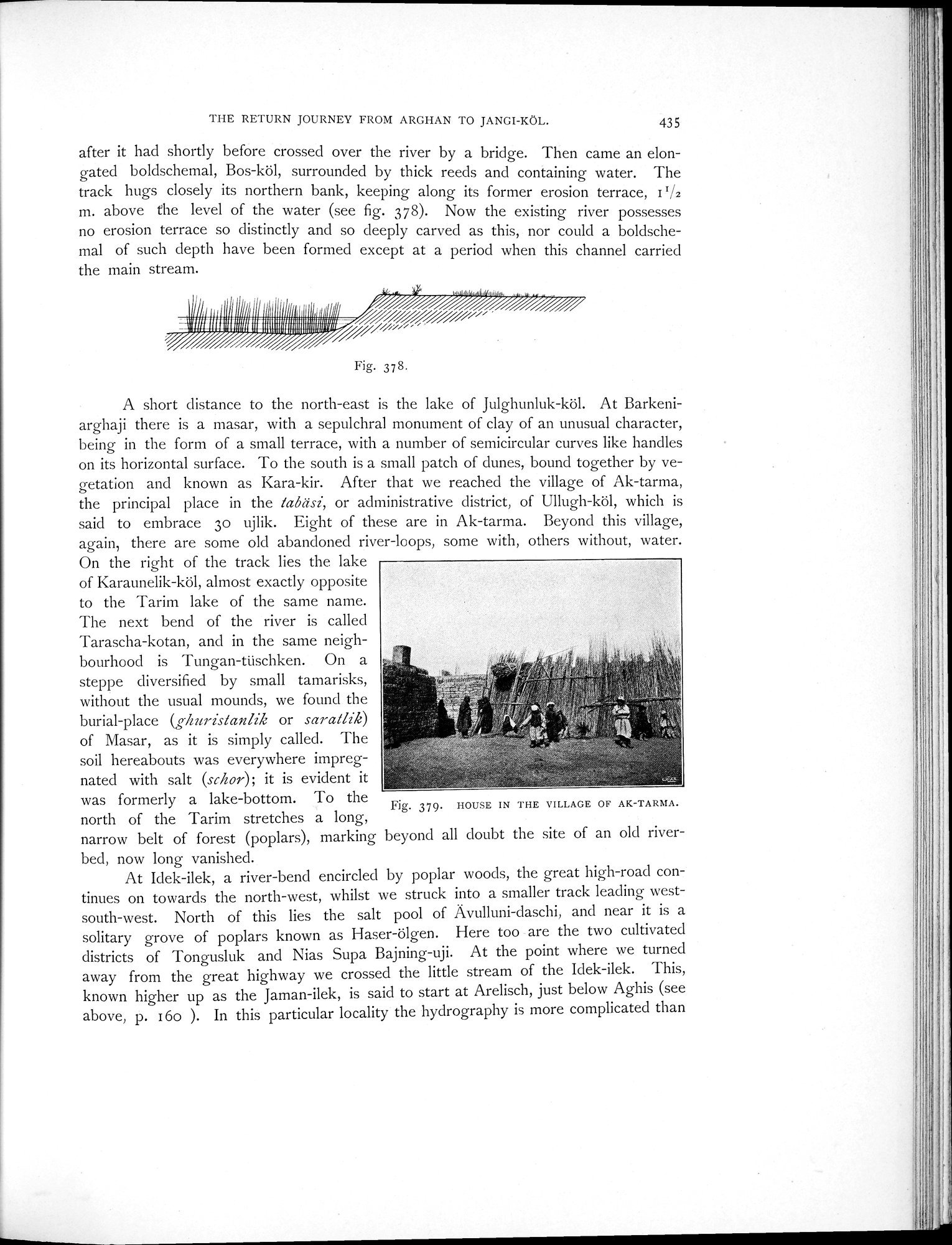
A short distance to the north-east is the lake of Julghunluk-köl. At Barkeniarghaji there is a masar, with a sepulchral monument of clay of an unusual character, being in the form of a small terrace, with a number of semicircular curves like handles on its horizontal surface. To the south is a small patch of dunes, bound together by vegetation and known as Kara-kir. After that we reached the village of Ak-tarma, the principal place in the tabdsi, or administrative district, of Ullugh-köl, which is said to embrace 3o ujlik. Eight of these are in Ak-tarma. Beyond this village, again, there are some old abandoned river-loops, some with, others without, water.
On the right of the track lies the lake
of Karaunelik-köl, almost exactly opposite
to the Tarim lake of the same name.
The next bend of the river is called
Tarascha-kotan, and in the same neigh-
bourhood is Tungan-tüschken. On a
steppe diversified by small tamarisks,
without the usual mounds, we found the
burial-place (ghuristanlik or saratlik)
of Masar, as it is simply called. The
soil hereabouts was everywhere impreg-
nated with salt (schor); it is evident it
was formerly a lake-bottom. To the
Fig. 379. HOUSE IN THE VILLAGE OF AK-TARMA.
north of the Tarim stretches a long,
narrow belt of forest (poplars), marking beyond all doubt the site of an old riverbed, now long vanished.
At Idek-ilek, a river-bend encircled by poplar woods, the great high-road continues on towards the north-west, whilst we struck into a smaller track leading west-south-west. North of this lies the salt pool of Avulluni-daschi, and near it is a solitary grove of poplars known as Haser-ölgen. Here too are the two cultivated districts of Tongusluk and Nias Supa Bajning-uji. At the point where we turned away from the great highway we crossed the little stream of the Idek-ilek. This, known higher up as the Jaman-ilek, is said to start at Arelisch, just below Aghis (see above, p. 16o ). In this particular locality the hydrography is more complicated than
|
Copyright (C) 2003-2019 National Institute of Informatics and The Toyo Bunko. All Rights Reserved.