National Institute of Informatics - Digital Silk Road Project
| |||||||||
|
| Scientific Results of a Journey in Central Asia, 1899-1902 : vol.1 |
 |
| Vertical section of shore-lines. | |
| Vertical section of river-bed. |
THE SCHIRGE-TSCHAPGHAN BRANCH AND CANALS. 447
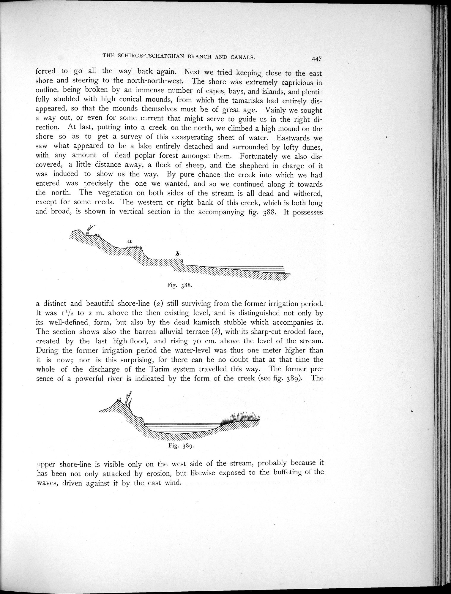
forced to go all the way back again. Next we tried keeping close to the east shore and steering to the north-north-west. The shore was extremely capricious in outline, being broken by an immense number of capes, bays, and islands, and plentifully studded with high conical mounds, from which the tamarisks had entirely disappeared, so that the mounds themselves must be of great age. Vainly we sought a way out, or even for some current that might serve to guide us in the right direction. At last, putting into a creek on the north, we climbed a high mound on the shore so as to get a survey of this exasperating sheet of water. Eastwards we saw what appeared to be a lake entirely detached and surrounded by lofty dunes, with any amount of dead poplar forest amongst them. Fortunately we also discovered, a little distance away, a flock of sheep, and the shepherd in charge of it was induced to show us the way. By pure chance the creek into which we had entered was precisely the one we wanted, and so we continued along it towards the north. The vegetation on both sides of the stream is all dead and withered, except for some reeds. The western or right bank of this creek, which is both long and broad, is shown in vertical section in the accompanying fig. 388. It possesses
Fig. 388.
a distinct and beautiful shore-line (a) still surviving from the former irrigation period. It was I `/2 to 2 m. above the then existing level, and is distinguished not only by its well-defined form, but also by the dead kamisch stubble which accompanies it. The section shows also the barren alluvial terrace (6), with its sharp-cut eroded face, created by the last high-flood, and rising 70 cm. above the level of the stream. During the former irrigation period the water-level was thus one meter higher than it is now; nor is this surprising, for there can be no doubt that at that time the whole of the discharge of the Tarim system travelled this way. The former presence of a powerful river is indicated by the form of the creek (see fig. 389). The
upper shore-line is visible only on the west side of the stream, probably because it has been not only attacked by erosion, but likewise exposed to the buffeting of the
waves, driven against it by the east wind.
Fig. 389.
|
Copyright (C) 2003-2019 National Institute of Informatics and The Toyo Bunko. All Rights Reserved.