National Institute of Informatics - Digital Silk Road Project
| |||||||||
|
| Scientific Results of a Journey in Central Asia, 1899-1902 : vol.1 |
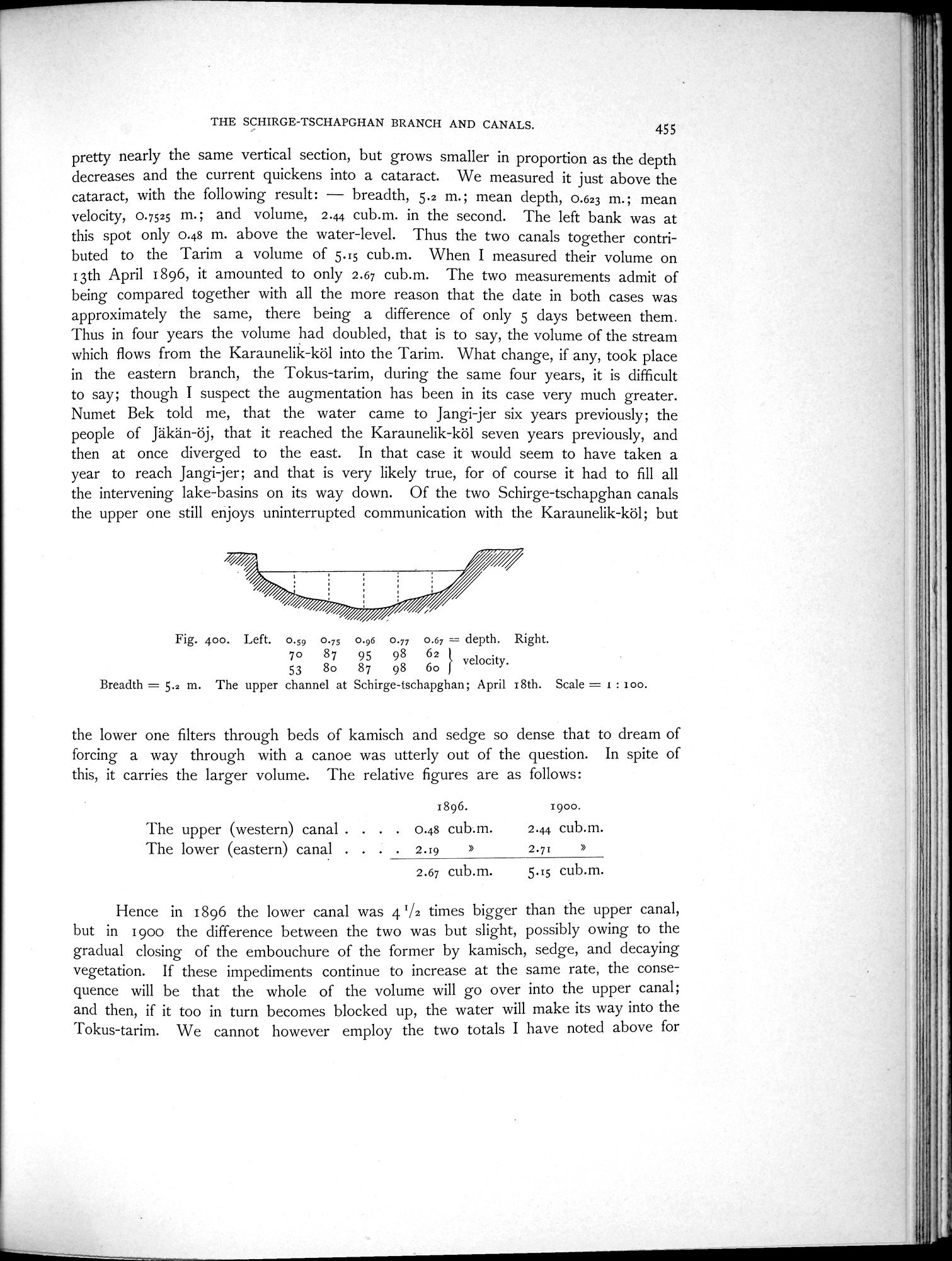 |
| The upper channel at Schirge-tschapghan; April 18th. |
THE SCHIRGE-TSCHAPGHAN BRANCH AND CANALS. 455
pretty nearly the same vertical section, but grows smaller in proportion as the depth decreases and the current quickens into a cataract. We measured it just above the cataract, with the following result: — breadth, 5.2 m.; mean depth, 0.623 m.; mean velocity, 0.7525 m.; and volume, 2.44 cub.m. in the second. The left bank was at this spot only 0.48 m. above the water-level. Thus the two canals together contributed to the Tarim a volume of 5.15 cub.m. When I measured their volume on 13th April 1896, it amounted to only 2.67 cub.m. The two measurements admit of being compared together with all the more reason that the date in both cases was approximately the same, there being a difference of only 5 days between them. Thus in four years the volume had doubled, that is to say, the volume of the stream which flows from the Karaunelik-köl into the Tarim. What change, if any, took place in the eastern branch, the Tokus-tarim, during the same four years, it is difficult to say; though I suspect the augmentation has been in its case very much greater. Numet Bek told me, that the water came to Jangi-jer six years previously; the people of Jäkän-öj, that it reached the Karaunelik-köl seven years previously, and then at once diverged to the east. In that case it would seem to have taken a year to reach Jangi-jer; and that is very likely true, for of course it had to fill all the intervening lake-basins on its way down. Of the two Schirge-tschapghan canals the upper one still enjoys uninterrupted communication with the Karaunelik-köl; but
Fig. 400. Left. 0.59 0.75 0.96 0.77 0.67 _ depth. Right.
70 87 95 98 62 velocity.
53 8o 87 98 60
Breadth = 5.2 m. The upper channel at Schirge-tschapghan; April 18th. Scale = i : ioo.
the lower one filters through beds of kamisch and sedge so dense that to dream of forcing a way through with a canoe was utterly out of the question. In spite of this, it carries the larger volume. The relative figures are as follows:
1896. 1900.
The upper (western) canal . . . . 0.48 cub.m. 2.44 cub.m.
The lower (eastern) canal . . . . 2.19 » 2.71 »
2.67 cub.m. 5.15 cub.m.
Hence in 1896 the lower canal was 41/2 times bigger than the upper canal, but in 1900 the difference between the two was but slight, possibly owing to the gradual closing of the embouchure of the former by kamisch, sedge, and decaying vegetation. If these impediments continue to increase at the same rate, the consequence will be that the whole of the volume will go over into the upper canal; and then, if it too in turn becomes blocked up, the water will make its way into the "I'okus-tarim. We cannot however employ the two totals I have noted above for
|
Copyright (C) 2003-2019 National Institute of Informatics and The Toyo Bunko. All Rights Reserved.