National Institute of Informatics - Digital Silk Road Project
| |||||||||
|
| Scientific Results of a Journey in Central Asia, 1899-1902 : vol.1 |
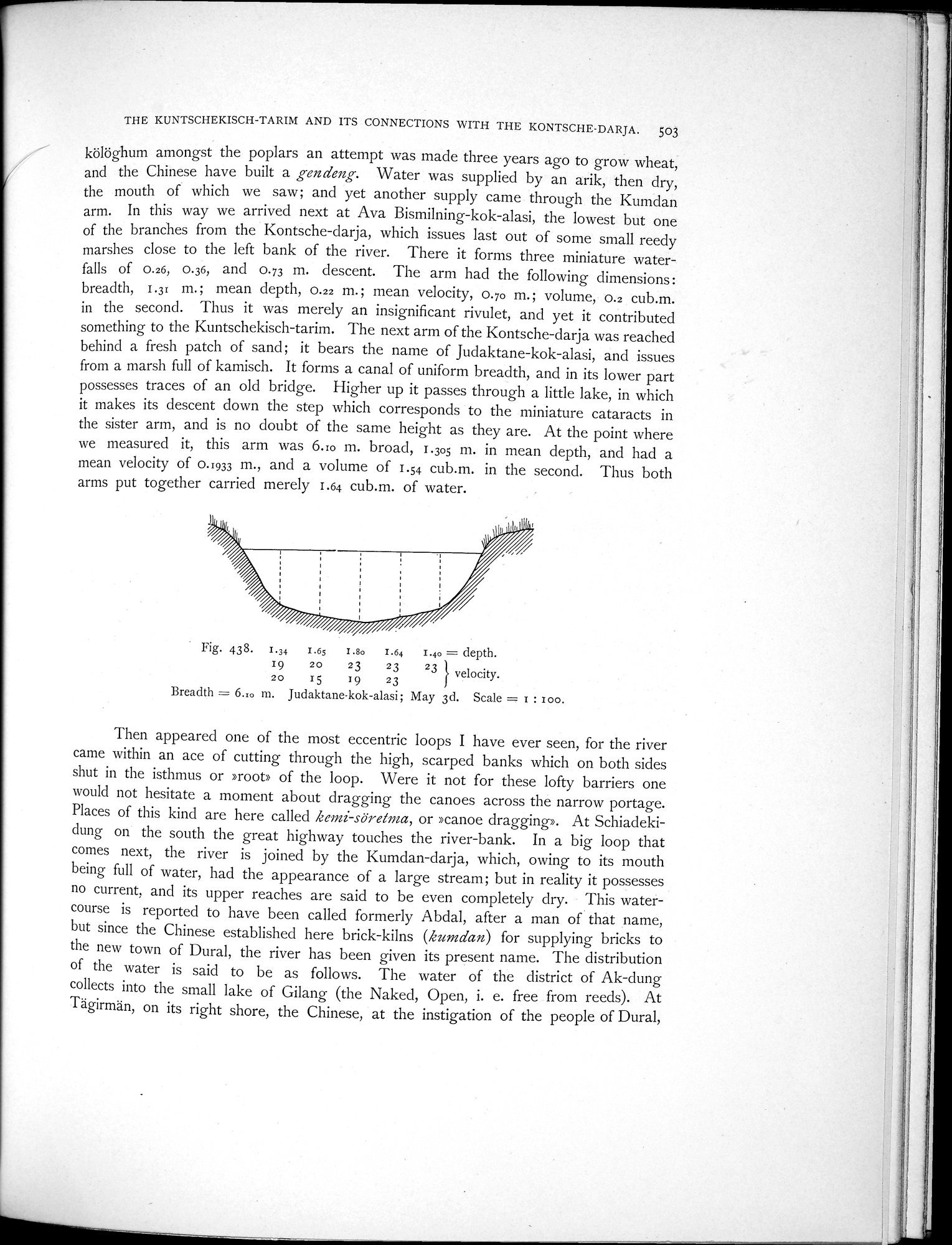 |
| Judaktane-kok-alasi; May 3d. |
THE KUNTSCHEKISCH-TARIM AND ITS CONNECTIONS WITH THE KONTSCHE-DARJA. 503
kölöghum amongst the poplars an attempt was made three years ago to grow wheat, and the Chinese have built a gendeng. Water was supplied by an arik, then dry, the mouth of which we saw; and yet another supply came through the Kumdan arm. In this way we arrived next at Ava Bismilning-kok-alasi, the lowest but one of the branches from the Kontsche-darja, which issues last out of some small reedy marshes close to the left bank of the river. There it forms three miniature waterfalls of 0.26, 0.36, and 0.73 m. descent. The arm had the following dimensions: breadth, 1.31 m.; mean depth, 0.22 m.; mean velocity, 0.70 m.; volume, 0.2 cub.m. in the second. Thus it was merely an insignificant rivulet, and yet it contributed something to the Kuntschekisch-tarim. The next arm of the Kontsche-darja was reached behind a fresh patch of sand; it bears the name of Judaktane-kok-alasi, and issues from a marsh full of kamisch. It forms a canal of uniform breadth, and in its lower part possesses traces of an old bridge. Higher up it passes through a little lake, in which it makes its descent down the step which corresponds to the miniature cataracts in the sister arm, and is no doubt of the same height as they are. At the point where we measured it, this arm was 6.10 m. broad, 1.305 m. in mean depth, and had a mean velocity of 0.033 m., and a volume of 1.54 cub.m. in the second. Thus both arms put together carried merely 1.64 cub.m. of water.
Fig. 438. 1.84 1.65 I.80 1.64 1.40 = depth.
19 20 23 20 15 I g 23 23 } velocity.
Breadth = 6.10 m. Judaktane•kok-alasi; May 3d. Scale = I : zoo.
Then appeared one of the most eccentric loops I have ever seen, for the river came within an ace of cutting through the high, scarped banks which on both sides shut in the isthmus or »root» of the loop. Were it not for these lofty barriers one would not hesitate a moment about dragging the canoes across the narrow portage. Places of this kind are here called kemi-söretma, or »canoe dragging». At Schiadekidung on the south the great highway touches the river-bank. In a big loop that comes next, the river is joined by the Kumdan-darja, which, owing to its mouth being full of water, had the appearance of a large stream; but in reality it possesses no current, and its upper reaches are said to be even completely dry. This watercourse is reported to have been called formerly Abdal, after a man of that name, but since the Chinese established here brick-kilns (kumdan) for supplying bricks to the new town of Dural, the river has been given its present name. The distribution of the water is said to be as follows. The water of the district of Ak-dung collects into the small lake of Gilang (the Naked, Open, i. e. free from reeds). At Tägirmän, on its right shore, the Chinese, at the instigation of the people of Dural,
|
Copyright (C) 2003-2019 National Institute of Informatics and The Toyo Bunko. All Rights Reserved.