国立情報学研究所 - ディジタル・シルクロード・プロジェクト
『東洋文庫所蔵』貴重書デジタルアーカイブ
|
|
カラー画像サムネイル -
目次 -
ページ番号 -
書誌情報(メタデータ) -
キャプション -
カラー画像 -
白黒高解像度画像 -
見開きページ -
グラフィック -
| 0204 |
History of the expedition in Asia, 1927-1935 : vol.3 |
| 中央アジア探検史 : vol.3 |
キャプション
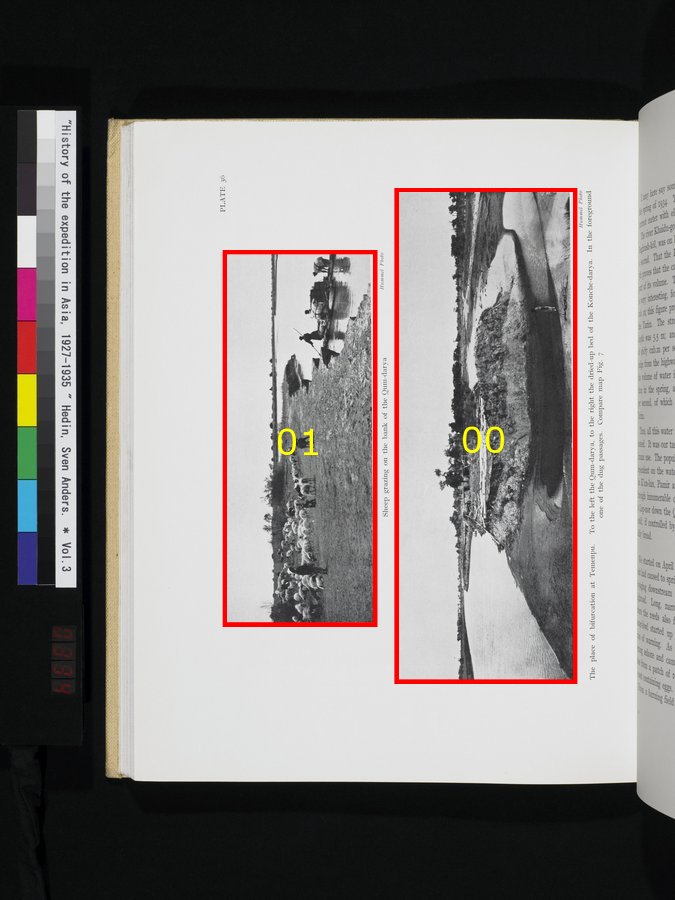
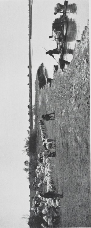
| [Photo] PLATE 36~t |
クム=ダリヤの岸での羊の放牧Sheep grazing on the bank of the Qum-darya
|
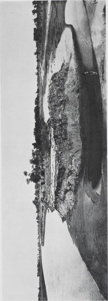
| [Photo] PLATE 36~b |
徳門堡の分岐点。左がクム=ダリヤ、右が干上がったコンチェ=ダリヤの河床。最前面は掘られた水路の一つ。Fig.7の地図参照。Theplace of bifurcation at Temenpu. To the left the Qum-darya, to the right the dried-up bed of the Konche-darya. In the foreground
one of the dug passages. Compare map Fig. 7
|
 引用情報
引用情報
3
.
.
.
.
|
.
.
.
.
62
.
.
.
.
|
.
.
.
.
96
.
.
.
.
|
.
.
.
.
165
.
.
.
.
|
.
200
203
204
206
208
.
.
.
|
.
.
.
.
227
.
.
.
.
|
.
.
.
.
246
.
.
.
.
|
.
.
.
.
314
.
.
.
.
|
.
.
.
.
359
.
.
.
.
427
Copyright (C) 2003-2019
National Institute of Informatics(国立情報学研究所)
and
The Toyo Bunko(東洋文庫). All Rights Reserved.
本ウェブサイトに掲載するデジタル文化資源の無断転載は固くお断りいたします。