National Institute of Informatics - Digital Silk Road Project
| |||||||||
|
| Storia della Spedizione Scientifica Italiana nel Himàlaia, Caracorùm e Turchestàn Cinese(1913-1914) : vol.1 | |
| History of an Italian Science Expedition to Himalayas, Kharakhorum and Chinese Turkistan(1913-1914) : vol.1 |
 |
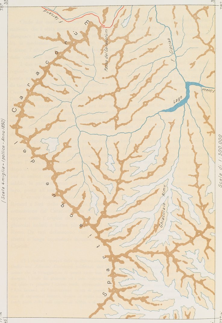
| Mountain dikes at the eastern end of the Karakorum dividing ridge, shown in a simplified map based on information from the Indian measurement office (The original map drawn in 1892 at the scale of 4 miles to an inch) (1:300,000)Schizzo oro-idrografico della estremità orientale del Caracorùm dalla Carta dell'Ufficio trigonometrico dell'India. |
|
Copyright (C) 2003-2019 National Institute of Informatics and The Toyo Bunko. All Rights Reserved.