| [Figure] t |
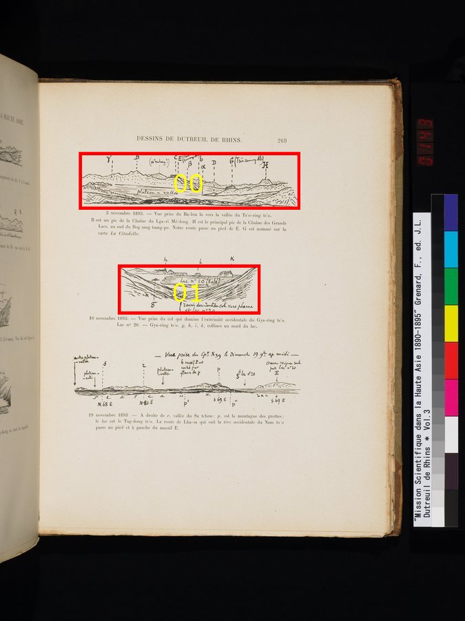
3 November 1893. - View taken from Ba-lou towards the valley of Ts'o-ring ts'o. B is a peek of the mountain chain of Lga-ri Me-long. H is the main peek of the mountain chain of the Great Lakes, in the South of Bog sang tsang-po. Our way passes at the foot of E. G is named on the map La Citadelle.3 novembre 1893. - Vue prise du Ba-lou la vers la vallée du Ts'o-ring ts'o. B est un pic de la Chaîne du Lga-ri Mé-long. H est le principal pic de la Chaîne des Grands Lacs, au sud du Bog sang tsang-po. Notre route passe au pied de E. G est nommé sur la carte La Citadelle.
|
| [Figure] c |
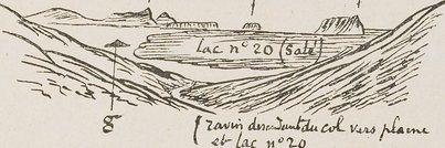
16 November 1893. - View taken from the pass which dominates the eastern edge of Gya-ring ts'o. Lake no 20. - Gya-ring t'so. g,h,i,k, hills in the North of the lake.16 novembre 1893. - Vue prise du col qui domine l'extrémité occidentale du Gya-ring ts'o. Lac no 20. - Gya-ring t'so. g,h,i,k, collines au nord du lac.
|
| [Figure] b |
19 November 1893. - In the right of r, valley of Sa tchou : p, is the mountain of caves; the lake is the Tag-dong ts'o. The road from Lha-sa which follows the western shore of Nam ts'o passes at the foot and left of massif E.19 novembre 1893. - A droite de r, vallée du Sa tchou : p, est la montagne des grottes ; le lac est le Tag-dong ts'o. La route de Lha-sa qui suit la rive occidentale du Nam ts'o passe au pied et à gauche du massif E.
|