National Institute of Informatics - Digital Silk Road Project
| |||||||||
|
| Archaeological Researches in Sinkiang : vol.1 |
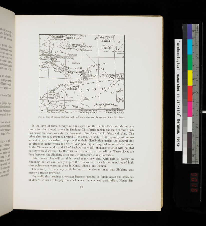 |
| Map of eastern Sinkiang with prehistoric sites and the courses of the Silk Roads. |
?a-
GHASHIIN
•
G B,I
4
~°- •
ti- •
; :r .......
1 û-mèrv
........
A G
. r.
~
~ e '
'40-•
Scale 1.7000000
.-4 so ßo0
2oolun
gg° 88• 9p1~ 9,2° - — 9 r."-
Prehistoricite _ _ __The Route of the _____The Route of the
The Route of' the Centre South/approx./ North /approx./
Fig. 4. Map of eastern Sinkiang with prehistoric sites and the courses of the Silk Roads.
In the light of these surveys of our expedition the Turf an Basin stands out as a centre for the painted pottery in Sinkiang. This fertile region, the main part of which lies below sea-level, was also the foremost cultural centre in historical time. The other sites are also grouped around T'ien- shan. In spite of the scarcity of known sites it seems reasonable to suppose that their distribution marks the general line of direction along which the art of vase painting was spread in successive waves. In the Yü-men corridor and SE of Suchow some still unpublished sites with painted pottery were discovered by BOHLIN and BEXELL of our expedition. These places are links between the Sinkiang sites and ANDERSSON'S Kansu localities.
Future researches will certainly reveal many new sites with painted pottery in Sinkiang, but we can hardly expect them to contain such large quantities of high class polychrome wares as those in Kansu, Shensi and Honan.
The scarcity of finds may partly be due to the circumstance that Sinkiang was merely a transit province.
Physically this province alternates between patches of fertile oases and stretches of desert, which are largely too sterile even for a nomad pastoralism. Hence Sin-
25
|
Copyright (C) 2003-2019 National Institute of Informatics and The Toyo Bunko. All Rights Reserved.