国立情報学研究所 - ディジタル・シルクロード・プロジェクト
| |||||||||
|
| Explorations in Turkestan 1903 : vol.1 | |
| トルキスタンの調査 1903年 : vol.1 |
| 00 | 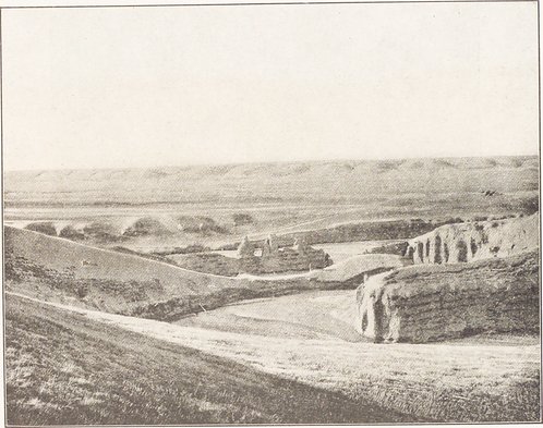 |
類似画像を検索 |
|---|
 |
| 天山山脈のChadir Kul近郊にある別のKuzzil Suの段丘と蛇行した川 標高11,000フィート これら段丘には、砂利や赤い第3紀石灰石などの層があるTerraces and Meanders of another Kuzzil Su near Chadir Kul, on the Tian Shan Plateau, at an elevation of 11, 000 feet. These terraces are cut partly in gravel and partly in red Tertiary limestone. |
|
Copyright (C) 2003-2019
National Institute of Informatics(国立情報学研究所)
and
The Toyo Bunko(東洋文庫). All Rights Reserved.
本ウェブサイトに掲載するデジタル文化資源の無断転載は固くお断りいたします。