National Institute of Informatics - Digital Silk Road Project
| |||||||||
|
| Explorations in Turkestan 1903 : vol.1 |
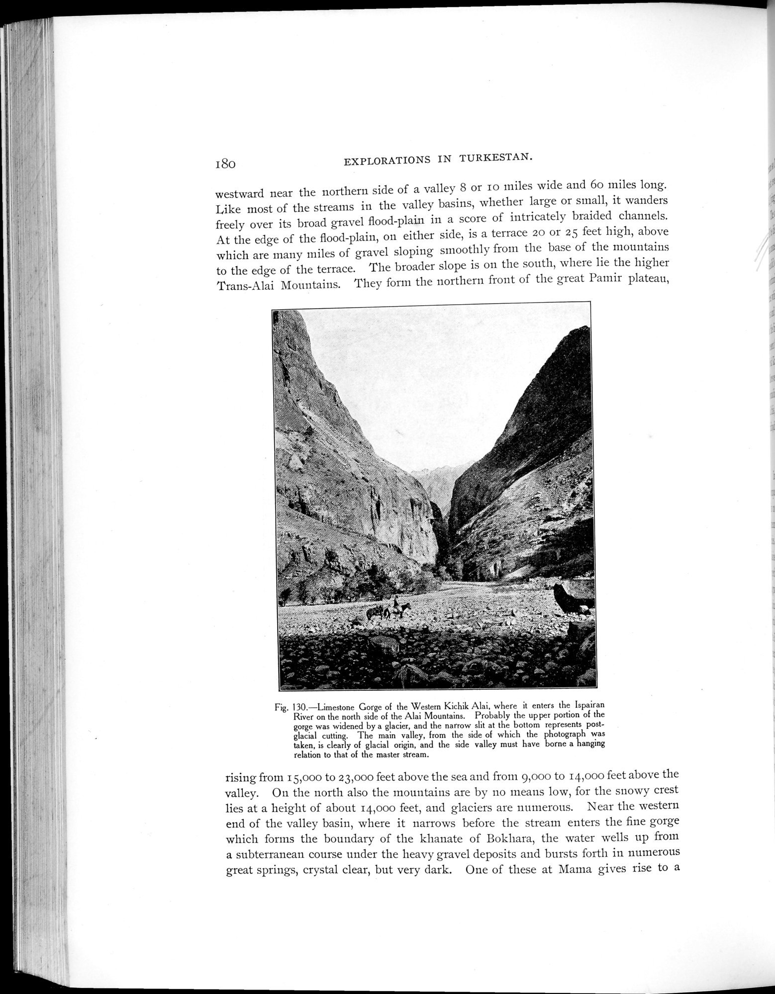 |
| Limestone Gorge of the Western Kichik Alai, where it enters the Ispairan River on the north side of the Alai Mountains. Probably the upper portion of the gorge was widened by a glacier, and the narrow slit at the bottom represents post-glacial cutting. The main valley, from the side of which the photograph was taken, is clearly of glacial origin, and the side valley must have borne a hanging relation to that of the master stream. |
180 EXPLORATIONS IN TURKESTAN.
westward near the northern side of a valley 8 or Io miles wide and 6o miles long. Like most of the streams in the valley basins, whether large or small, it wanders freely over its broad gravel flood-plain in a score of intricately braided channels. At the edge of the flood-plain, on either side, is a terrace 20 or 25 feet high, above which are many miles of gravel sloping smoothly from the base of the mountains to the edge of the terrace. The broader slope is on the south, where lie the higher Trans-Alai Mountains. They form the northern front of the great Pamir plateau,
Fig. 130.—Limestone Gorge of the Western Kichik Alai, where it enters the lspairan River on the north side of the Alai Mountains. Probably the upper portion of the gorge was widened by a glacier, and the narrow slit at the bottom represents post-glacial cutting. The main valley, from the side of which the photograph was taken, is clearly of glacial origin, and the side valley must have borne a hanging relation to that of the master stream.
rising from 15,000 to 23,000 feet above the sea and from 9,000 to 14,000 feet above the valley. On the north also the mountains are by no means low, for the snowy crest lies at a height of about 14,000 feet, and glaciers are numerous. Near the western end of the valley basin, where it narrows before the stream enters the fine gorge which forms the boundary of the khanate of Bokhara, the water wells up from a subterranean course under the heavy gravel deposits and bursts forth in numerous
j.
great springs, crystal clear, but very dark. One of these at Mama gives rise to a
|
Copyright (C) 2003-2019 National Institute of Informatics and The Toyo Bunko. All Rights Reserved.