国立情報学研究所 - ディジタル・シルクロード・プロジェクト
| |||||||||
|
| Explorations in Turkestan 1903 : vol.1 | |
| トルキスタンの調査 1903年 : vol.1 |
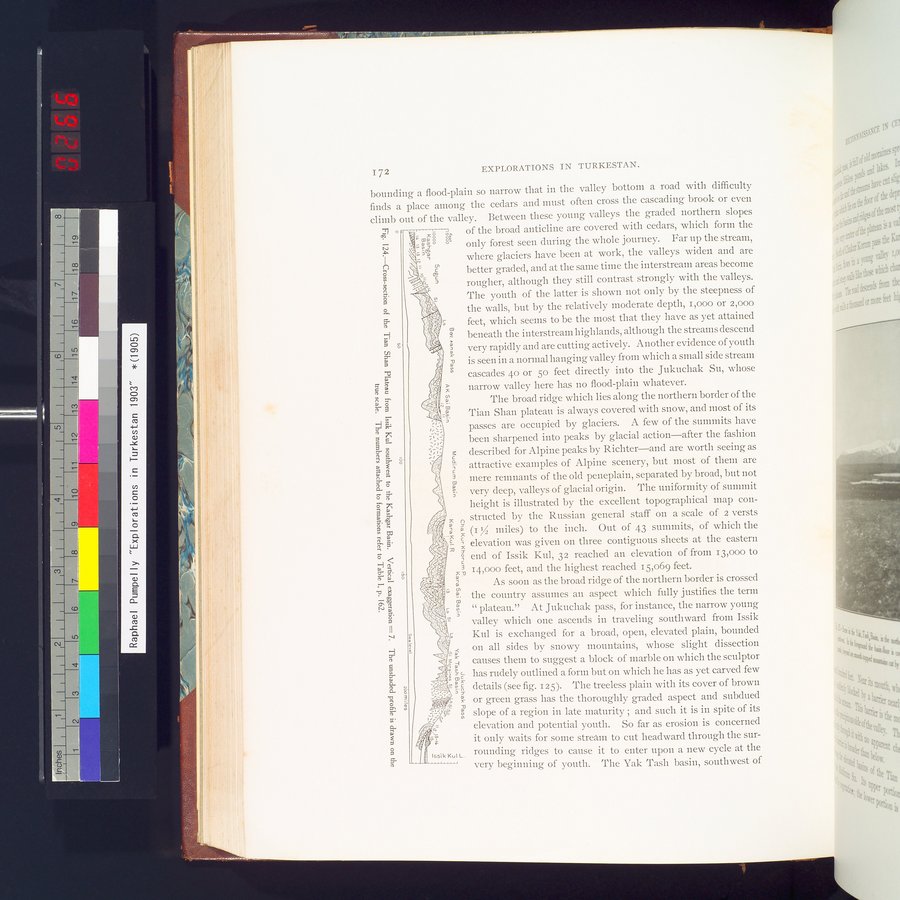 |
| イシククルの南西からカシュガル盆地にかけての天山山脈の断面 過高感=7 陰影なしの概略が実際の規模で描かれている 地層に付けられた番号はp.162図Iを参照Cross-section of the Tian Shan Plateau from Issik Kul southwest to the Kashgar Basin. Vertical exaggeration= 7. The unshaded profile is drawn on the true scale. The numbers attached to formations refer to Table I, p. 162. |
~ 72 EXPLORATIONS IN TURKESTAN.
bounding a flood-plain so narrow that in the valley bottom a road with difficulty finds a place among the cedars and must often cross the cascading brook or even climb out of the valley. Between these young valleys the graded northern slopes
°c ,. : xo N, of the broad anticline are covered with cedars, which form the
N ,- â Tg .. only forest seen during the whole journey. Far up the stream,
-51
-, here glaciers have been at work, the valleys widen and are
0 - s better graded, and at the same time the interstream areas become
x ' rougher, although they still contrast strongly with the valleys.
~
5. The youth of the latter is shown not only by the steepness of
0 ,'l ; the walls, but by the relatively moderate depth, i,000 or 2,000
' feet, which seems to be the most that they have as yet attained
5- Y Y
~~ beneath the interstream highlands, although the streams descend
w
g' very rapidly and are cutting actively. Another evidence of youth
m is seen in a normal hanging valley from which a small side stream
I. o cascades 4o or 5o feet directly into the Jukuchak Su, whose
0.
c narrow valley here has no flood-plain whatever.
The broad ridge which lies along the northern border of the
Fr § l % 'N W
H Tian Shan plateau is always covered with snow, and most of its
'
passes are occupied by glaciers. A few of the summits have
been sharpened into peaks by glacial action—after the fashion
c 3 described for Alpine peaks by Richter—and are worth seeing as
a ` r a attractive examples of Alpine scenery, but most of them are
-â mere remnants of the old peneplain, separated by broad, but not
s very deep, valleys of glacial origin. The uniformity of summit
d height is illustrated by the excellent topographical map con-
w ; ...structed by the Russian general staff on a scale of 2 versts
~, ; (/f â z (1 IZ miles) to the inch. Out of 43 summits, of which the
s•>!A, c , elevation was given on three contiguous sheets at the eastern eÇ: A s
Ó~ t'., g end of Issik Kul, 32 reached an elevation of from 13,000 to
~. f`; ' â , 14,000 feet, and the highest reached 15,069 feet.•
_> a As soon as the broad ridge of the northern border is crossed
t;~, W the country assumes an aspect which fully justifies the term
N Â , t4 plateau." At Jukuchak pass, for instance, the narrow young
?c.. valley which one ascends in traveling southward from Issik
II
i; Kul is exchanged for a broad, open, elevated plain, bounded
.-.1 _
7. 11{ on all sides by snowy mountains, whose slight dissection
$` ; F. causes them to suggest a block of marble on which the sculptor
co .. _ L has rudely outlined a form but on which he has as et carved few
WC Y Y
"s I ;"s details (see fig. 125). The treeless plain with its cover of brown
N
11 or green grass has the thoroughly graded aspect and subdued
" = N slope of a region in late maturity ; and such it is in spite of its
Li- „'. ti elevation and potential youth. So far as erosion is concerned
a r'r_ a
:~..N;, it only waits for some stream to cut headward through the sur-
I66ik Kul L. rounding ridges to cause it to enter upon a new cycle at the
ç very beginning of youth. The Yak Tash basin, southwest of
LI!
|
Copyright (C) 2003-2019
National Institute of Informatics(国立情報学研究所)
and
The Toyo Bunko(東洋文庫). All Rights Reserved.
本ウェブサイトに掲載するデジタル文化資源の無断転載は固くお断りいたします。