National Institute of Informatics - Digital Silk Road Project
| |||||||||
|
| Explorations in Turkestan : Expedition of 1904 : vol.2 |
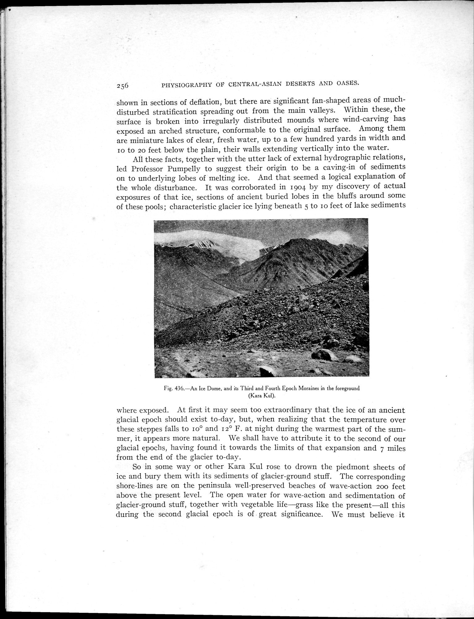 |
| An Ice Dome, and its Third and Fourth Epoch Moraines in the foreground (Kara Kul). |
256 PIHYSIOGRAPHY OP CENTRAI,-ASIAN DESERTS AND OASES.
shown in sections of deflation, but there are significant fan-shaped areas of much-disturbed stratification spreading out from the main valleys. Within these, the surface is broken into irregularly distributed mounds where wind-carving has exposed an arched structure, conformable to the original surface. Among them are miniature lakes of clear, fresh water, up to a few hundred yards in width and to to 20 feet below the plain, their walls extending vertically into the water.
All these facts, together with the utter lack of external hydrographie relations, led Professor Pumpelly to suggest their origin to be a caving-in of sediments on to underlying lobes of melting ice. And that seemed a logical explanation of the whole disturbance. It was corroborated in 1904 by my discovery of actual exposures of that ice, sections of ancient buried lobes in the bluffs around some of these pools; characteristic glacier ice lying beneath 5 to to feet of lake sediments
Fig. 436.—An Ice Dome, and its Third and Fourth Epoch Moraines in the foreground
(Kara Kul).
where exposed. At first it may seem too extraordinary that the ice of an ancient glacial epoch should exist to-day, but, when realizing that the temperature over these steppes falls to Io° and 12° F. at night during the warmest part of the summer, it appears more natural. We shall have to attribute it to the second of our glacial epochs, having found it towards the limits of that expansion and 7 miles from the end of the glacier to-day.
So in some way or other Kara Kul rose to drown the piedmont sheets of ice and bury them with its sediments of glacier-ground stuff. The corresponding shore-lines are on the peninsula well-preserved beaches of wave-action 200 feet above the present level. The open water for wave-action and sedimentation of glacier-ground stuff, together with vegetable life—grass like the present—all this during the second glacial epoch is of _ great significance. We must believe it
|
Copyright (C) 2003-2019 National Institute of Informatics and The Toyo Bunko. All Rights Reserved.