National Institute of Informatics - Digital Silk Road Project
| |||||||||
|
| Explorations in Turkestan : Expedition of 1904 : vol.2 |
 |
| A Fortress in the Alai Valley on the Ancient Route from Bactra to Kashgar. |
OASES. 309
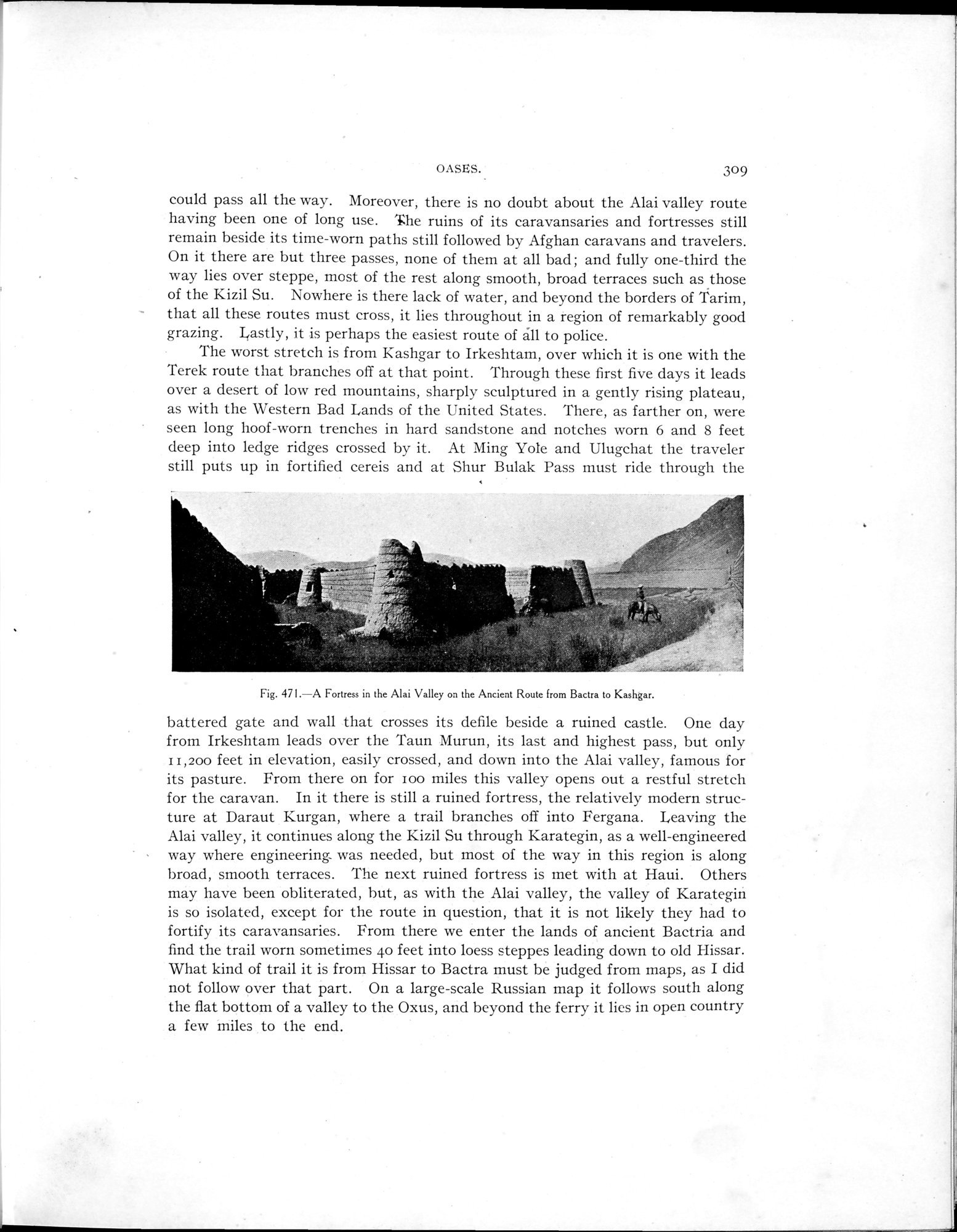
could pass all the way. Moreover, there is no doubt about the Alai valley route having been one of long use. The ruins of its caravansaries and fortresses still remain beside its time-worn paths still followed by Afghan caravans and travelers. On it there are but three passes, none of them at all bad ; and fully one-third the way lies over steppe, most of the rest along smooth, broad terraces such as those of the Kizil Su. Nowhere is there lack of water, and beyond the borders of Tarim,
- that all these routes must cross, it lies throughout in a region of remarkably good grazing. Lastly, it is perhaps the easiest route of âll to police.
The worst stretch is from Kashgar to Irkeshtam, over which it is one with the Terek route that branches off at that point. Through these first five days it leads over a desert of low red mountains, sharply sculptured in a gently rising plateau, as with the Western Bad Lands of the United States. There, as farther on, were
seen long hoof-worn trenches in hard sandstone and notches worn 6 and 8 feet deep into ledge ridges crossed by it. At Ming Yole and Ulugchat the traveler still puts up in fortified cereis and at Shur Bulak Pass must ride through the
Fig. 47I.—A Fortress in the Alai Valley on the Ancient Route from Bactra to Kashgar.
battered gate and wall that crosses its defile beside a ruined castle. One day from Irkeshtam leads over the Taun Murun, its last and highest pass, but only 11,200 feet in elevation, easily crossed, and down into the Alai valley, famous for its pasture. From there on for loo miles this valley opens out a restful stretch for the caravan. In it there is still a ruined fortress, the relatively modern structure at Daraut Kurgan, where a trail branches off into Fergana. Leaving the Alai valley, it continues along the Kizil Su through Karategin, as a well-engineered way where engineering was needed, but most of the way in this region is along broad, smooth terraces. The next ruined fortress is met with at Haui. Others may have been obliterated, but, as with the Alai valley, the valley of Karategiri is so isolated, except for the route in question, that it is not likely they had to fortify its caravansaries. From there we enter the lands of ancient Bactria and find the trail worn sometimes 4o feet into loess steppes leading down to old Hissar. What kind of trail it is from Hissar to Bactra must be judged from maps, as I did not follow over that part. On a large-scale Russian map it follows south along the flat bottom of a valley to the Oxus, and beyond the ferry it lies in open country a few miles to the end.
|
Copyright (C) 2003-2019 National Institute of Informatics and The Toyo Bunko. All Rights Reserved.