National Institute of Informatics - Digital Silk Road Project
| |||||||||
|
| Explorations in Turkestan : Expedition of 1904 : vol.2 |
 |
| Map and Section of Kodishar Kurgan. |
OASES. 319
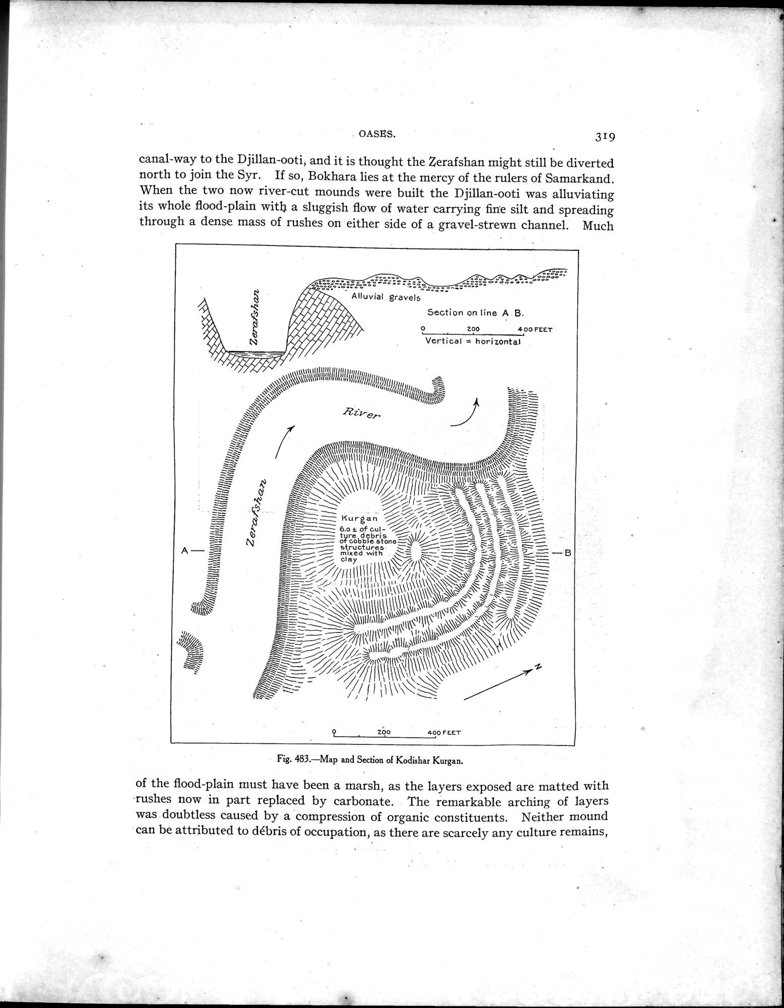
canal-way to the Djillan-ooti, and it is thought the Zerafshan might still be diverted north to join the Syr. If so, Bokhara lies at the mercy of the rulers of Samarkand. When the two now river-cut mounds were built the Djillan-ooti was alluviating its whole flood-plain with a sluggish flow of water carrying fine silt and spreading through a dense mass of rushes on either side of a gravel-strewn channel. Much
. ,
---
,i . (3vft, Alluvial gravels °°_
Secton oliABzooFEET v, Vertical -- horizontal
t~unuuu frljl+llu
~1 ,~1~1"jI~Yhlli~fl1111t f `~~=
i~\
a:• •
~.,~~
- ~`•~~~~\\ \ ~1 1 111 ll/ llll r'rra,~J f 1! 1,1{SSI uhWd„1~n~~;~~~~~ `
rrillnu~l~~`~.~,/'~--
,
- ~ ~~°~~\~\~~~\1~~~~~jj ~~~~~~IÍÌr~,•~ %~ ~`_ f
~~lr=~%` ~i
/ ~ / ~ %%/„ ~ _ r % ~~--`~ ~ Kurgan j j ~ % jr r _ ~ % ~ y= ~ ~ =-__— ~ 6.o t 41 ~ — t re d8bris i 1;`• ~= i— i,
_-- (~ ~— ~ o~cobb`e
--~ structures •
A— _ mixed with ~ ^ ~--~ ~ ~•• _= ~ —B
clay //\~~\ \~ =~4-7=4: ~ ~
\ ! \ ~ ` .r
~~~I~~~lllll ~~~~,~i11i~\~~~\ \`' ---•_
` /\`411\~\\1\~\~~\~~~ A~
11411+I1t \ \11\\ ~~~~
1 11+,.
~~1~lll~~li~~i~ói~.~\` ,,il~<1~~~\ n►Il\
~ll 1~1t\~ , \\~~ ~~~~` \ /I~\\
~~/11`Nll`'II~ 1 \úi{;llilll~ ~,\~ (```~
"''/ 1r Il •~lill~ ~ '11
~=a111,1 I/\\~
\~~\\\\\~ ~
1+\~ \I~\~~~ ~\\\~ ~~ /~~I,,i\I\1~\
.,.~ ~, , + ~
200 400 FEET
Fig. 483.—Map and Section of Kodishar Kurgan.
of the flood-plain must have been a marsh, as the layers exposed are matted with -rushes now in part replaced by carbonate. The remarkable arching of layers was doubtless caused by a compression of organic constituents. Neither mound can be attributed to débris of occupation, as there are scarcely any culture remains,
|
Copyright (C) 2003-2019 National Institute of Informatics and The Toyo Bunko. All Rights Reserved.