National Institute of Informatics - Digital Silk Road Project
| |||||||||
|
| Explorations in Turkestan : Expedition of 1904 : vol.2 |
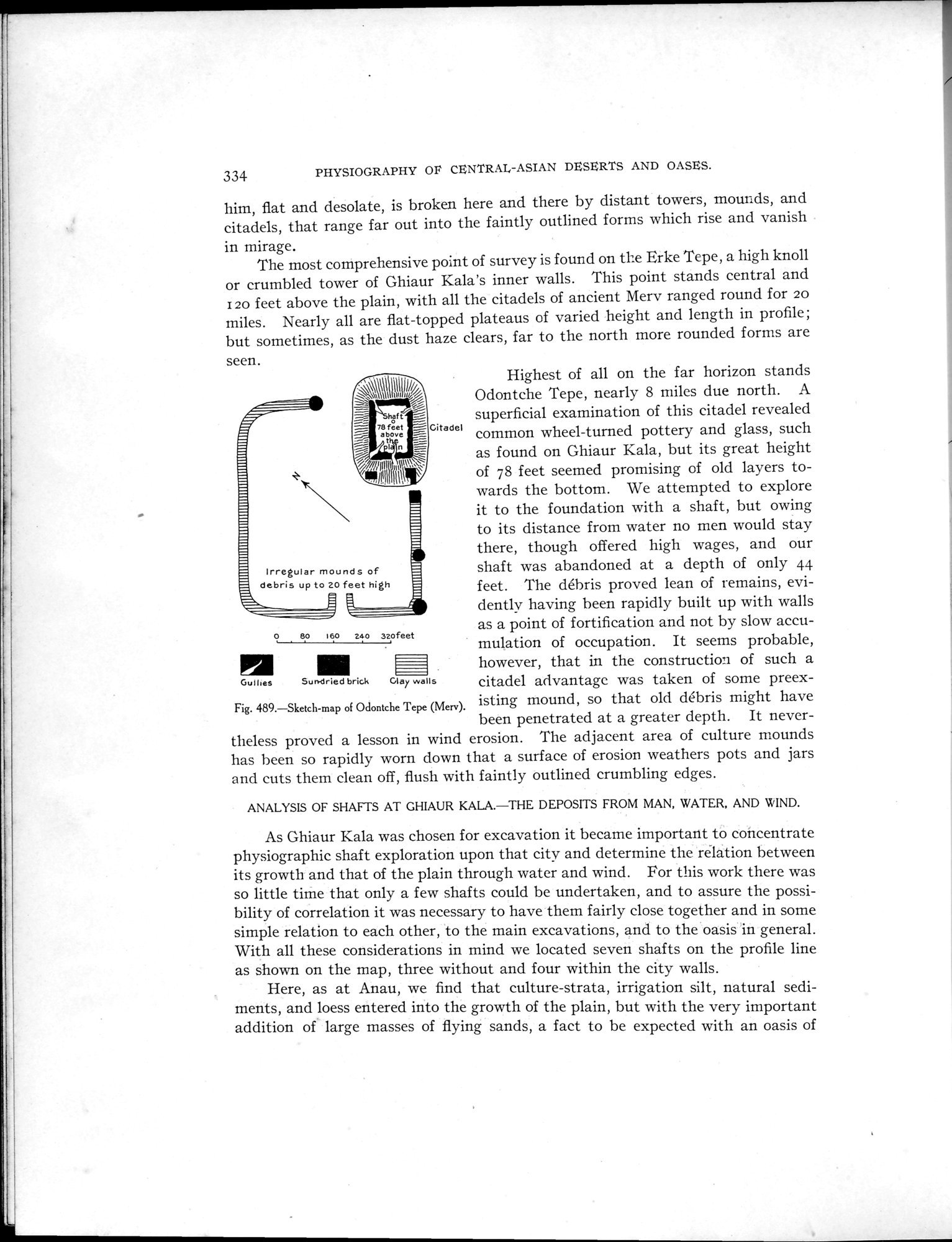 |
| Sketch-map of Odontche Tepe (Merv). |
334 PHYSIOGRAPHY OP CENTRAL-ASIAN DESERTS AND OASES.
him, flat and desolate, is broken here and there by distant towers, mounds, and citadels, that range far out into the faintly outlined forms which rise and vanish
in mirage.
The most comprehensive point of survey is found on the Erke Tepe, a high knoll or crumbled tower of Ghiaur Kala's inner walls. This point stands central and I 20 feet above the plain, with all the citadels of ancient Mery ranged round for 20 miles. Nearly all are flat-topped plateaus of varied height and length in profile; but sometimes, as the dust haze clears, far to the north more rounded forms are
seen.
as found on Ghiaur Kala, but its great height of 78 feet seemed promising of old layers towards the bottom. We attempted to explore it to the foundation with a shaft, but owing to its distance from water no men would stay there, though offered high wages, and our shaft was abandoned at a depth of only 44 feet. The débris proved lean of remains, evidently having been rapidly built up with walls as a point of fortification and not by slow accu-
80 160 240 32ofeet
mulation of occupation. It seems probable, however, that in the construction of such a citadel advantage was taken of some preex
Fig. 489.—Sketch-map of Odontche Tepe (Merv). isting mound, so that old débris might have been penetrated at a greater depth. It nevertheless proved a lesson in wind erosion. The adjacent area of culture mounds has been so rapidly worn down that a surface of erosion weathers pots and jars and cuts them clean off, flush with faintly outlined crumbling edges.
ANALYSIS OF SHAFTS AT GHIAUR KALA.—THE DEPOSITS FROM MAN, WATER, AND WIND.
As Ghiaur Kala was chosen for excavation it became important to concentrate physiographic shaft exploration upon that city and determine the relation between its growth and that of the plain through water and wind. For this work there was so little time that only a few shafts could be undertaken, and to assure the possibility of correlation it was necessary to have them fairly close together and in some simple relation to each other, to the main excavations, and to the oasis in general. With all these considerations in mind we located seven shafts on the profile line as shown on the map, three without and four within the city walls.
Here, as at Anau, we find that culture-strata, irrigation silt, natural sediments, and loess entered into the growth of the plain, but with the very important addition of large masses of flying sands, a fact to be expected with an oasis of
~~III~II~~~~~~~ Highest of all on the far horizon stands
~~\ t i "~ °~ Odontche Tepe, nearly 8 miles due north. A
haft -- superficial examination of this citadel revealed
7a above - Citadel common wheel-turned pottery and glass, such
about
' `RIÌÌ1'
Irregular mounds of debris up to 20 feet high
Sun-dried brick Gar walls
Gullles
|
Copyright (C) 2003-2019 National Institute of Informatics and The Toyo Bunko. All Rights Reserved.