National Institute of Informatics - Digital Silk Road Project
| |||||||||
|
| Memoir on Maps of Chinese Turkistan and Kansu : vol.1 |
 |
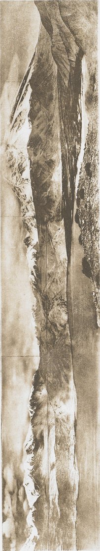
| PHOTO-THEODOLITE VIEW FROM KOK-TUMSHUK HILL, ABOVE WESTERN SHORE OF LITTLE KARA-KUL, TO SOUTH-EAST AND SOUTH (SEE PAGES 6, 64). | |
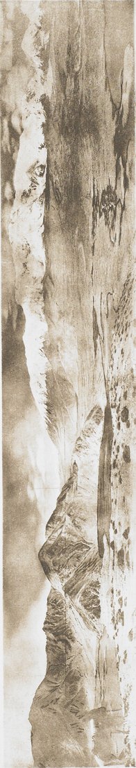
| PHOTO-THEODOLITE VIEW FROM KOK-TUMSHUK HILL, ABOVE WESTERN SHORE OF LITTLE KARA-KUL, TO NORTH-EAST AND NORTH (SEE PAGES 6, 64). |
|
Copyright (C) 2003-2019 National Institute of Informatics and The Toyo Bunko. All Rights Reserved.