National Institute of Informatics - Digital Silk Road Project
| |||||||||
|
| Memoir on Maps of Chinese Turkistan and Kansu : vol.1 |
 |
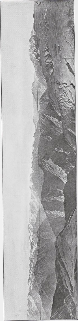
| PHOTO-THEODOLITE VIEW FROM TOPE RIDGE, ABOVE YURUNG-KASH VALLEY, TO SOUTH-EAST AND SOUTH (SEE PAGE 7). | |
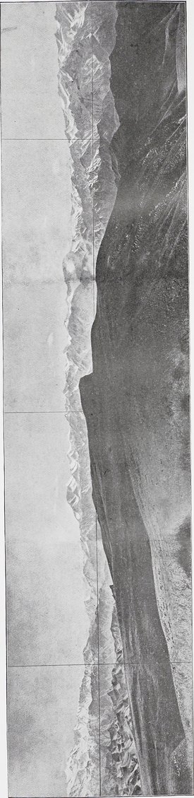
| PHOTO-THEODOLITE VIEW FROM TOPE RIDGE, ABOVE YURUNG-KASH VALLEY, TO SOUTH-WEST AND WEST (SEE PAGE 7). The foreground in both scetions of plate shows loess deposits of peneplain sloping up from Pisha valley. |
|
Copyright (C) 2003-2019 National Institute of Informatics and The Toyo Bunko. All Rights Reserved.