National Institute of Informatics - Digital Silk Road Project
Digital Archive of Toyo Bunko Rare Books
|
|
Color Thumbnail -
Table of Contents -
Page Number -
Biliographic Information (Metadata) -
Caption -
Color Image -
Gray HighRes. Image -
Facing Pages -
Graphics -
| 0247 |
Memoir on Maps of Chinese Turkistan and Kansu : vol.1 |
Captions
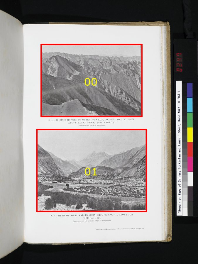
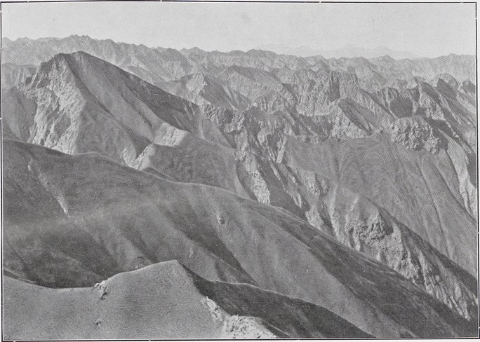
| [Photo] 8. A. |
ERODED RANGES OF OUTER K‘UN-LUN, LOOKING TO N. W. FROM ABOVE YAGAN-DAWAN (SEE PAGE 7). Loess-covered spurs in foreground. |
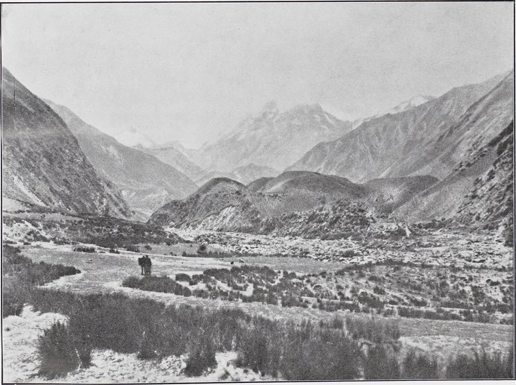
| [Photo] 8. B. |
HEAD OF NISSA VALLEY SEEN FROM TAM-OGHIL ABOVE TOR (SEE PAGE 12). Loess-covered old moraine ridges in foreground. |
 Citation Information
1
.
.
.
.
|
.
.
.
.
243
245
247
249
251
|
.
.
.
.
263
.
.
.
.
|
.
.
.
.
283
.
.
.
291
Copyright (C) 2003-2019
National Institute of Informatics
and
The Toyo Bunko. All Rights Reserved.