National Institute of Informatics - Digital Silk Road Project
| |||||||||
|
| On Ancient Central-Asian Tracks : vol.1 |
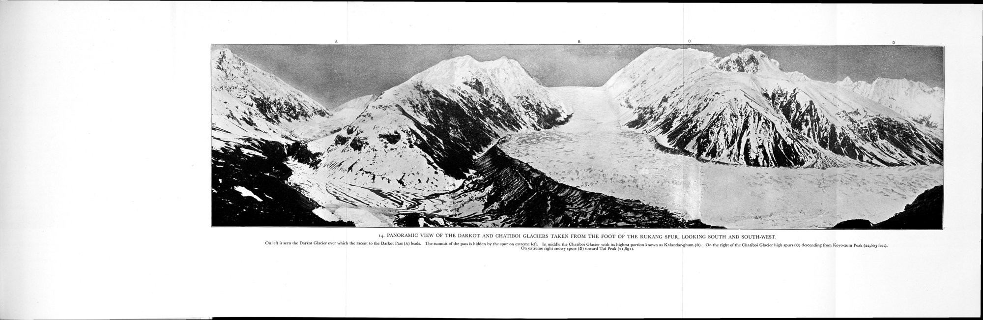 |
| PANORAMIC VIEW OF THE DARKOT AND CHATIBOI GLACIERS TAKEN FROM THE FOOT OF THE RUKANG SPUR, LOOKING SOUTH AND SOUTH-WEST. On left is seen the Darkot Glacier over which the ascent to the Darkot Pass (A) leads. The summit of the pass is hidden by the spur on extreme left. In middle the Chatiboi Glacier with its highest portion known as Kalandar-ghum (B). On the right of the Chatiboi Glacier high spurs (C) descending from Koyo-zum Peak (22,603 feet). On extreme right snowy spurs (D) toward Tui Peak (21,891). |
.4. PANORAMIC \'1K\\' OF THE 1).\RKOT :\\I) (iH:\f'll3OI GI_\CII:RS TAKEN ik()\i 1111. k (10I (Ik' I Rlk:.\\(: ,I'L R. LOOK I\(: Mil [II AND SOL 11l.WFS"f.
(hi left is seen the Darkest Glacier oser which the ascent to the Darkot Pau (a) karts. The summit ache push hidden by the spur on extreme left. In middk the Outiboi Glaser with its highest portion kms. a Kalandar;hum (g). On the right of the Qutiboi Glacier high spun IC) descending (ran Koyo-cum l'sak l 00.503 feet).
On extreme right snowy spun (01 toward Tui Peak (21,88.1.
|
Copyright (C) 2003-2019 National Institute of Informatics and The Toyo Bunko. All Rights Reserved.