National Institute of Informatics - Digital Silk Road Project
| |||||||||
|
| On Ancient Central-Asian Tracks : vol.1 |
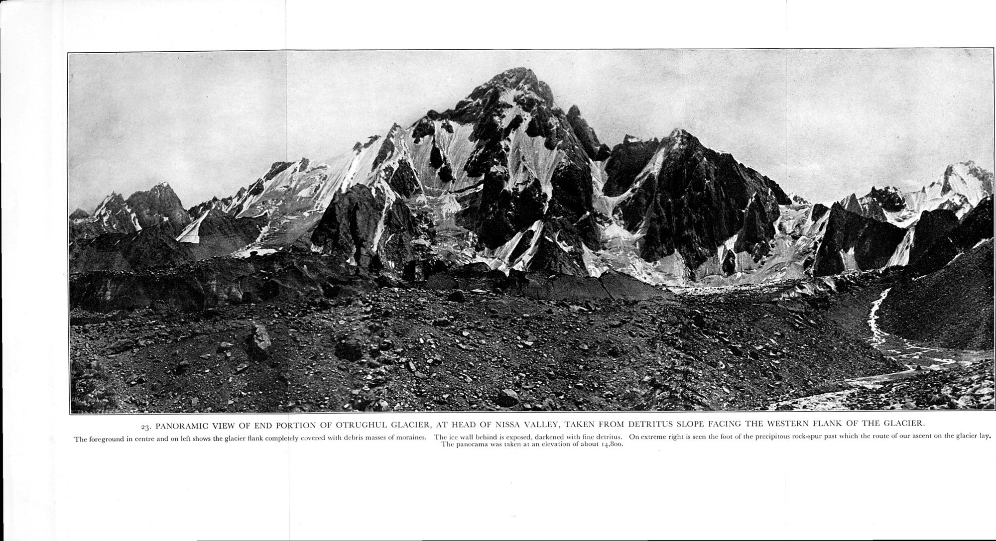 |
| PANORAMIC VIEW OF END PORTION OF OTRUGHL GLACIER, AT HEAD OF NISSA VALLEY, TAKEN FROM DETRITUS SLOPE FACING THE WESTERN FLANK OF THE GLACIER. The foreground in centre and on left shows the glacier flank completely covered with debris masses of moraines. The ice wall behind is exposed, darkened with fine detritus. On extreme right is seen the foot of the precipitous rock-spur past which the route of our ascent on the glacier lay. The panorama was taken at an elevation of about 14,800. |
rMiNHG:MiMIMMI
R
û
V
fJ
u
O
V
qV
O
O
u
O
LV
ß
o.
a
V
V
V
m
u
~
u
%
a ~
2
5 'û
ô.
F ° C7 L.
4
d
O .-
fn
b0
f/i
v •
C~i ÿ Fu
w e
• ff Z. Si a e, ▪ -o
C
0
~ i û
s t ß
R
~ ~ V / / Y
Q
/. m
c_
O "
q ~R
K C
w 'â
x û~ E- FF
4~7 û
C
ü 'â
.¢] ô
c
ô
t▪ ""
E
'
F ~ O =
r. •:
v.
V
F
x
É
0
z w ;
c
O =
3
m
u
S
z
;
4
é
~ ß
0
M
q C
C
-0
C
7
O
L
F
|
Copyright (C) 2003-2019 National Institute of Informatics and The Toyo Bunko. All Rights Reserved.