National Institute of Informatics - Digital Silk Road Project
| |||||||||
|
| On Ancient Central-Asian Tracks : vol.1 |
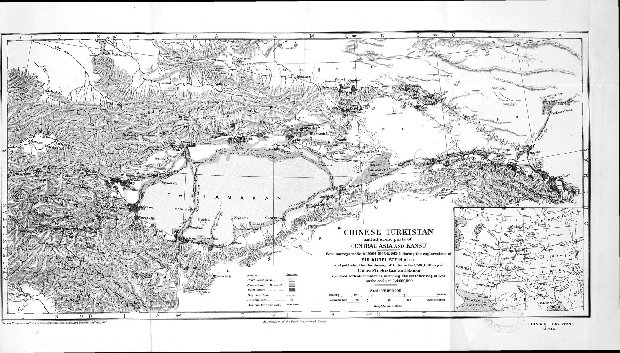 |
| CHINEZE TURKISTAN and adjacent parts of CENTRAL ASIA AND KANSU From surveys made in 1900-1,1906-8, 1913-5 during the explorations of SIR AUREL STEIN, K. C. I. E. and published by the Survey of India in his 1/500,000 map of Chinese Turkistan and Kansu combined with other material, including the War Office map of Asia on the scale of 1/4,000,000 |
eo A es M 0 ao N G es' 0 L wti I
Ah•ae.kö)
y6.' =!v•~
y,~nSito Sva-tonrusnd
ChBLtdd.
Qi
F
U
~. ben
'.,., n 5,4
D
Routes
Drin -.,md area. . Sank: tr,vl with smut.... -
tultiwatintt. -
Dry riverbed.
Aneiettt. one .. ... C.
Aneienl. 11•onner.enli. .~.~ •
N CHINESE TIIRKISTAN
and adjacent parts of
CENTRAL ASIA KANSU
Prom surveys umde m78001.1906`8,1813•S during the erploratioos of
SIR AUREL STEIN,K.c.I.E.
andpublishedbythe Survey of India inbis 1/500,000map of
ChineseTurkistan and ransu.
combined with other materiel, including the Wm' Office map of Amin
on the scale of 1/4000,000
Scale 1/6.000,000
na.erus~ao ie....9 140 mo aaoKno.etnts
Mighte in mover
a0• T as'
91)•
Conned A e.r,r,,wW tYrvrla.a Mondtau and Blauland. Atnürl. a6 and 44• 9epwwta•of Ne &i Gn'on,fJ,t'ptl. Saeir
C1UNESE TURKISTAN
Stein
|
Copyright (C) 2003-2019 National Institute of Informatics and The Toyo Bunko. All Rights Reserved.