National Institute of Informatics - Digital Silk Road Project
| |||||||||
|
| Ruins of Desert Cathay : vol.1 |
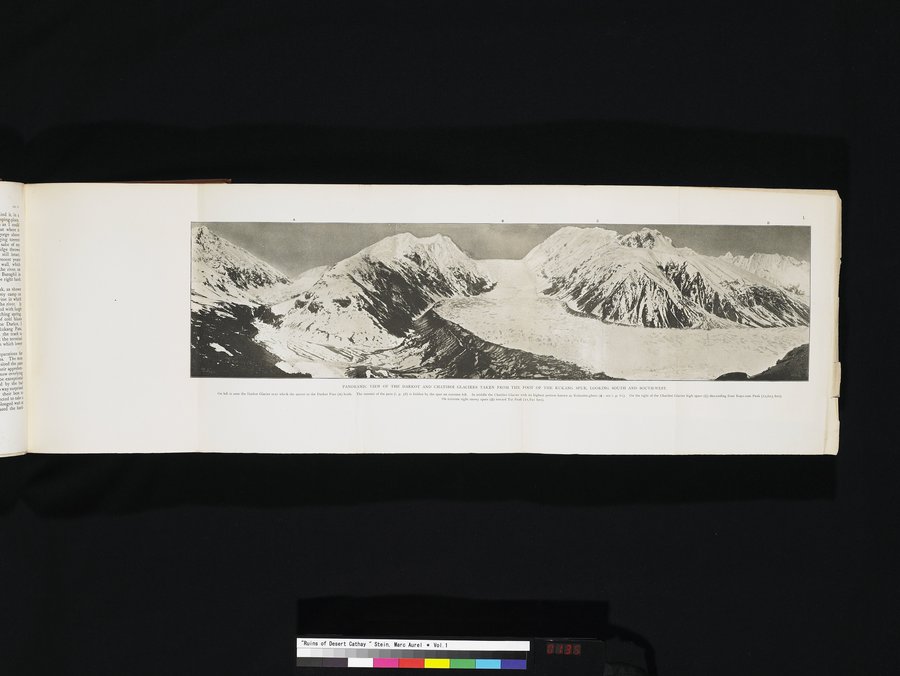 |
| PANORAMIC VIEW OF THE DARKOT AND CHATIBOI GLACIERS TAKEN FROM THE FOOT OF THE RUKANG SPUR, LOOKING SOUTH AND SOUTH-WEST. On left is seen the Darkot Glacier over which the ascent to the Darkot Pass (A) leads. The summit of the pass (i. p. 58) is hidden by the spur on extreme left. In middle the Chatboi Glacier with its highest portion known as Kalandar-ghum (B; see i. p. 61). On the right of the Chatiboi Glacier high spurs (c) descending from Koyo-zum peak (22,603 feet). |
PANORAMIC VIEW OP THE DARKOT AND CHATIROI GLACIERS TAKEN FROM THE FOOT OF THE RUKANG SPUR. LOOKING SOUTH AND SOU'l'H.WFs7.
On Rh it teen the Darts Glaner o.er which the ascent to the Dark. Pava (a) Rub. The wmmit or the Inn (i. p. IS) is hidden by th..pur on extreme kh. In middle the CWtiboi Cl..., with its high., portion known as Aala do .ghum (B: see i p. 61). On the right of the amid,. Clavier high spurs (C) descending faun Royurum Peak (00,60) feet) On extreme right annoy pun (0) Inward Tui leak (01,89. (eet)
|
Copyright (C) 2003-2019 National Institute of Informatics and The Toyo Bunko. All Rights Reserved.