National Institute of Informatics - Digital Silk Road Project
| |||||||||
|
| Ruins of Desert Cathay : vol.2 |
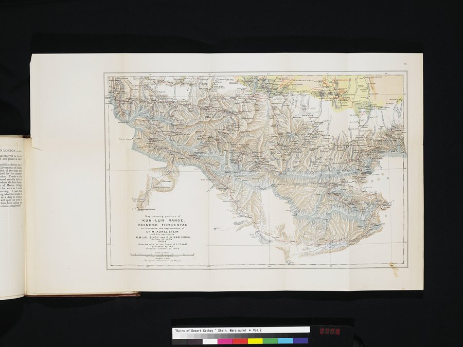 |
| Map showing portions of KUN-LUN RANGE, CHINESE TURKESTAN, to illustrate the explorations of DR. M. AUREL STEIN and his assistants R. B. LAL SINGH AND R.S. RAM SINGH. Surveyor General of India. 1906-8. |
¢.
| .1,••• ;•.••, |
\ .~✓«:/,.
i '.s:;3-i1dd\~•~~
m•.At Sae
Map showing port,onn of
KUN - LUN RANGE.
CHINESE TURKESTAN,
to IIv strate the explorations of
D^ M. AUREL STEIN
and his assistants
R.S.LAL SINGH AND R.S.RAM SINGH.
Survey of India.
1906-8.
From the map en the Scale of h 253,440
published by the
Surveyor G I of India.
4_• Saal..aâ Adel. .e
1.1n. fa. i I: ••p00..
Heights ,n net
(6.symbols and.Yl....pe•• see Map l)
|
Copyright (C) 2003-2019 National Institute of Informatics and The Toyo Bunko. All Rights Reserved.