国立情報学研究所 - ディジタル・シルクロード・プロジェクト
| |||||||||
|
| Serindia : vol.3 | |
| セリンディア : vol.3 |
 |
1184 KARA-SHAHR AND ITS RUINED SITES [Chap. XXIX
Mongol cultivation of Shikchin, had received visits from several European travellers, including Dr. Hedin.2 I knew that Professor Grünwedel had on two occasions in 1906-7 made stays of several weeks at Shorchuk for the sake of the ruins. But information received at Turfân indicated that his work and that of his party had been mainly devoted to the cave-temples north of the main site, and a rapid inspection of the latter soon convinced me that ample scope was left here for systematic excavations. It also showed that local conditions would allow them to be carried on rapidly. So no time was lost about pitching camp in the midst of the ruins and arranging for adequate labour.
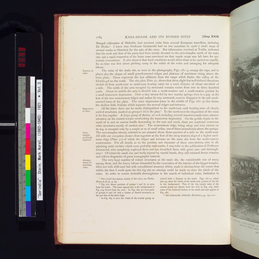
The ruins of the main site, as seen in the photographs, Figs. 281-5, occupy the tops, and in places also the slopes, of small gravel-covered ridges and plateaus of sandstone rising above the loess plain. These represent the last offshoots from the range which flanks the valley of the Khaidu-gol on the south. The site plan, Plate 51, shows that these slight but well-defined elevations stretch all from north-west to south-east, bearing ruins for a total distance of about one-third of a mile. The width of the area occupied by structural remains varies from two to three hundred yards. About its middle the area is divided into a north-western and a south-eastern portion by a small transverse depression. I-Iere a tiny stream fed by two marshy springs rises in a gap at the foot of the two westernmost ridges and makes its way eastwards, soon to disappear in the soft scrub-covered loess of the plain. The same depression (seen in the middle of Figs. 281-3) also drains the shallow little Nullahs which separate the several ridges and terraces.
Of the latter three can be easily distinguished to the south-east, each bearing rows of closely serried structures, marked as groups I—III in the plan.3 To the north-west the disposition of the ruins is far less regular. A large group of shrines, xi—xvii, including several massive temple ruins, attracts attention on the central terrace overlooking the transverse depression. On the gentle slopes to the north of it, and on narrow knolls descending to the east and south, there are scattered numerous other structures mostly of modest size.4 The westernmost ridge, being steep and very narrow on its top, is occupied only by a couple or so of small cellas, one of them immediately above the springs. The cave-temples already referred to are situated about three-quarters of a mile to the north-west. All with one exception cluster close together at the foot of the steep western slope of a higher sandstone ridge (Plate 51) of which the ridges and terraces on the main site form the south-eastern continuation. For all details as to the position and character of these cave-shrines, nine in all, adjoining some cavities which were probably rock-tombs, I may refer to the publication of Professor Grünwedel, who completely explored them and has described them with great care and thoroughness.s Of relatively small size and badly injured by vandal hands, they still retained fresco remains and relievo fragments of great iconographic interest.
The very large number of ruined structures at the main site, the considerable size of many among them, and the heavy labour demanded by the excavation of the interior of the bigger temples, filled not with drift-sand but with consolidated masonry débris, made it obvious from the outset that within the time I could spare for this big site no attempt could be made to clear the whole of the ruins. In order to assure desirable thoroughness in the search of individual ruins, limitation in
For a brief description, mainly of the caves, see Hedin,
Reisen in Z-A., p. 67.
s Fig. 281 shows portions of groups I and II, as seen from the south. The same appear also in the background of Fig. 274 viewed from the west. In Fig._ 283 are seen parts of groups II and III with a cluster of domed structures at the east foot of the third ridge.
In Fig. 285 is seen the whole of the central group as
viewed from a distance in the south. Figs. 281-2, which join up, show the whole of the north-west portion of the site in the background. Two of the big temple ruins of the central group are shown from the west in Fig. 284, while some of the scattered shrines to the north and east appear in Fig. 287.
c See Grünwedel, Altbuddh. Kull:fallen, pp. 192-211.
Position of ruins.
Disposition of ruins.
Cave-temples previously explored.
Arrangements for searching ruins.
|
Copyright (C) 2003-2019
National Institute of Informatics(国立情報学研究所)
and
The Toyo Bunko(東洋文庫). All Rights Reserved.
本ウェブサイトに掲載するデジタル文化資源の無断転載は固くお断りいたします。