National Institute of Informatics - Digital Silk Road Project
| |||||||||
|
| Archaeological Reconnaissances in North-Western India and South-Eastern Īrān : vol.1 |
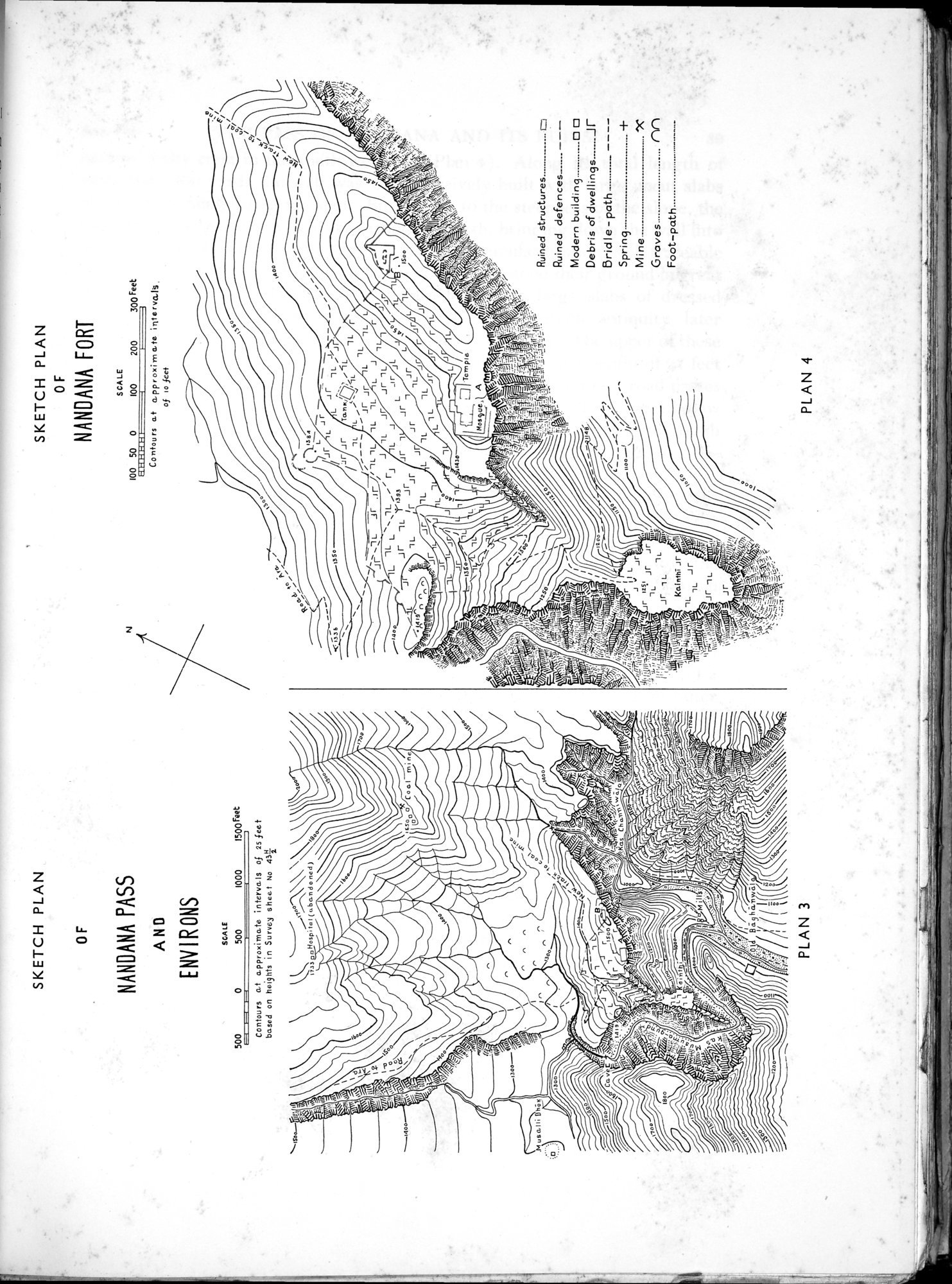 |
| SKETCH PLAN OF NANDANA PASS AND ENVIRONS | |
| SKETCH PLAN OF NANDANA FORT |
| SKETCH PLAN OF | SKETCH PLAN OF NANDANA FORT |
NANDANA PASS
AND
ENVIRONS
ivys . oHosp;tat (caban do ned)
~ISOO~
~4o
7t'tÇÇEt..haat
PLAN 3
SCALE
100 50 0 t00 200 300 Feet
Contours at approximate intervalg, of io feet
JfLLJrL Jr lli" Jr ..jr Tan k~ ~'• ~5L
y _ ~_ L~:05L
~ J"~J_~/— Jr jr L ~L
Jr ~lL .!r .,r ; 1L,L 1L lL L J, ta~'~ L L L~~.11~~~ rJ J L L J Jr JJr LL /
e
J Jr 1L `~ASS Jr l Jr L
~1~s^n r, ^ 9L ,r JrJf jr Jr ,
? n Jr Jr~ lL L lL lL -IL
L
Jr L
L J~ J 9i
'Temple.
Hosyue,l A
.14
Ruined structures..__..__.... to Ruined defences------L
Modern ....... ❑
Debris of dwellings Jr
Bridle - path
-••.•..__ ----
Spring. -..._... .. ±
Mine. _.._ 7C
Groves M
Foot—path
~~.
Jr ÎL
4 jr
^mLPI
PLAN 4
| 500 0 ~ .--.. | SCA LE 500 1000 | 1500Feet | ||
Contours at approximate intervals of 25 feet based on heights in Survey sheet No 4S1
|
Copyright (C) 2003-2019 National Institute of Informatics and The Toyo Bunko. All Rights Reserved.