 IIIFカラー高解像度
国立情報学研究所 - ディジタル・シルクロード・プロジェクト
| |||||||||
|
| IIIFカラー高解像度 |
| Explorations in Turkestan : Expedition of 1904 : vol.2 | |
| トルキスタンの調査 1904年 : vol.2 |
 |
 |
 |
 |
 |
 |
|
|
 |
|
|
|
|
|
|
|
|
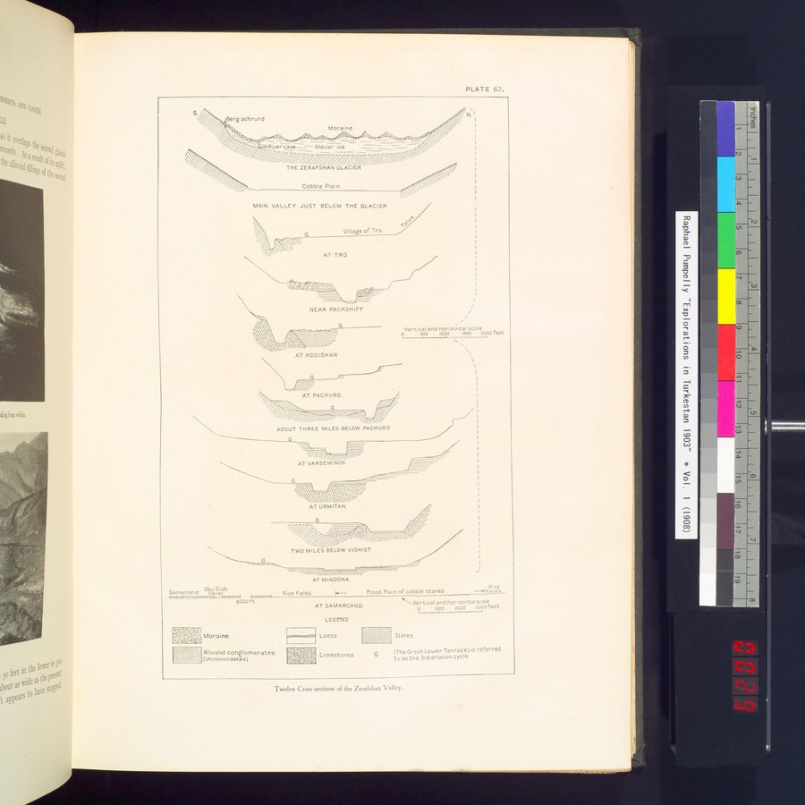
| ゼラフシャン渓谷の12の断面Twelve Cross-sections of the Zerafshan Valley. |
引用情報
PLATE 62.
Moraine
Riyercave—~Glacierice r `~'
Berg schrund
N.
THE ZERAFSHAN GLACIER Cobble Plain
MAIN VALLEY JUST BELOW THE GLACIER
Village of Tro
/
/
i
•
Vertical and horizontal scale
o 500 1000 1500 2000 feet
NEAR PACKSHIFF
AT KODISHAR
G
AT PACHURD
i
ABOUT THREE MILES BELOW PACHURD
AT VARSE MINOR
,~~/— ,~%%//I ,~~~j~%
*Ì~Ì/I~I%I/~Ì~~
AT URMITAN.
G ~/~I#
'7ltfl/n. ii~i ii/,~%Ì~
~ .i/~
TWO MILES BELOW VISHIST
AT MIN DONA
Alluvial conglomerates
(Unconsolidated)
r:w~jI
~i~.
!%!i
(The Great Lower Terrace) Is referred to as the 3rd.erosion cycle
Samarcand Obu Siab
Canal
mmllttifl(Illnuunmimmaimr--Rmhrtmnrt} lmiummuP
6000 ft.
00 oóóó 000o000ó0
ooóoggo
k— Flood Plain of cobble stones
.Vertical and horizontal scale
0 1000 2000 a000feet
Slates
Rice fields
Rice
—>Ifields
Limestones G
AT SAMARCAND
LEGEND
Loess
Moraine
Twelve Cross-sections of the Zerafshan Valley.
|
|
|
|
|
|
|
|
|
Copyright (C) 2003-2019
National Institute of Informatics(国立情報学研究所)
and
The Toyo Bunko(東洋文庫). All Rights Reserved.
本ウェブサイトに掲載するデジタル文化資源の無断転載は固くお断りいたします。