| [Figure] 43 |
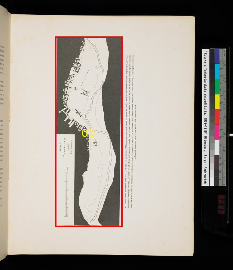
Plan showing all of Bezelik. Measured by D.A. Smirnoff in autumn 1909. The scale of the original is equivalent to 1 inch to 10 sazhen. The dark areas represent the mountains. The line passing through some of the grottoes represents the outline of the mountain. In this diagram the line is not continuous, but this is because for the most part the line is contiguous with the surface of wall of the grotto. The line in front of the grotto represents their outline of the plateau in front of the cliff by the edge of the river. The area on the other side of this line is at a lower elevation than the river banksОбщiй планъ Безеклика, снятый Д. А. Смирновым осенью 1909 года; оригинальный планъ 10 сажень в дюймh. Черным обозначены массивы горъ; черта, проходящая черезъ нhкоторыя пещеры, показываетъ тh мhста, гдh проходитъ лiния горы; на предлагаемомъ здhсь планh эта черта видна не на всемъ протяженiи, такъ какъ большею частью она совпадаетъ съ краями пещеръ и сливается поэтому съ рельефомъ горы. Линiя передъ пещерами – край платформы, за которою начинается небольшой обрыв къ рhкh; еще ниже линiи береговъ рhки.
|