National Institute of Informatics - Digital Silk Road Project
Digital Archive of Toyo Bunko Rare Books
|
|
Color Thumbnail -
Table of Contents -
Page Number -
Biliographic Information (Metadata) -
Caption -
Color Image -
Gray HighRes. Image -
Facing Pages -
Graphics -
| 0087 |
Ancient Khotan : vol.2 |
Captions
| [Figure] XXXVIII |
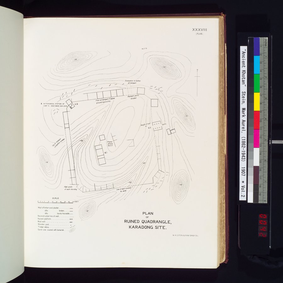
PLAN OF RUINED QUADRANGLE, KARADONG SITE. |
Citation Information
OCR Text
A.C. III
-34
-40
Excavation to bottom
of rampart.
Floor of rampart (7 above
ground level of K.i
Rampart partly
eroded
▲ ASTRONOMICAL STATION OF
CAMP III. 3850' ABOVE SEA LEVEL.
K. III
Top of rampart
completely eroded
-20
K. i
Original
ground
level O
Height of roof
K. ii ... GATE
-15
-20
-25
High posts
of walls standing
Line of wall covered
by sand
-45
SCALE
0 5 10 20 30 40 50 FEET
Wall of timber and plaster...........___
ditto broken...........___
ditto barely traceable...........___
Reconstructed line of wall...........
Raised platform ...........
Mud wall ...........
Wooden post...........
Timber débris...........
Sand cone covered with tamarisk ...........
1
.
.
.
.
|
.
.
.
.
11
.
.
.
.
|
.
.
.
.
29
.
.
.
.
|
.
.
.
.
49
.
.
.
.
|
.
.
.
.
69
.
.
.
.
|
.
83
85
87
89
91
.
.
.
|
.
.
.
.
109
.
.
.
.
|
.
.
.
.
129
.
.
.
.
|
.
.
.
.
149
.
.
.
.
|
.
.
.
.
169
.
.
.
.
|
.
.
.
.
189
.
.
.
.
|
.
.
.
.
209
.
.
.
.
|
.
.
.
.
229
.
.
.
.
|
.
.
.
.
249
.
.
.
.
256
Copyright (C) 2003-2026
National Institute of Informatics
and
The Toyo Bunko. All Rights Reserved.