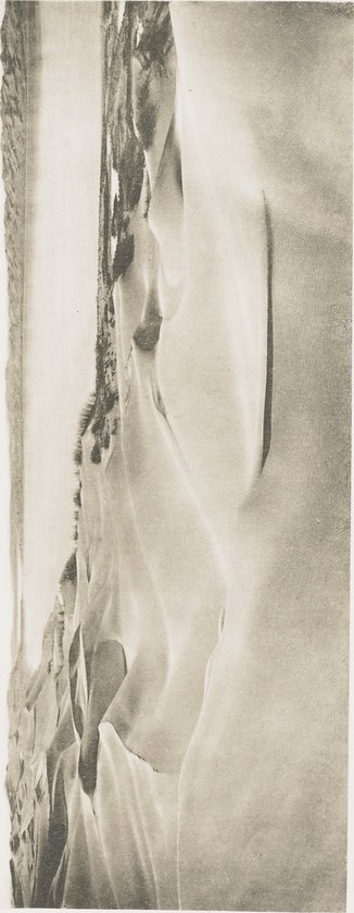
| [Photo] Pl. 39. |
図38と同地点からの景観。ただし、南から29度だけ西の方にセイト・クル湖の向こうを見たところ。背景には湖の南北の窪地の間に「ボルタ」がある。左手は湖の東岸。写真は、砂丘群の険しい風下側がどのように位置しているかを写している。ところが、右手の写真上部の外形に見えるように、西岸では砂丘は次の砂丘までなだらかな斜面となっている。VIEW FROM THE SAME POINT AS IN PL. 38, BUT LOOKING S. 29° W. ACROSS THE SEJT-KÖL. In the Background is the «Bolta» between the Northern and Southern Basins of the Lake. On the Left, I. E. the Eastern Shore of the Lake, the Photograph shows how the Steep Lee-sides of the Dune-masses are situated, whereas on the West Shore the Dunes have a Gentle Slope up to the Next Accumulation, Shown in Contour in the Upper Part of the Photograph on the Right.
|