国立情報学研究所 - ディジタル・シルクロード・プロジェクト
| |||||||||
|
| Scientific Results of a Journey in Central Asia, 1899-1902 : vol.1 | |
| 1899-1902年の中央アジア旅行における科学的成果 : vol.1 |
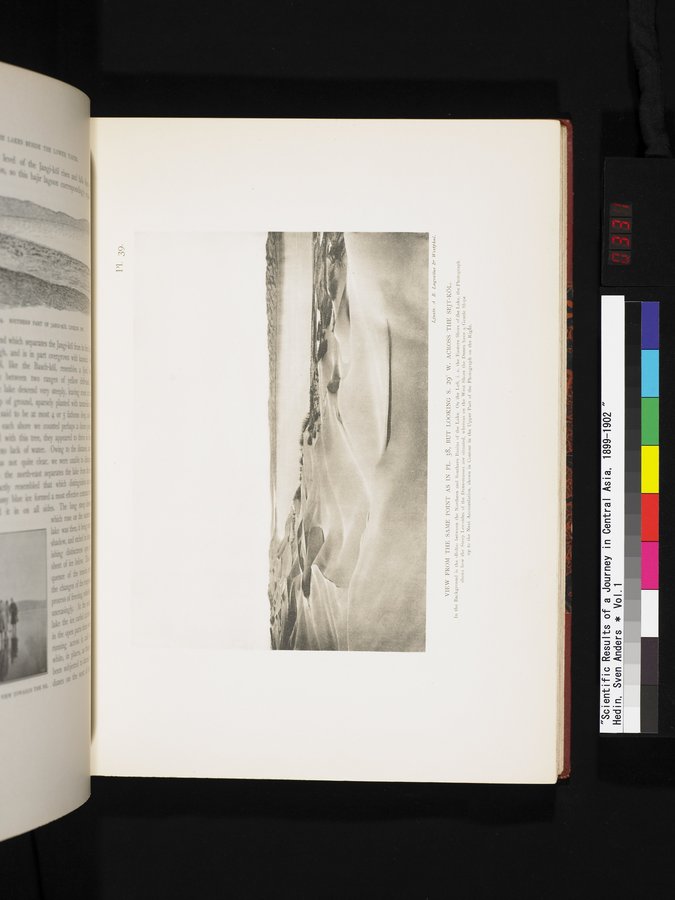 |
| 図38と同地点からの景観。ただし、南から29度だけ西の方にセイト・クル湖の向こうを見たところ。背景には湖の南北の窪地の間に「ボルタ」がある。左手は湖の東岸。写真は、砂丘群の険しい風下側がどのように位置しているかを写している。ところが、右手の写真上部の外形に見えるように、西岸では砂丘は次の砂丘までなだらかな斜面となっている。VIEW FROM THE SAME POINT AS IN PL. 38, BUT LOOKING S. 29° W. ACROSS THE SEJT-KÖL. In the Background is the «Bolta» between the Northern and Southern Basins of the Lake. On the Left, I. E. the Eastern Shore of the Lake, the Photograph shows how the Steep Lee-sides of the Dune-masses are situated, whereas on the West Shore the Dunes have a Gentle Slope up to the Next Accumulation, Shown in Contour in the Upper Part of the Photograph on the Right. |
Ljuslr. A B. Lagrelius b' Wesljhal.
VIEW FROM THE SAME POINT AS IN PL. 38, BUT LOOKING S. 29° W. ACROSS THE SEJT-KÖL.
In the Background is the •Bolen• between the Northern and Southern Basins of the Lake. On the Left, i. e. the Eastern Shore of the Lake, the Photograph
shows how the Steep Lee-sides of the Dune-masses are situated, whereas on the West Shore the Dunes have a. Gentle Slope
up to the Next Accumulation, shown in Contour in the Upper Part of the Photograph on the Rigfit.
|
Copyright (C) 2003-2019
National Institute of Informatics(国立情報学研究所)
and
The Toyo Bunko(東洋文庫). All Rights Reserved.
本ウェブサイトに掲載するデジタル文化資源の無断転載は固くお断りいたします。