国立情報学研究所 - ディジタル・シルクロード・プロジェクト
| |||||||||
|
| Scientific Results of a Journey in Central Asia, 1899-1902 : vol.1 | |
| 1899-1902年の中央アジア旅行における科学的成果 : vol.1 |
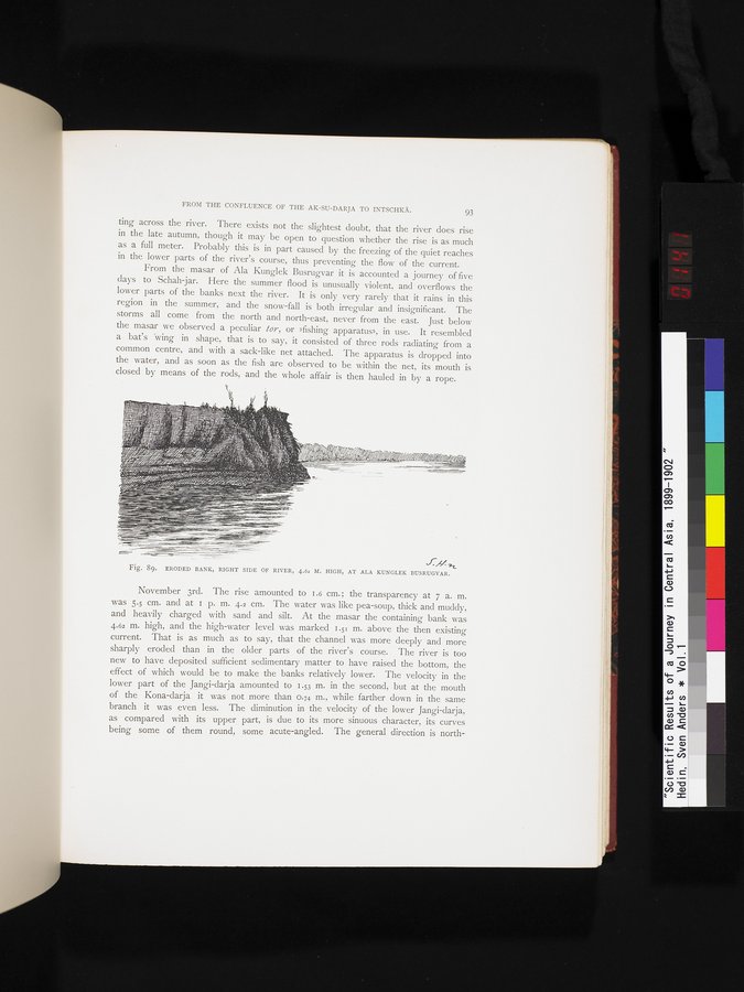 |
| 浸食される河岸。川の右側。高さ4。62メートル。アラ・ルンレク・ブスルガルにて。ERODED BANK, RIGHT SIDE OF RIVER, 4.62 M. HIGH, AT ALA KUNGLEK BUSRUGVAR. |
FROM THE CONFLUENCE OF THE AK-SU-DARJA TO INTSCHKÄ. 93
ting across the river. There exists not the slightest doubt, that the river does rise in the late autumn, though it may be open to question whether the rise is as much as a full meter. Probably this is in part caused by the freezing of the quiet reaches in the lower parts of the river's course, thus preventing the flow of the current.
From the masar of Ala Kunglek Busrugvar it is accounted a journey of five days to Schah-jar. Here the summer flood is unusually violent, and overflows the lower parts of the banks next the river. It is only very rarely that it rains in this region in the summer, and the snow-fall is both irregular and insignificant. The storms all come from the north and north-east, never from the east. Just below the masar we observed a peculiar toy, or »fishing apparatus», in use. It resembled a bat's wing in shape, that is to say, it consisted of three rods radiating from a common centre, and with a sack-like net attached. The apparatus is dropped into the water, and as soon as the fish are observed to be within the net, its mouth is closed by means of the • rods, and the whole affair is then hauled in by a rope.
fy ~
Fig. 89. ERODED BANK, RIGHT SIDE OF RIVER, 4.62 M. HIGH, AT ALA KUNGLEK BUSRUGVAR.
November 3rd. The rise amounted to 1.6 cm.; the transparency at 7 a. m. was 5.5 cm. and at I p. m. 4.2 cm. The water was like pea-soup, thick and muddy, and heavily charged with sand and silt. At the masar the containing bank was 4.62 m. high, and the high-water level was marked 1.5i m. above the then existing current. That is as much as to say, that the channel was more deeply and more sharply eroded than in the older parts of the river's course. The river is too new to have deposited sufficient sedimentary matter to have raised the bottom, the effect of which would be to make the banks relatively lower. The velocity in the lower part of the Jangi-darja amounted to 1.53 m. in the second, but at the mouth of the Kona-darja it was not more than 0.74 m., while farther down in the same branch it was even less. The diminution in the velocity of the lower Jangi-darja, as compared with its upper part, is due to its more sinuous character, its curves being some of them round, some acute-angled. The general direction is north-
|
Copyright (C) 2003-2019
National Institute of Informatics(国立情報学研究所)
and
The Toyo Bunko(東洋文庫). All Rights Reserved.
本ウェブサイトに掲載するデジタル文化資源の無断転載は固くお断りいたします。