国立情報学研究所 - ディジタル・シルクロード・プロジェクト
| |||||||||
|
| Scientific Results of a Journey in Central Asia, 1899-1902 : vol.1 | |
| 1899-1902年の中央アジア旅行における科学的成果 : vol.1 |
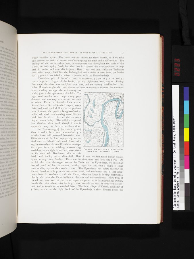 |
| カラウルでのウゲン・ダリヤとタリム川の合流地点。THE CONFLUENCE OF THE UGEN-DARJA WITH THE TARIM AT KARAUL. |
THE HYDROGRAPHIC RELATIONS OF THE UGEN-DARJA AND THE TARIM. 151
water subsides again. The river remains frozen for three months, or if we take into account the soft and rotten ice of early spring, for three and a half months. The melting of the ice occasions here, as everywhere else throughout the basin of the Tarim, an early spring flood; but after that has passed, the river continues to drop until it reaches its lowest ebb in June. Here I was told that, whilst the Tscha-jan does indeed empty itself into the Tschong-köl and a series of small lakes, yet for the last I5 years it has failed to effect a junction with the Kontsche-darja.
December 4th. A rise of 1.1 cm.; transparency, 7.4 cm. at 7 a. m. and 7.9 cm. at I p. m. Height of the banks, 1.92 m.; high-water level, 0.65 m. During this stage the river was straighter than ever, and the velocity considerable. Just below Momuni-ottogho the river widens out over an enormous expanse; its numerous
arms, winding amongst the sedimentary deposits, give it the appearance of a delta. The high sand recedes to a comparatively great distance, and was only seen on two or three occasions. Forest is plentiful all the way to Karaul; but at Karaul kamisch steppe, tamarisks, and small conical hills are the predominant features, the poplars being confined to
a few individual trees standing some distance • : "•
back from the river. Here we did not see a ' ! °'
single human being. The drift-ice appeared n_
less abundant than usual, though it was in 'b. • v
•
appearance only, for the river was here wider.
At Attamet-arghaj (Attamet's grave) ~••r`~ ; •~
there is said to be a tomb, surrounded by a `Q
wooden fence, still preserved from olden times.
Other names of the local topography— ~.,~°
are ;;Xr".é •,;, ° ~' :: , M,yp
Aral-kum, the Island Sand, small dunes, with •
vegetation on them, situated like islands amongst the poplar forest; Karaul-dung, a dominating rig 133_ THE CONFLUENCE OF THE UGEN-
sand-dune on the right bank; then, lower down DARDA WITH THE TARIM AT KARAUL.
on the same side, Basch-tam, with an arti-
ficial canal leading to a wheat-field. Here it was we first found human beings again, namely, two families. There too the river turns and flows due north. On the left, that is on the angle between the Tarim and the Ugen-darja, we passed an isolated patch of low sand-dunes, bearing vegetation, and with a couple of small lakes nestling against their southern foot. The Ugen-darja, just before entering the Tarim, describes a loop to the south-east, south, and north-east, and in that direction effects its confluence with the Tarim, when the latter is flowing northwards. Shortly after that the Tarim inclines to the east and east-south-east. Here then at Karaul we have one of the most important points in its hydrographical system, namely the point where, after its long course towards the east, it turns to the southeast, and so travels to its terminal lakes. The little village of Karaul, consisting of 4 huts, stands on the right bank of the Ugen-darja, a short distance above the
|
Copyright (C) 2003-2019
National Institute of Informatics(国立情報学研究所)
and
The Toyo Bunko(東洋文庫). All Rights Reserved.
本ウェブサイトに掲載するデジタル文化資源の無断転載は固くお断りいたします。